
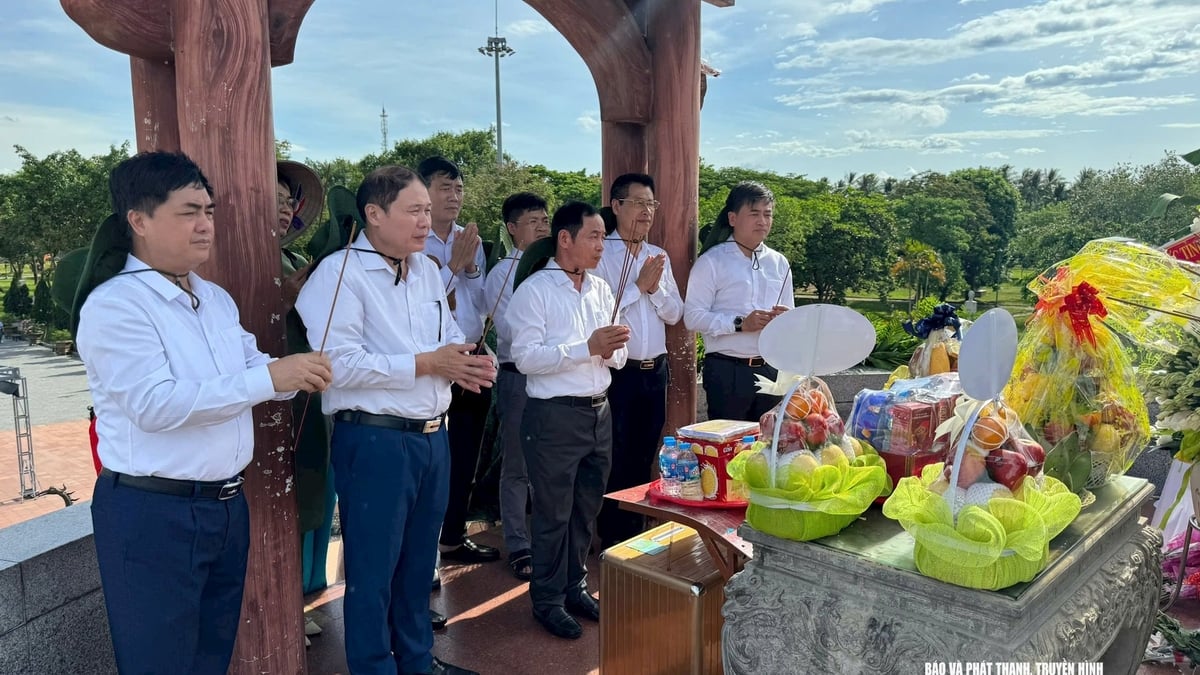
165 years ago, the French-Spanish coalition fired the first shot to invade our country in Da Nang . The event of the people of Da Nang representing the whole country to confront the modern military force, with big ships, big guns... wrote heroic and tragic pages of our nation's history.
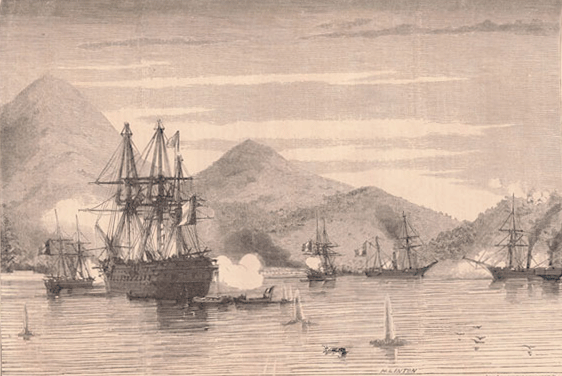 |
| French warships attack Da Nang on September 1, 1858. Source: French Ministry of Defense Archives |
Part 1: Chan Sang Fort and Nam Chon Station
If we talk about the “real epic” battle between the Vietnamese army and people in Da Nang and the French-Spanish connection, which battle? That is the battle of Chan Sang fort? If we ask which historical relic in Da Nang that is directly related to the resistance war against the French-Spanish alliance needs to be urgently protected, restored, and embellished, then that must be Nam Chan station. From looking up documents and conducting direct surveys on the field, we would like to mention a few things about these two historical relics.
First of all, it is necessary to confirm that Nam Chon is also Nam Chan (the French called it Kien Chan), Chon Sang is also Chan Sang in most of the documents recording these two place names as well as in the familiar way of calling of the local people. During the resistance war to protect the Han gate in 1858-1860, Nam Chon and Chon Sang were located in a large river defense area throughout the northwest of Da Nang, around the bay and to the Son Tra peninsula of the Hue court.
The defense system here includes Dinh Hai fortress located on a low mountain near the sea to the northeast of Chan Sang village, next to Chan Sang station (located near the Thien Ly road from Hai Van Quan down, now used as a border station); then Nam Chan station (located south of Chan Sang station, the traces of which are still quite clear). This area is blocked by Hai Van Quan, the last checkpoint on the border of the two provinces to Hue. Next is the Cu De area including Cu De and Hoa O forts, ramparts, and forts. South of Hoa O fort is Nam O station. To the west, upstream of Cu De, after the French attacked Da Nang, the Nguyen Dynasty established two more forts, Quan Nam and Truong Dinh.
Chan Sang Fort Chan Sang Fort is located to the south of the foot of Hai Van mountain, next to Thong Son mountain (commonly called Hon Hanh), in the 4th year of Minh Mang, it was named Dinh Hai mountain and a fortress was built here called Dinh Hai fortress (the current estimated location is the mountain peak behind Lang Van border post, about 300 meters as the crow flies to the west, about 800 meters from the top of Hai Van pass going south, about 600 meters from Son Tra island to the northeast).
Chan Sang Fort is located at the foot of Sang Mountain to the south of Hai Van Pass. If viewed from an airplane, Chan Sang Mountain range juts out into the sea like a long fist, the end point of which is the small Son Tra Islet, creating a very convenient arc shape for deep-water Lien Chieu Bay for ships to anchor. On this mountain, the Nguyen Dynasty established a military fortification system to guard the seaport: "Out at sea to the northeast rises a peak, in the 21st year of Minh Mang, it was named Ngu Hai Island, there is a Fire Prevention Tower, which is the northern boundary of the seaport", there is also a fortress named Dinh Hai, with a circumference of 25 truong 3 thuoc linh, 5 thuoc 8 tac high, one gate, one flag tower and seven fortresses (according to Dai Nam Nhat Thong Chi).
Regarding the name, on administrative documents under the Nguyen Dynasty, it was called Chan Sang Fort, while the locals in Cu De and Cua Han used to call it Don Nhat (Chan Sang) and Don Nhi (ie Dinh Hai Fort). If we count from Hai Van Quan, the first fort we encounter is Chan Sang, the second one is Dinh Hai, so the folk song says: "From Don Nhat, we count - Lien Chieu, Thuy Tu, Nam O, Cua Han".
In 1856, King Tu Duc ordered the defense system in Da Nang to be repaired and reorganized. Dao Tri was assigned to coordinate with the Governor of Quang Nam to plan the defense. After investigation, Dao suggested "destroying Fort Nhat and Fort Nhi because they were not necessary". However, Ton That Cap reconsidered and suggested to King Tu Duc that "That seaport is an important place, Fort Nhat and Fort Nhi should be kept intact".
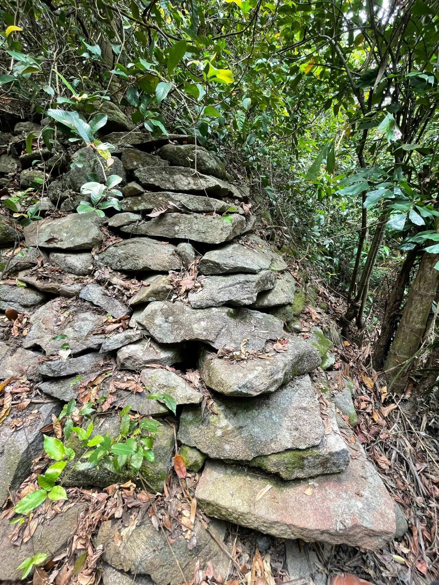 |
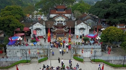
| The remaining vestiges of Nam Chon station today. Photo: LUU ANH RO |
Nam Chon Station
During the Nguyen Dynasty, in Quang Nam province, the Nguyen Dynasty established “seven stations” to transmit messages from the southern provinces to the capital, including: Nam Chon, Nam O, Nam Gian, Nam Phuc, Nam Ngoc, Nam Ky and Nam Van. Thus, Nam Chon was the first station among these stations along the Thien Ly road, not far from the top of the pass - Hai Van Quan, which was considered the “throat of Thuan Quang”, that location showed the outpost nature of this station, where war still relied on archery and swords, and traveling through Hai Van pass was still terrified by wild animals for tourists.
Based on the traces of the Thien Ly road, starting from Hai Van Quan, the trail curves in an arc shape to the southwest for a few miles to reach Nam Chinh station (Nam Chon), which was the northernmost station of Quang Nam at that time. Nam Chon station was located at Sang mountain, during the Gia Long dynasty, it was named Chon Sang station (the name of the village where this station was located). In the third year of Minh Mang (1823), the station was renamed Nam Chon station. The Nguyen Dynasty history book recorded: “To the south of the foot of the mountain is Thong Son mountain, commonly known as Hon Hanh, to the west is Sen mountain, Sang mountain is the stopover station (Nam Chon) to pass through… the mountain road is rugged with mixed trees, the foot of the mountain to the south is adjacent to the sea bay, there are rocky cliffs standing tall on the coast, high and low like a miniature landscape, the waves crashing into the water spraying like rain”.
When the French attacked Da Nang, King Tu Duc paid special attention to protecting the official road passing through Nam Chon and Nam O stations. The king increased the number of personnel to protect and clear the official route to ensure smooth communication. The king "ordered the Governor of Hoa Vang District, Pham Dang Duong, to clear the mountain road depending on the situation. Then, according to his report, he considered selecting a group of laborers to clear trees and open a straight road from behind Nam Chon station through the mountains of Lien Chieu commune straight to Cau De ferry, adjacent to Nam O station. The opening of this new road inevitably caused difficulties for the people, so I request that each laborer be given 40 coins and 1 bowl of rice per day for expenses".
District chief Pham Dang Duong ordered the opening of a new road, starting from Nam Chan station to Lien Chieu commune, Cau De and to Nam O station, "selecting 100 laborers to clear and widen the road by 1 truong 5 thuoc, taking about 20 days, and asking for each person to be given 1 vein of money and 1 bowl of rice per day". When the French army blockaded Hai Van road, King Tu Duc directed to find a new road to ensure communication, Nguyen Tri Phuong relied on the local people on both sides of Quang Nam and Thua Thien to establish the road: "3 people from Thua Thien prefecture, Hoang Van Xuan and others, currently living in Son Linh hamlet, all said that they had previously lived on Hai Van mountain collecting firewood.
Previously, on the right side of Hai Van, there was a small road through Lien Son going down to Lien Chieu, down to Cu De. The route was different from the old Nam Chan road. Currently, there was a section filled in. Now, if it was cleared when needed for military operations. If the Western enemy ships anchored near the coast with the intention of spying, then the mountains and forests outside would block the way so that cannons could not fire on that road. Thiem Chuc considered the truth and thought that he should have the Guard Ho Van Hien and 15 civilians and soldiers led by them to that road cut down trees and reopen that road so that when the mandarin reported to Cu De station, it would be convenient to be near.
At present, the traces of Nam Chon station are still very clear, Chan Sang station is only a guess, however, the battle of Nam Chon has surprised us with its scale, preciousness in terms of historical and cultural value, of which the stone ramparts stacked on top of each other are an example. This is the basis for us to quickly protect, restore and exploit this precious relic. Because, considering all the stations on the ancient Thien Ly road, only Nam Chon station still has a fairly clear and intact shape, after hundreds of years.
Liu Ying Ro
Permanent Vice President, General Secretary of the Historical Science Association
Danang city
Source


Comment (0)