

On the afternoon of July 20, a representative of the Department of Dyke Management and Natural Disaster Prevention ( Ministry of Agriculture and Environment ) said that the disaster warning system via telephone had sent more than 35 million warning messages since the tropical depression was still in the East Sea.
“Since the storm formed, the department has sent 29 million more subscribers messages with suggestions and instructions on how to respond to storm No. 3 and the floods after the storm,” said a representative of the Department of Dyke Management and Disaster Prevention.

Updated as of the evening of July 20 from the National Center for Hydro-Meteorological Forecasting, the center of storm No. 3 (Wipha) has moved to a position of about 21.8 degrees North latitude - 112.8 degrees East longitude, about 560km east of Quang Ninh - Hai Phong , wind level 12, gust level 15. The storm continues to move west at a speed of 20-25km/hour.
Deputy Director of the National Center for Hydro-Meteorological Forecasting, Mr. Hoang Phuc Lam, commented that the storm has strengthened by 2 levels in the past 24 hours, reaching level 12 (the first threshold of a very strong storm group). Forecasts show that the storm may weaken slightly when it touches the terrain of Guangdong (China), but its intensity will remain at a dangerous level when it changes direction and enters the Gulf of Tonkin.

By the evening of July 21, the storm center was located in the northern Gulf of Tonkin, level 11-12, gusting to level 15. Then, from morning to noon on July 22, the storm approached the mainland of our country, directly affecting the North and North Central regions. By the afternoon of July 22, the storm center was on the mainland from Hai Phong to Thanh Hoa, weakening to level 9-10, gusting to level 12.
The meteorological agency warns that from tomorrow night, July 21, the coast from Quang Ninh to Nghe An will begin to experience winds gradually increasing to level 7-9, near the storm center level 10-11, gusting to level 14. Areas deep inland will also experience strong winds of level 6-7, gusting to level 8-9.
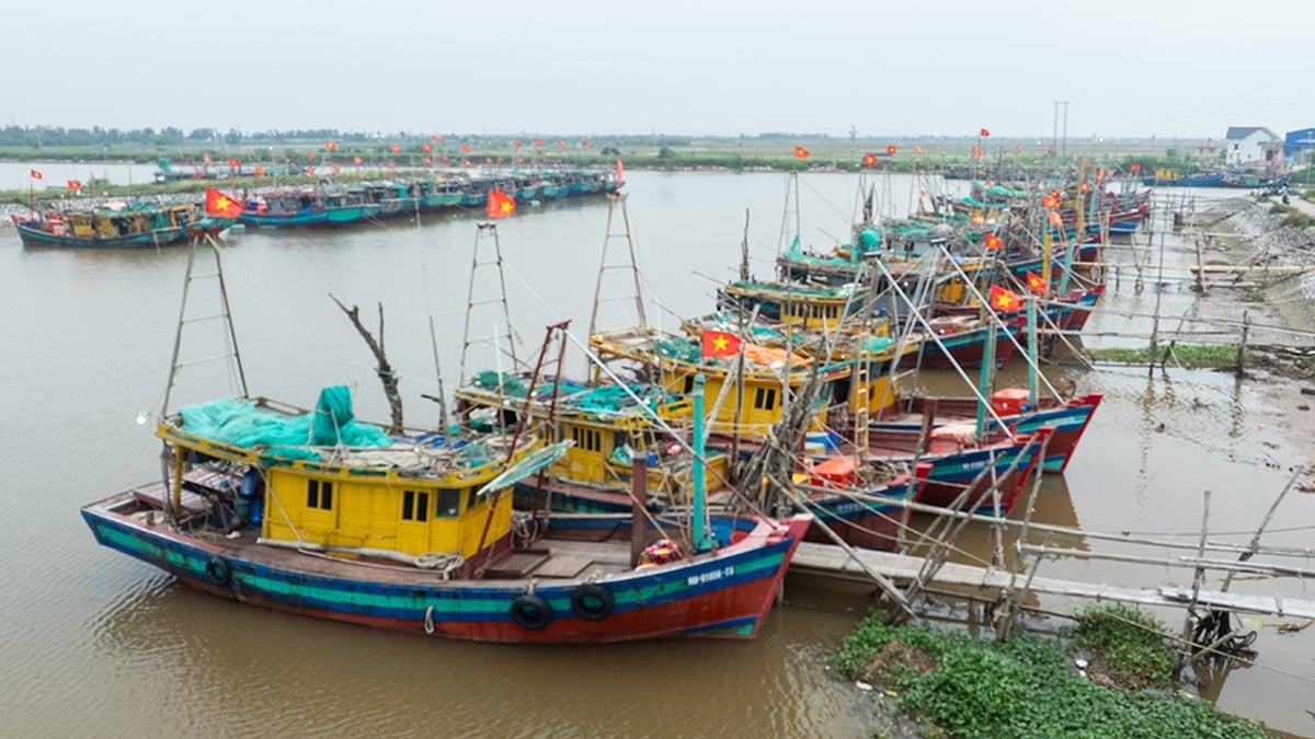
“People in coastal provinces need to urgently reinforce their houses, evacuate people if necessary and absolutely not let boats operate in dangerous areas,” the National Center for Hydro-Meteorological Forecasting recommends.
On the afternoon of July 20, the Ministry of Agriculture and Environment also sent an urgent dispatch to 13 provinces and cities in the North and North Central regions, requesting the urgent completion of reinforcing dike locations at risk of becoming unsafe before the storm makes landfall.
According to Deputy Minister of Agriculture and Environment Nguyen Hoang Hiep, the storm's arrival coincides with the high tide, and rising water levels can cause insecurity for sea dykes and river dykes. At the same time, the storm also causes widespread heavy rain and the possibility of flooding in river systems (while large reservoirs are almost full, and the water levels of the Red and Thai Binh rivers are high), making the risk of dike failures even more serious.
 this afternoon, July 20.")

On the evening of July 20, Hanoi and many places in the North began to have rain but there was no significant wind. Some areas in the northern mountainous region (especially in Lao Cai province) still had unexpected thunderstorms, with little damage due to people's proactive response.
Source: https://www.sggp.org.vn/64-trieu-thue-bao-nhan-tin-bao-bao-post804618.html


![[Photo] National Assembly Chairman Tran Thanh Man visits Vietnamese Heroic Mother Ta Thi Tran](https://vphoto.vietnam.vn/thumb/1200x675/vietnam/resource/IMAGE/2025/7/20/765c0bd057dd44ad83ab89fe0255b783)


Comment (0)