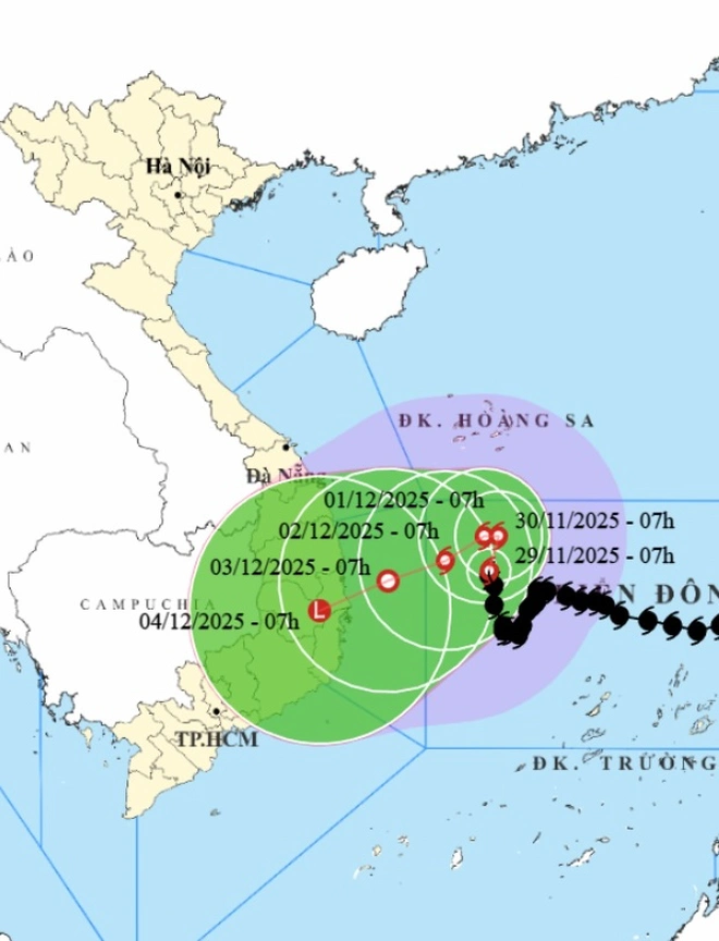
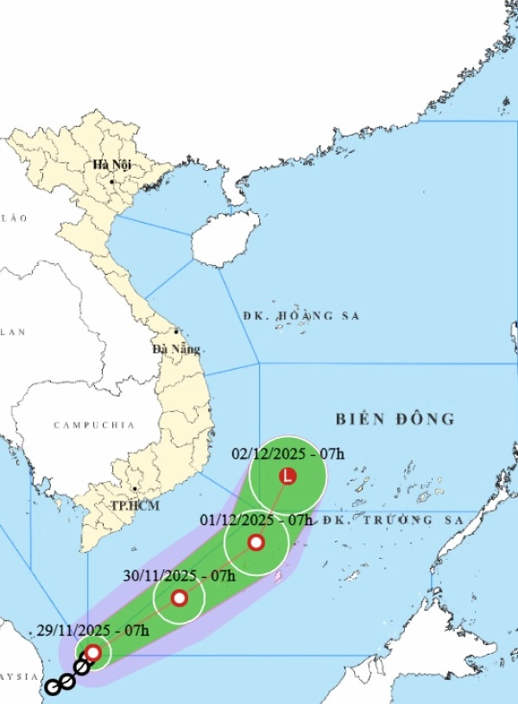
Forecast of location and direction of storm Koto and tropical depression at 7am on November 29 - Photo: NCHMF
According to the National Center for Hydro-Meteorological Forecasting on the morning of November 29, a tropical depression in the east of the Malay Peninsula has entered the southwestern waters of the southern East Sea.
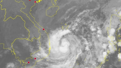
So there are storms and tropical depressions operating at the same time in the East Sea.
According to the meteorological agency, the tropical depression is currently at level 6-7 (39-61km/h), gusting to level 9 and moving northeast at a speed of about 10-15km/h.
It is forecasted that after entering the East Sea, the tropical depression will move in a northeast direction, from the sea off the southern provinces to the South Central region - where storm Koto is active.
The National Center for Hydro-Meteorological Forecasting assessed that the possibility of a tropical depression directly affecting the southern mainland is not high.
Most likely, when reaching the sea off the South Central provinces, the tropical depression will weaken into a low pressure area.
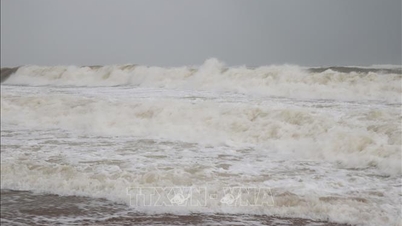
The circulation of this tropical depression mainly causes strong winds in the western sea area of the southern East Sea (including the western sea area of Truong Sa special zone), the eastern sea area from Lam Dong - Ca Mau has strong winds of level 6-7, gusts of level 8, waves from 2.5 - 4m high.

Storm and tropical depression operating together in the East Sea - Photo: VNDMS
Regarding typhoon Koto, at 8am on November 29, the eye of the storm was about 320km northwest of Song Tu Tay island. The strongest wind near the eye of the storm was level 9-10 (75-102km/h), gusting to level 13. The storm moved north at a speed of about 5km/h.
Mr. Mai Van Khiem, Director of the National Center for Hydro-Meteorological Forecasting, said the storm is expected to change direction continuously in the next 3 days.
Today, November 29, the storm moves north. On November 30, the storm changes direction to move west and on December 1, the storm moves west-southwest and its intensity is likely to gradually weaken (weakening by one level each day).
When moving into the sea off Quang Ngai - Dak Lak (formerly Phu Yen ), storm No. 15 is likely to weaken into a tropical depression.
In the next three days, it is necessary to pay attention to strong winds in the central East Sea with strong winds of level 7-9, near the storm center level 10-11, gusting to level 14, waves 7-9m high, and rough seas.
In the next three days, it is necessary to pay attention to strong winds in the central East Sea with strong winds of level 7-9, near the storm center level 10-11, gusting to level 14, waves 7-9m high, and rough seas.
The offshore sea area from Gia Lai to Khanh Hoa has strong winds of level 6-7, then increasing to level 8, gusting to level 9-10, waves 4-6m high, rough seas.
Vessels operating in the above mentioned dangerous areas are susceptible to the impact of storms, whirlwinds, strong winds and large waves.
"Unprecedented tropical depression"
The above tropical depression originated from storm Senyar, moving from the Indian Ocean region, passing through Malaysia to the northwest Pacific region.
According to Mr. Khiem, according to data from 1951 to now, there have been a number of tropical depressions formed at latitudes lower than 5 degrees North. However, most of these tropical depressions move west, not east.
"The formation of a tropical depression at low latitudes and moving eastward like the tropical depression currently active in the eastern region of Malaysia is very rare or unprecedented," Mr. Khiem added.
Source: https://tuoitre.vn/ap-thap-nhiet-doi-la-chua-tung-co-vao-nam-bien-dong-huong-ve-phia-bao-koto-20251129084336837.htm















Comment (0)