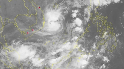
At 4:00 p.m. the same day, the center of the low pressure area was at about 5.3 degrees North latitude; 107.1 degrees East longitude. The strongest wind in the center of the low pressure area decreased to below level 6 (below 39 km/h). It is forecasted that in the next 12 hours, the low pressure area will continue to move in the Northeast direction, at a speed of 10-15 km/h, weakening and gradually dissipating.
 |
| Forecast map of storm No. 15's trajectory and intensity issued at 5:00 p.m. on November 29, 2025. |
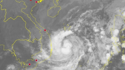
Storm No. 15 (Koto) is currently active in the northwest sea area of the central East Sea with wind gusts of level 11. It is forecasted that in the coming days, the storm will move slowly and head towards the sea areas of the provinces from Gia Lai to Dak Lak .
According to the National Center for Hydro-Meteorological Forecasting, at 4:00 p.m. on November 29, the center of the storm was located at about 13.7 degrees North latitude; 112.2 degrees East longitude, in the northwest sea area of the central East Sea . The strongest wind near the center of the storm was level 9 (75 - 88 km/h), gusting to level 11. The storm was moving north at a speed of about 5 km/h.
Forecast until 4:00 p.m. on November 30, the storm is moving slowly to the North (about 3 km/h), intensity remains at level 9, gusting to level 11. The center of the storm is about 340 km east of the eastern coast of Gia Lai - Dak Lak province.
 |
| Instructions for anchoring boats to avoid storms. Source : BNNMT |
At 4:00 p.m. on December 1, the storm moved westward at a speed of about 3 km/h and gradually weakened to level 8-9, gusting to level 11. The center of the storm was about 310 km east of the eastern coast of Gia Lai - Dak Lak province.
At 4:00 p.m. on December 2, the storm moved southwest at a speed of 3-5 km/hour, continuing to weaken to level 8, gusting to level 10. At this time, the storm center was only about 250 km east of the eastern coast of Gia Lai - Dak Lak province.
During the next 72 to 120 hours, the storm will move in the West Southwest direction at a speed of 5 - 10 km/hour and continue to weaken.
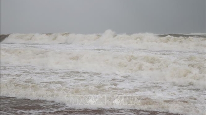
Due to the influence of the storm, the northwest sea area of the central East Sea has strong winds of level 7, the area near the eye of the storm has strong winds of level 8-9, gusting to level 11. Waves are 3-5 m high, the area near the eye of the storm is 5-7 m; the sea is very rough.
 |
| Instructions for reinforcing and protecting ponds, lagoons, and aquaculture cages from storms. Source : BNNMT |
The National Center for Hydro-Meteorological Forecasting warns that vessels operating in the above-mentioned dangerous areas (the northwest sea area of the central East Sea, the sea area off the coast of provinces from Gia Lai to Khanh Hoa ) are likely to be affected by storms, whirlwinds, strong winds and big waves.
Faced with the complicated developments of storm No. 15 approaching the sea of Dak Lak province, coastal localities and relevant units need to closely monitor forecasts to proactively respond.
Source: https://baodaklak.vn/thoi-su/202511/ap-thap-nhiet-doi-se-tan-tren-bien-dong-bao-so-15-du-bao-tien-sat-vung-bien-gia-lai-dak-lak-4b7160a/






























Comment (0)