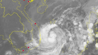
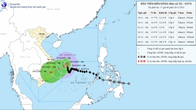
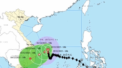
Regarding storm No. 15, at 1:00 p.m. on November 28, the center of the storm was at about 12.4 degrees North latitude; 112.7 degrees East longitude, about 190km northwest of Song Tu Tay island. The strongest wind near the center of the storm was level 10 (89-102km/h), gusting to level 13. The storm moved southwest at a speed of 5km/h.
The National Center for Hydro-Meteorological Forecasting predicts that in the next 24-72 hours:
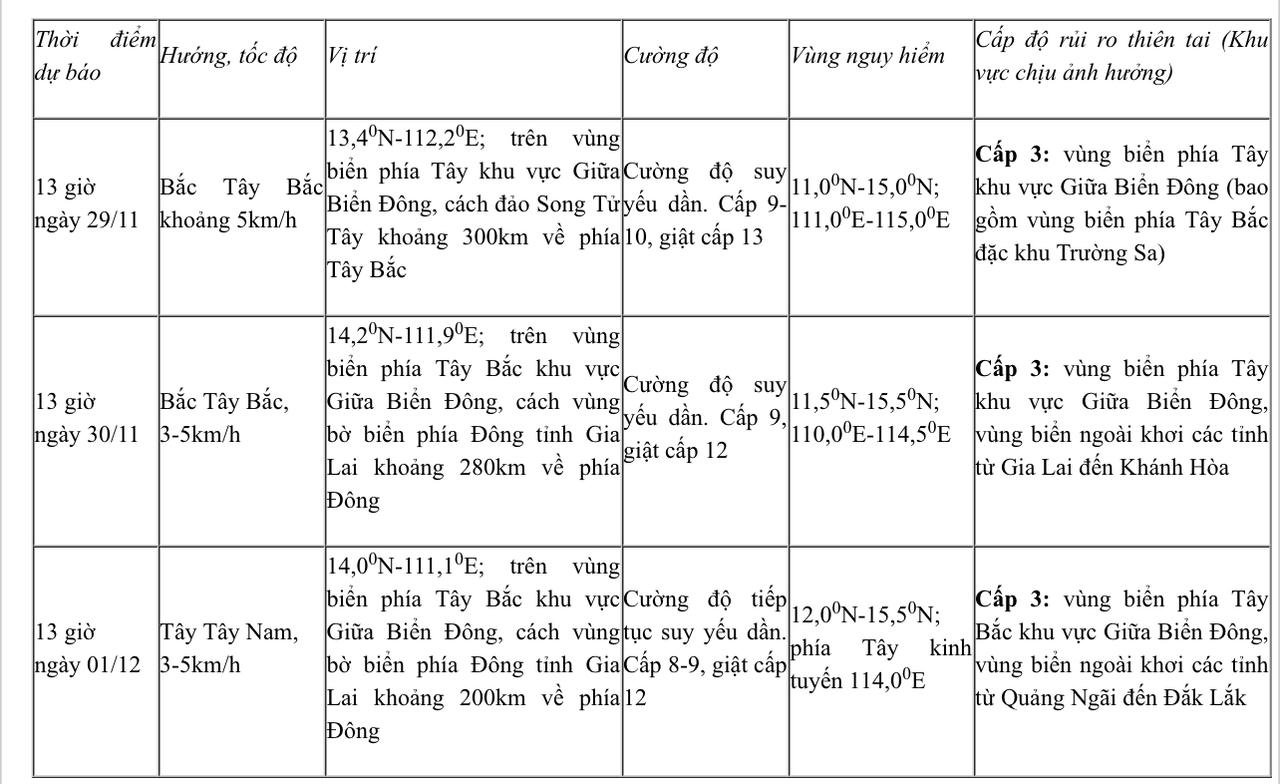
From the next 72 to 120 hours, the storm moved slowly in the West Southwest direction at a speed of about 5km/h and continued to weaken.
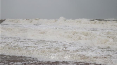
Due to the impact of the storm, the western sea area of the Central East Sea (including the northwest sea area of Truong Sa special zone) has strong winds of level 7-9; the area near the storm's eye has strong winds of level 10, gusting to level 12-13; waves 3-5m high, the area near the storm's eye is 6-8m; the sea is very rough.
The offshore sea area from Gia Lai to Khanh Hoa has strong winds of level 6-7, then increasing to level 8, gusting to level 9-10, waves 4-6m high, rough seas.
Vessels operating in the above mentioned dangerous areas are susceptible to the impact of storms, whirlwinds, strong winds and large waves.
Meanwhile, a tropical depression is active over the eastern coast of Malaysia.
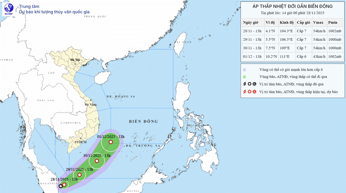
At 1 p.m. today, the center of the tropical depression was at about 4.1 degrees North latitude; 104.3 degrees East longitude, on the eastern coastal area of Malaysia. The strongest wind near the center of the tropical depression was level 6-7 (39-61 km/h), gusting to level 9. The storm moved northeast at a speed of about 15 km/h.
Forecast for the next 48-72 hours:
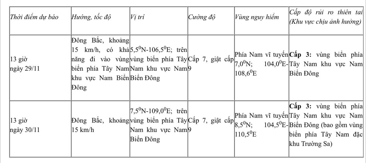
From the next 48 to 72 hours, the tropical depression will move mainly in the Northeast direction, about 15km per hour, gradually weakening in intensity.
Due to the impact of the tropical depression, the southwestern sea area of the South East Sea has winds gradually increasing to level 6-7, gusting to level 9, with waves 2.5-4.0m high. Rough seas.
"Vessels operating in the above-mentioned dangerous areas are likely to be affected by storms, whirlwinds, strong winds, and large waves," the National Center for Hydro-Meteorological Forecasting warned.
Source: https://baophapluat.vn/bao-giat-cap-13-dang-hoanh-hanh-tren-bien-dong-ap-thap-nhiet-doi-lai-tien-gan.html

















Comment (0)