
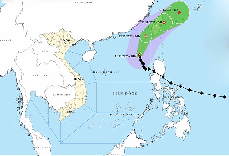
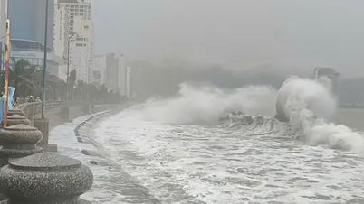
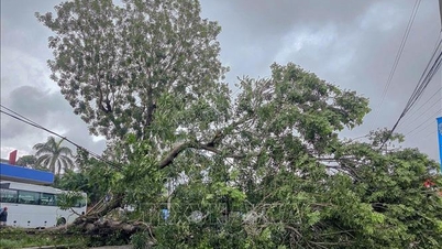
According to the National Center for Hydro-Meteorological Forecasting, at 1:00 p.m. on November 11, the center of the storm was located at about 20.0 degrees North latitude; 118.4 degrees East longitude, in the eastern sea area of the North East Sea. The strongest wind near the center of the storm was level 11 (103-117 km/h), gusting to level 14. Moving northward, at a speed of about 10 km/h.
Forecast until 13:00 on November 12, the storm in the northeastern sea of the North East Sea with wind force level 10, gust level 13, moving in the North Northeast direction, speed 10-15 km/h and gradually weakening. The affected area is the northeastern sea of the North East Sea with disaster risk level level 3.
At 1 p.m. on November 13, the storm in the northeastern sea of Taiwan (China) gradually weakened into a tropical depression with wind speed of level 6, gusting to level 8 and moving northeast at a speed of about 20 km/h. The affected area is the northeastern sea of the North East Sea with a disaster risk level of level 3.
Then at 1:00 a.m. on November 14, the storm in the sea northeast of Taiwan (China), moved in the East Northeast direction, speed 20 km/h and continued to weaken into a low pressure area with winds below level 6.
Due to the impact of the storm, the eastern sea area of the North East Sea has strong winds of level 7-8; the area near the eye of the storm has strong winds of level 9-11, gusts of level 14, waves 4-6m high, the area near the eye of the storm is 7-9m. The sea is very rough.
All vessels operating in the above mentioned danger zones are susceptible to the effects of storms, whirlwinds, strong winds and large waves.
Source: https://baotintuc.vn/xa-hoi/bao-so-14-van-giu-nguyen-cuong-do-huong-di-chuyen-va-suy-yeu-dan-20251111151005001.htm


![[Photo] Highways passing through Dong Nai](https://vphoto.vietnam.vn/thumb/1200x675/vietnam/resource/IMAGE/2025/11/12/1762940149627_ndo_br_1-resize-5756-jpg.webp)
![[Photo] Prime Minister Pham Minh Chinh attends a conference to review one year of deploying forces to participate in protecting security and order at the grassroots level.](https://vphoto.vietnam.vn/thumb/1200x675/vietnam/resource/IMAGE/2025/11/12/1762957553775_dsc-2379-jpg.webp)


![Dong Nai OCOP transition: [Article 3] Linking tourism with OCOP product consumption](https://vphoto.vietnam.vn/thumb/402x226/vietnam/resource/IMAGE/2025/11/10/1762739199309_1324-2740-7_n-162543_981.jpeg)


Comment (0)