
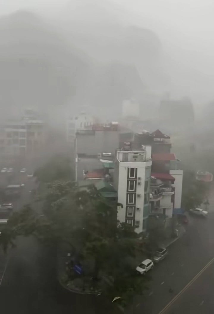
At around 1:30 p.m. on July 19, heavy rain accompanied by hail, strong winds, and thunder and lightning appeared in many areas in Quang Ninh .
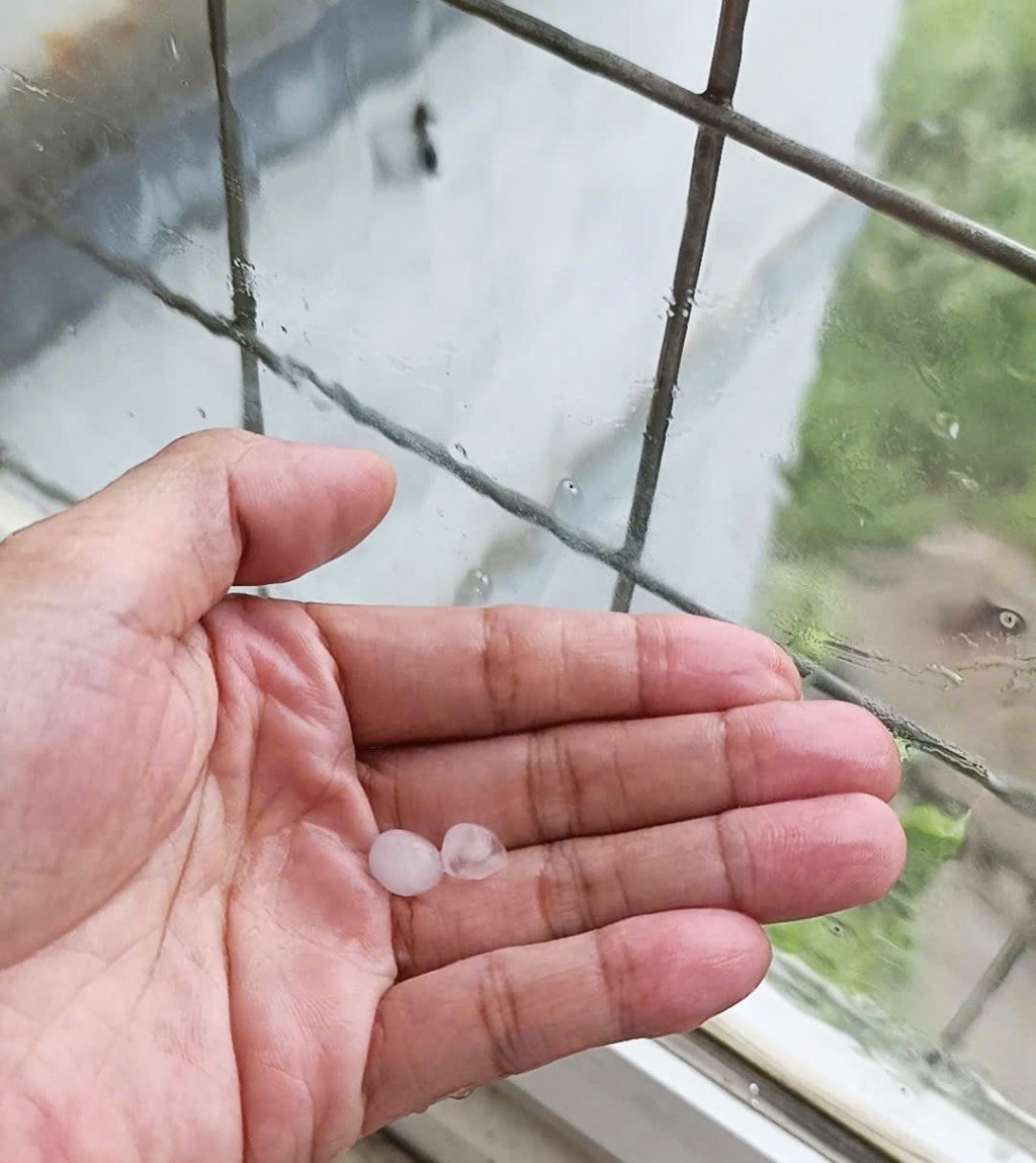
According to images and videos circulating on social networks, hail appeared after large thunderstorms, with hailstones the size of chopsticks falling heavily, forcing passersby to stop and take shelter.
Mr. TAT (living in Ha Long ward) said he was in his house when he heard continuous thunder, followed by heavy rain and strong winds. “Many flower pots in the yard were knocked over, and the porch roof shook violently because of the wind,” he said.
In Cao Thang ward, Ms. H. recorded a hailstorm that lasted about 10-12 minutes. “At first it was just heavy rain, but a few minutes later, hailstones were falling heavily on the yard and the corrugated iron roof, and the strong wind made everyone close their doors,” she said.
Mr. Nguyen Gia Hung (owner of a restaurant in Bai Chay) said that learning from the previous storm, his restaurant is now preparing water bags to be ready to reinforce the roof before storm number 3 Wipha makes landfall.
According to local residents, in some areas such as Bai Chay and Ha Khanh wards, the storms were stronger, causing the roofs of many houses to be blown off and corrugated iron sheets to fall on cars parked on the side of the road.

Quang Ninh Provincial People's Committee has issued a document requesting localities and units to proactively respond to storm No. 3. The Provincial Office of Natural Disaster Prevention (Command Committee for Natural Disaster Prevention - Search and Rescue and Civil Defense of the province) also requested the Inland Waterway Port Authority to inform tourists about the storm, proactively schedule appropriate travel to avoid tourist congestion at coastal tourist areas when there is a sea ban situation; ensure safety for people and vehicles at shelters and coastal tourist areas.
At the same time, units are ready with forces, means, and plans to respond to storms and heavy rains caused by storms; organize on-duty shifts, and be ready to receive and implement instructions from the Central and the province in the coming time.
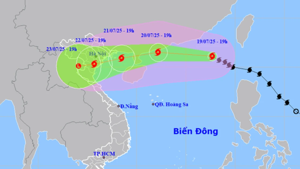
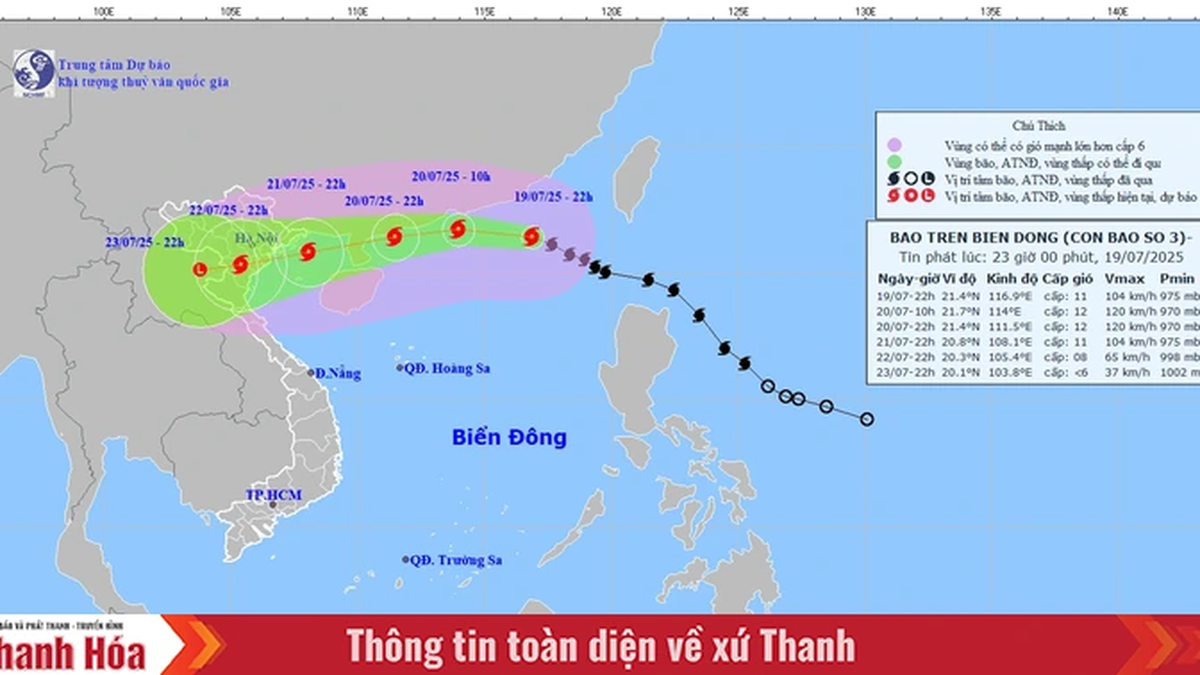
According to the National Center for Hydro-Meteorological Forecasting, in the past 3 hours, storm number 3 has strengthened by one level. At 1:00 p.m., storm number 3 reached level 10, gusting to level 12, moving northwest at a speed of about 20km/h.
From this afternoon and evening, there will be thunderstorms in the North. Thunderstorms will be concentrated in mountainous areas (especially in the provinces of Ha Giang, Cao Bang, Quang Ninh, Lang Son), and in the late afternoon and evening, they will likely occur in the plains and coastal areas.
The Meteorological Center recommends that in hot weather conditions, high humidity, thunderstorms will appear with a very high risk of lightning and gusts of wind, so people need to pay attention and be careful.
Updating information about storm number 3 Wipha in 2025, the Department of Hydrometeorology said that storm Wipha is strong, moving fast, and has a wide circulation. It is forecasted that in the early morning of July 21, the storm will likely move into the Gulf of Tonkin, and on the night of July 21 and early morning of July 22, it may affect the coastal mainland of provinces from Quang Ninh to Thanh Hoa.
VN (according to VTC News)Source: https://baohaiphongplus.vn/bao-so-3-dang-ngoai-khoi-quang-ninh-da-xuat-hien-mua-da-gio-giat-manh-416737.html


Comment (0)