
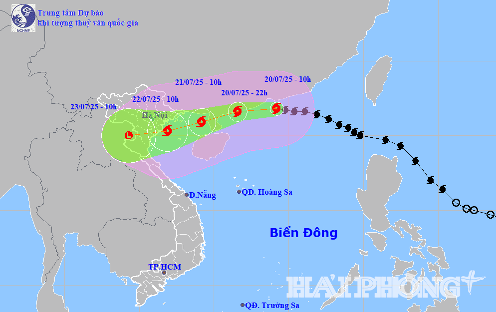
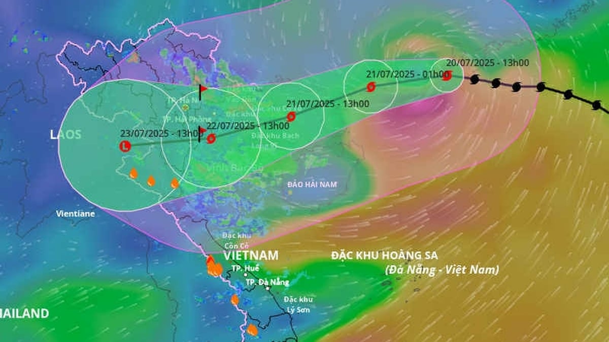
According to the National Center for Hydro-Meteorological Forecasting, at 1:00 p.m. on July 20, the center of storm No. 3 (storm WIPHA) was located at about 21.9 degrees north latitude, 113.4 degrees east longitude, in the northern sea area of the North East Sea, about 630 km east of Quang Ninh - Hai Phong . The strongest wind near the center of the storm was level 12 (118 - 133 km/h), gusting to level 15. The storm moved west at a speed of 20 - 25 km/h.
It is forecasted that in the next 24 - 72 hours, storm No. 3 will continue to move west, then turn west-west at a speed of 20 - 25 km/hour. At 10:00 on July 21, the center of storm No. 3 is in the sea east of the northern Gulf of Tonkin. Winds near the storm center are at level 11, gusting to level 14. At 10:00 on July 22, the storm center will enter the coastal area from Quang Ninh - Thanh Hoa. The storm's wind intensity is at level 10 - 11, gusting to level 14.
Due to the influence of storm No. 3, the northern East Sea has strong storm winds of level 8-10, near the storm center of level 11-12, gusting to level 15; waves 5-7m high, rough seas.
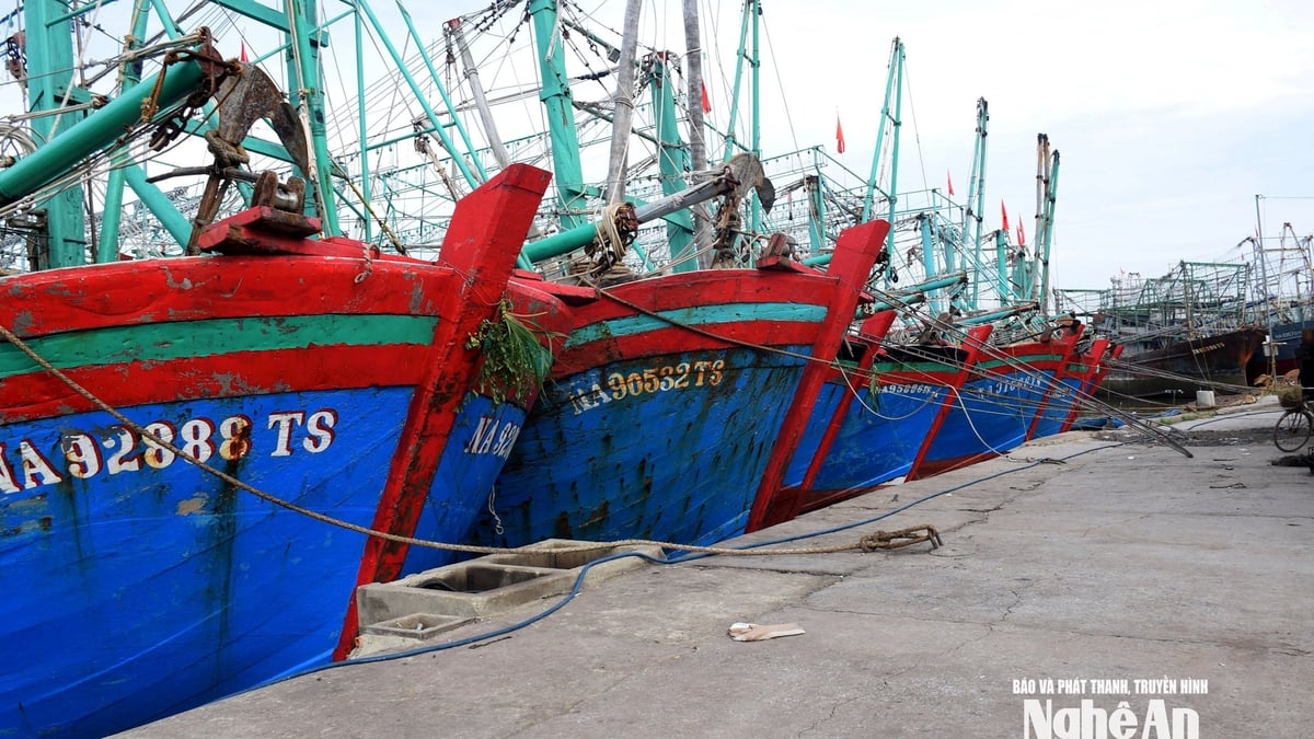
From the night of July 20, the northern Gulf of Tonkin (including Co To, Bach Long Vi, Cat Hai, Hon Dau) will have strong winds of level 6-7, then increasing to level 10-11, gusting to level 14; waves 2-5m high.
Hai Phong - Quang Ninh area, sea level rise due to storm from 0.5 - 1.0m, total water level from 4 - 5m. High risk of flooding in low-lying areas at noon on July 22.
From July 21 to 23, the Northeast region, the Northern Delta, Thanh Hoa, and Nghe An will have very heavy rain of 200 - 350mm, with some places having over 600mm.
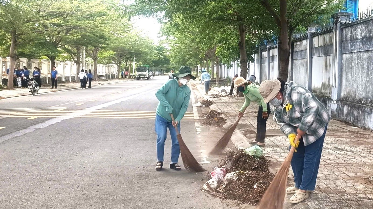
Ready to respond to heavy rain due to the impact of storm No. 3
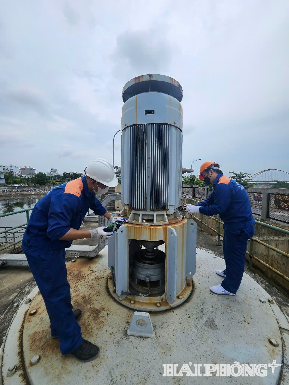
Forecasting that storm No. 3 (storm WIPHA) will cause heavy rain, Hai Phong Drainage One Member Co., Ltd. requested units operating pumping stations and tide-prevention sluices to regulate and lower water levels in ditches and lakes; test-run pumps to ensure good operation in all conditions when there is heavy rain caused by the storm.
Clear all drainage outlets, collect garbage at the manholes; remove duckweed and obstacles in the ditches and regulating lakes; prepare auxiliary flaps and sandbags at the tide-preventing sluices; prepare all available equipment, cranes, mobile pumps with a capacity of 1,000 m3/hour; arrange sludge suction trucks and pipeline cleaning trucks to be ready during the storm. Workers at the pumping stations work 24/7 according to assigned shifts...
In order to promptly and quickly direct the work of preventing flooding due to the impact of storm No. 3, the company has developed a detailed plan for each department and unit to deploy the task of operating the urban drainage system during the time the storm affects the mainland and after the storm has dissipated. Establish 3 inspection teams for storm prevention work before, during and after the storm, continuously reviewing and checking key areas for flooding until the storm is over.
Source: https://baohaiphongplus.vn/bao-so-3-manh-cap-12-giat-cap-15-cach-quang-ninh-hai-phong-khoang-630-km-416803.html


![[Photo] National Assembly Chairman Tran Thanh Man visits Vietnamese Heroic Mother Ta Thi Tran](https://vphoto.vietnam.vn/thumb/1200x675/vietnam/resource/IMAGE/2025/7/20/765c0bd057dd44ad83ab89fe0255b783)


Comment (0)