
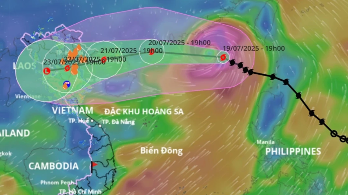
The National Center for Hydro-Meteorological Forecasting said that at 10:00 p.m. on July 19 , the center of storm No. 3 (international name Wipha) was located at about 21.4 degrees North latitude; 116.9 degrees East longitude, in the northern sea area of the North East Sea. 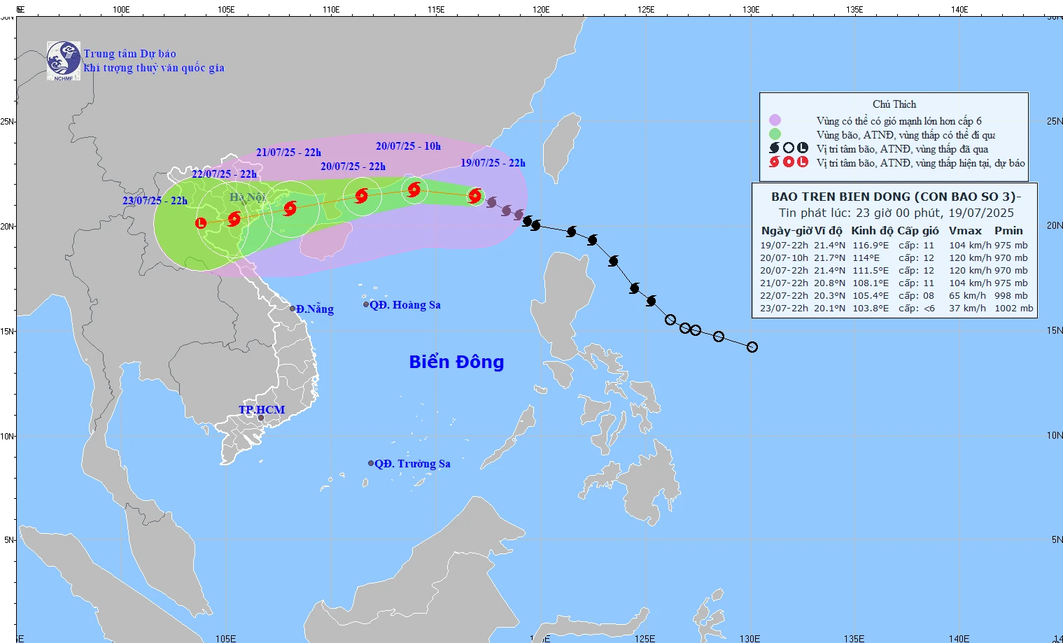
The storm has strengthened, the strongest wind near the storm center is level 10-11 (89-117km/h), gusting to level 14; moving in the West Northwest direction at a speed of about 20-25km/h. It is forecasted that in the next 72 to 96 hours, the storm will move mainly in the West Southwest direction, traveling 5-10km per hour and continue to weaken.
Storm forecast ( in the next 24 to 72 hours):
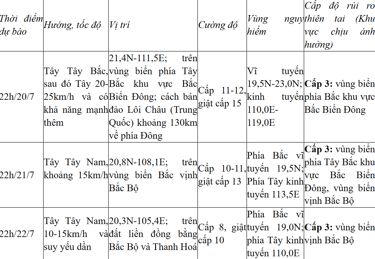
The northern sea area of the North East Sea has strong winds of level 8-10, near the eye of the storm it has level 11-12, gusting to level 15; waves 5.0-7.0m high. The sea is very rough. From July 21, the northern sea area of the Gulf of Tonkin (including the special zones of Bach Long Vi, Co To, and Cat Hai) has winds gradually increasing to level 6-7, then increasing to level 8-9, near the eye of the storm it has level 10-11, gusting to level 14; waves 2.0-4.0m high, near the eye 3.0-5.0m. The sea is very rough.
From the afternoon of July 21, the sea in the southern Gulf of Tonkin will have winds gradually increasing to level 6-7, near the storm center level 8-9, gusting to level 11, waves 2.0-4.0m high. The sea is very rough. Ships operating in the above-mentioned dangerous areas are likely to be affected by storms, whirlwinds, strong winds, and large waves.
NDS
Source: https://baothanhhoa.vn/bao-so-3-tiep-tuc-manh-len-gio-giat-cap-14-tien-rat-nhanh-ve-vinh-bac-bo-255380.htm


Comment (0)