
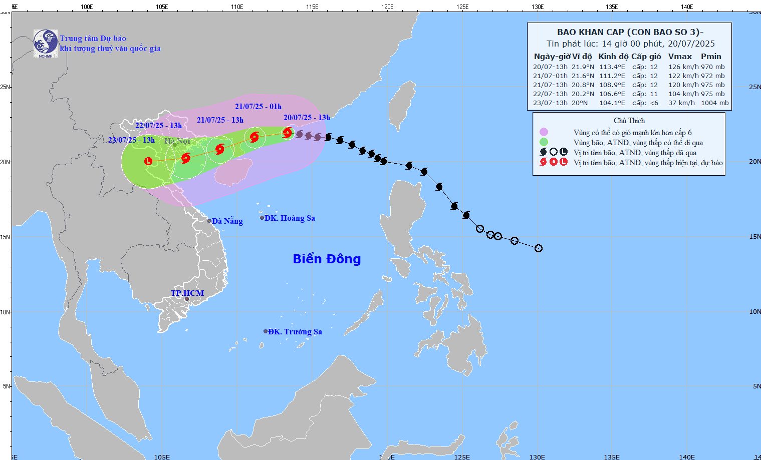
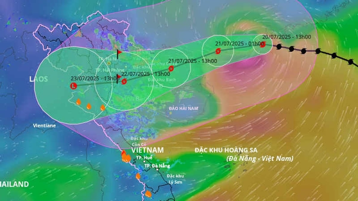
At 1 p.m. on July 20, the center of the storm was at approximately 21.9°N; 113.4°E, in the northern sea area of the North East Sea, approximately 630km east of Quang Ninh - Hai Phong . The strongest wind near the center of the storm was level 12 (118-133km/h), gusting to level 15. The storm moved west at a speed of 20-25km/h.
Forecast:
At 1:00 p.m. on July 21: The storm was at about 20.8°N; 108.9°E, in the eastern sea of the northern Gulf of Tonkin. Intensity level 11–12, gust level 15.
At 1:00 p.m. on July 22: The storm was at about 20.2°N; 106.6°E, on the coastal area of Quang Ninh - Thanh Hoa. Intensity level 10-11, gust level 14.
At 1:00 p.m. on July 23: Over Upper Laos, gradually weakening into a low pressure area.
Strong winds – rough seas
Northern sea area of the North East Sea: Strong wind level 8-10, near the storm center level 11-12, gust level 15. Waves 5.0-7.0m high, rough seas.
Northern Gulf of Tonkin (Bach Long Vi, Co To, Cat Hai, Hon Dau): Strong wind level 6–7, increasing to level 8–9, near the storm center level 10–11, gusting to level 14. Wave height 3.0–5.0m.
Southern Gulf of Tonkin (Hon Ngu): Strong wind level 6–7, near the storm center level 8–9, gust level 11. Wave height 2.0–4.0m.
Warning: Vessels operating in the danger zone are at high risk of encountering thunderstorms, tornadoes, strong winds and large waves. The coastal area of Hai Phong - Quang Ninh is at risk of flooding due to storm surges of 0.5-1.0m, with a total water level of 4.0-5.0m at noon - afternoon on July 22.
From the evening and night of July 21, the coast from Quang Ninh to Nghe An will have strong winds of level 7-9, near the storm center of level 10-11, gusting to level 14. Inland, winds of level 6-7, gusting to level 8-9.
From July 21-23, the Northeast region, the Northern Delta, Thanh Hoa, Nghe An will have heavy to very heavy rain (200-350mm, some places >600mm). The North and Ha Tinh will have moderate to heavy rain (100-200mm, some places >300mm). Warning of the risk of heavy rain >150mm/3 hours.
Source: https://baonghean.vn/bao-wipha-giat-cap-15-tren-vung-bien-bac-bien-dong-10302698.html


![[Photo] National Assembly Chairman Tran Thanh Man visits Vietnamese Heroic Mother Ta Thi Tran](https://vphoto.vietnam.vn/thumb/1200x675/vietnam/resource/IMAGE/2025/7/20/765c0bd057dd44ad83ab89fe0255b783)


Comment (0)