
Mr. Hoang Phuc Lam, Deputy Director of the National Center for Hydro-Meteorological Forecasting, said that at 4:00 a.m. on July 20, the center of storm Wipha (storm No. 3) was active in the northern sea area of the North East Sea, about 830km east of Quang Ninh - Hai Phong .
The strongest wind near the storm center is level 11 (103-117km/h), gusting to level 14. The storm moves in a West Northwest direction at a speed of about 20-25km/h.
In the next 24 hours, the storm will move mainly westward at a speed of 20-25km/h and is likely to reach level 11-12, gusting to level 15 on the mainland northeast of Leizhou Peninsula (China).
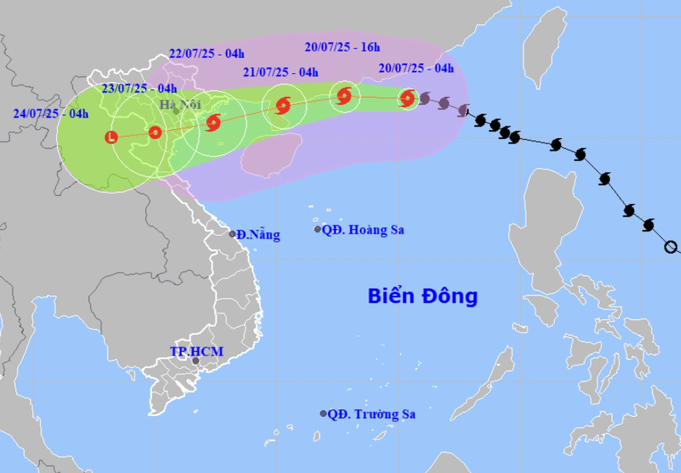
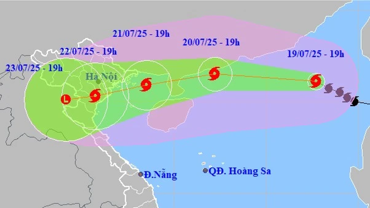
Storm Wipha will affect many areas in the North and North Central regions, causing widespread heavy rain (Photo: NCHMF).
It is forecasted that by 4am on July 22, the storm will move in a West-Southwest direction with a level 10-11 intensity, gusting to level 14, over the sea area of Quang Ninh - Ninh Binh .
The storm then continued to weaken into a tropical depression over the Northern Delta and Thanh Hoa .
Due to the influence of the storm, the northern sea area of the North East Sea has strong winds of level 8-10, the area near the storm's eye has winds of level 11-12, gusting to level 15; waves are 5-7m high, and the sea is very rough.
From the night of July 20, the northern sea area of Bac Bo Gulf (including the special zones of Bach Long Vi, Co To, Cat Hai) will have winds gradually increasing to level 6-7, then increasing to level 8-9, the area near the storm's center will have winds of level 10-11, gusting to level 14; waves 2-4m high, 3-5m near the center, rough seas.
From July 21, the sea in the southern Gulf of Tonkin will have winds gradually increasing to level 6-7, near the storm center level 8-9, gusting to level 11, waves 2-4m high, very rough seas. Ships/boats operating in the above-mentioned dangerous areas are likely to be affected by storms, whirlwinds, strong winds, and large waves.
According to forecasts, coastal areas of Hai Phong - Quang Ninh provinces will have storm surges from 0.5m (Hai Phong) to 0.8m (Quang Ninh), combined with tides creating a combined water level from 4.1m (at Hon Dau, Hai Phong city) to 5.0m (at Bai Chay, Quang Ninh province), causing flooding in low-lying areas along the coast and river mouths at noon and afternoon on July 22.
According to the Hydrometeorological Agency, from the evening and night of July 21, on the mainland from Quang Ninh to Thanh Hoa, winds will gradually increase to level 7-9, gusting to level 10-11; further inland, winds will increase to level 6-7, gusting to level 8-9; near the storm center, winds will increase to level 10-11, gusting to level 14.
From July 21 to 23, the Northern and North Central regions are likely to experience widespread heavy rain with rainfall ranging from 100-200mm, locally over 300mm. In particular, the Northeast, Northern Delta, Thanh Hoa and Nghe An will experience heavy to very heavy rain with rainfall ranging from 200-350mm, locally over 600mm, warning of the risk of heavy rain (>150mm/3 hours).
Dantri.com.vn
Source: https://dantri.com.vn/xa-hoi/bao-wipha-tang-len-cap-11-giat-cap-14-huong-vao-quang-ninh-ninh-binh-20250720061534504.htm


![[Photo] National Assembly Chairman Tran Thanh Man visits Vietnamese Heroic Mother Ta Thi Tran](https://vphoto.vietnam.vn/thumb/1200x675/vietnam/resource/IMAGE/2025/7/20/765c0bd057dd44ad83ab89fe0255b783)


Comment (0)