
The center of the storm is located at 20 degrees North latitude - 119.8 degrees East longitude. The strongest wind is level 9 (75-88km/h), gusting to level 12. The storm is moving northwest at a speed of 20km/h.
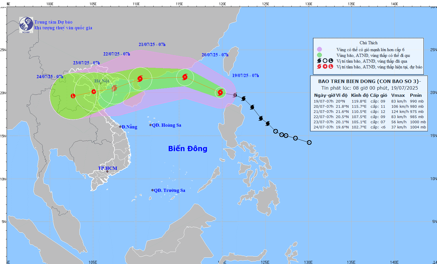
Forecast path of storm Wipha at 8:00 a.m. on July 19, 2025.
Forecast at 7am on July 20, the storm is moving in the West-Northwest direction, maintaining a speed of 20 km/h, entering the East Sea and strengthening. Location at 21.8 degrees North latitude - 115.7 degrees East longitude; in the northern sea area of the North East Sea; about 600 km east of Leizhou Peninsula (China). Intensity level 10-11, gust level 13.
As of 7:00 a.m. on July 21, the storm was moving mainly westward at a speed of about 20 km/h. Location was at 21.6 degrees north latitude - 110.5 degrees east longitude; on the eastern coast of Leizhou Peninsula (China). Intensity level 11-12, gust level 14.
Around the morning of July 22, the storm moved in a West-Southwest direction, at 20.5 degrees North latitude - 107.5 degrees East longitude, in the Gulf of Tonkin, then gradually weakened.
Detailed forecast of storm developments in the next 24 to 72 hours is as follows:
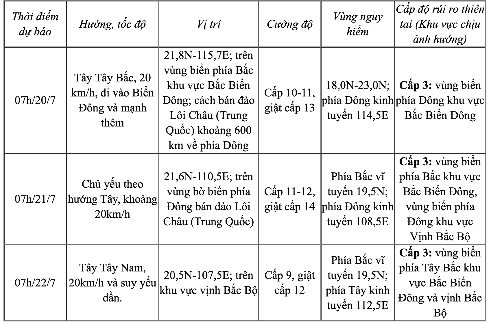
From the next 72-120 hours, the storm will continue to move in the West Southwest direction at a speed of 10-15km/h and continue to weaken further.
At sea, strong winds level 6-7; near the storm center level 8-9, increasing to 10-11, gusting to level 13. Waves 4-6m high. Rough seas.
NDS
Source: https://baothanhhoa.vn/bao-wipha-tro-thanh-con-bao-so-3-nam-2025-255273.htm


Comment (0)