
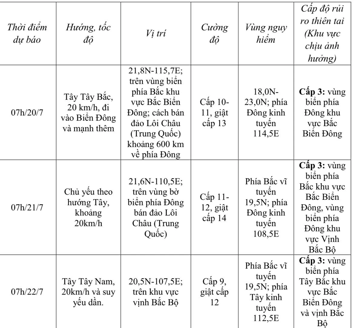
At 7:00 a.m., the center of the storm was at about 20 degrees North latitude; 119.8 degrees East longitude, in the northeastern sea area of the North East Sea. The strongest wind near the center of the storm was level 9 (75-88 km/h), gusting to level 12; moving northwest at a speed of about 20 km/h.
 |
| Forecast of storm Wipha (in the next 24 to 72 hours). |
From the next 72 to 120 hours, the storm will move mainly in the West Southwest direction, traveling 10-15km per hour and continue to weaken further.
In the eastern sea area of the North East Sea, the wind gradually increases to level 6-7, in the area near the storm's eye it increases to level 8-9, then increases to 10-11, gusting to level 13; waves are 4-6m high, the sea is very rough.
Ships operating in the above mentioned dangerous areas are likely to be affected by storms, whirlwinds, strong winds and large waves.
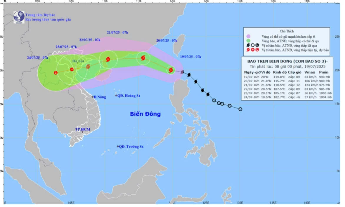 |
| Map of forecast trajectory and intensity of storm No. 3, released at 8:00 a.m., July 19. |
Storm No. 3 does not directly affect the weather in Dong Nai province.
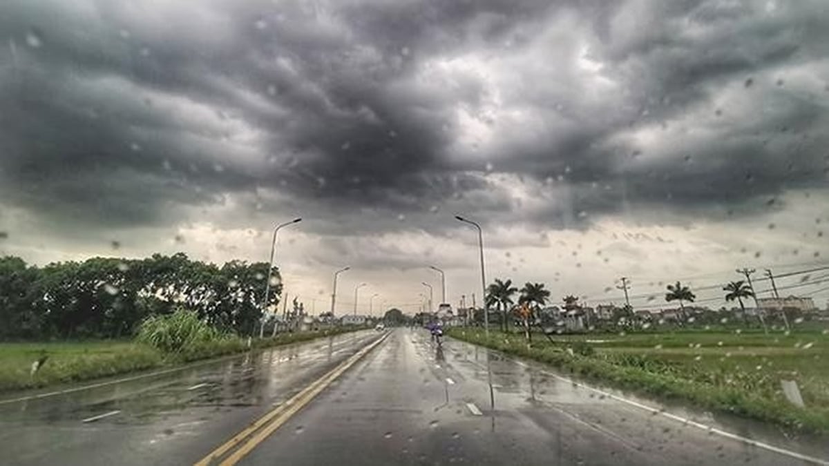
Weather in Dong Nai, cloudy, scattered showers and thunderstorms in the afternoon, afternoon and evening, some places have moderate rain, some places have heavy rain. During thunderstorms, beware of tornadoes, lightning and strong gusts of wind.
Kim Lieu
Source: https://baodongnai.com.vn/tin-moi/202507/bao-wipha-vao-bien-dong-tro-thanh-bao-so-3-trong-nam-2025-1310211/


Comment (0)