
This morning (July 19), storm Wipha entered the northeastern sea of the North East Sea, becoming storm number 3 in 2025, moving towards the Gulf of Tonkin.
According to the National Center for Hydro-Meteorological Forecasting, as of 7:00 a.m. this morning (July 19), the center of storm No. 3 Wipha was located at about 20.0 degrees North latitude; 119.8 degrees East longitude, in the northeastern sea area of the North East Sea. The strongest wind near the center of the storm is level 9 (75-88 km/h), gusting to level 12; moving northwest at a speed of about 20 km/h.
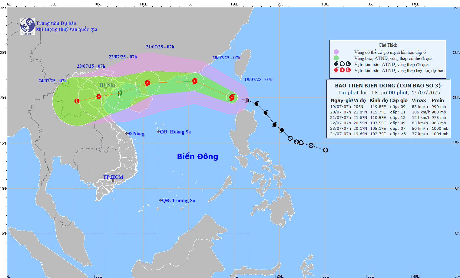 |
Direction of movement of storm No. 3 Wipha updated on the morning of July 19. |
Storm forecast (in the next 24 to 72 hours):
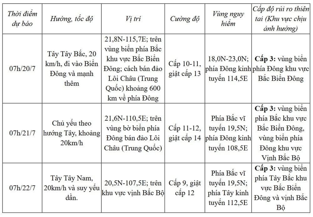 |
From the next 72 to 120 hours, the storm will move mainly in the West Southwest direction, traveling 10 - 15km per hour and continue to weaken further.
Due to the influence of storm No. 3, the sea area east of the North East Sea gradually increased to level 6-7, the area near the storm center had strong winds of level 8-9, then increased to 10-11, gusting to level 13; waves 4-6m high. The sea was very rough.
Ships operating in the above mentioned dangerous areas are likely to be affected by storms, whirlwinds, strong winds and large waves.
NGOC ANH
* Please visit the Society section to see related news and articles.
Source: https://baolamdong.vn/bao-wipha-vao-bien-dong-tro-thanh-con-bao-so-3-di-chuyen-ve-huong-vinh-bac-bo-382848.html


Comment (0)