According to the National Center for Hydro-Meteorological Forecasting, this morning (July 19), storm Wipha entered the northeastern sea of the North East Sea, becoming storm number 03 in 2025.
At 7:00 a.m., the center of the storm was located at approximately 20.0 degrees North latitude; 119.8 degrees East longitude, in the northeastern sea area of the North East Sea. The strongest wind near the center of the storm was level 9 (75-88 km/h), gusting to level 12; moving northwest at a speed of approximately 20 km/h.
It is forecasted that by 7:00 a.m. on July 20, the storm will move west-northwest at a speed of about 20 km/h, enter the East Sea and continue to strengthen. The center of the storm is at about 21.8 degrees North latitude - 115.7 degrees East longitude, in the northern sea area of the North East Sea, about 600 km east of Leizhou Peninsula (China). Wind strength is level 10-11, gusting to level 13.
The dangerous area at sea is determined from latitude 18.0N to 23.0N and east of longitude 114.5E. Disaster risk level: level 3, applied to the sea area east of the North East Sea.
At 7:00 a.m. on July 21, the storm was moving mainly westward at a speed of about 20 km/h. The center of the storm was at about 21.6 degrees North latitude - 110.5 degrees East longitude, located on the eastern coast of Leizhou Peninsula (China). Winds were at level 11-12, gusting to level 14.
The danger zone extends to the north of latitude 19.5N and the east of longitude 108.5E, including the sea area north of the North East Sea and the east of the Gulf of Tonkin. The disaster risk level remains at level 3.
At 7:00 a.m. on July 22, the storm continued to move west-southwest at a speed of about 20 km/h and began to weaken gradually. The center of the storm was at about 20.5 degrees North latitude - 107.5 degrees East longitude, located in the Gulf of Tonkin. Wind speed decreased to level 9, gusting to level 12.
The danger zone narrows to the north of latitude 19.5N and the west of longitude 112.5E. Level 3 natural disaster risk is determined for the northwestern sea area of the North East Sea and the Gulf of Tonkin.
From the next 72 to 120 hours, the storm will move mainly in the West Southwest direction, traveling 10-15km per hour and continue to weaken further.
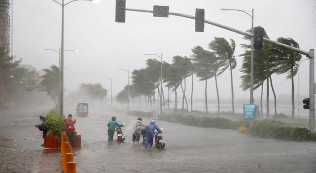
Forecast of storm impact, the eastern sea area of the North East Sea will gradually increase to level 6-7, the area near the storm center will increase to level 8-9, then increase to level 10-11, gusting to level 13; waves 4.0-6.0m high. The sea will be rough. Ships operating in the above dangerous areas are likely to be affected by storms, whirlwinds, strong winds, and large waves.
Mr. Mai Van Khiem - Director of the National Center for Hydro-Meteorological Forecasting said that the path and impact of storm Wipha has the shape of storm Yagi , so we need to pay close attention and have a plan to prevent strong storms when they make landfall at level 10-11, gusting to level 14, 15.
If it maintains its current path, Wipha could directly impact mainland Vietnam from the night of July 21 to July 22, with the impact area extending from Quang Ninh to Nghe An . Rainfall from July 21 to 24 is forecast to reach 200-350mm, with some places reaching over 600mm, causing a high risk of flash floods, landslides and inundation. Particularly from the afternoon of July 20, the storm's western circulation could begin to cause early thunderstorms in some northern areas.
Although international models have not yet agreed on the storm's landing point and maximum intensity, the National Center for Hydro-Meteorological Forecasting warns that the worst-case scenario is that the storm will make landfall with winds of level 10-11, gusting to level 14-15, causing strong winds and heavy rain over a wide area.
Source: https://baolaocai.vn/bien-dong-chinh-thuc-don-bao-so-3-voi-duong-di-phuc-tap-kho-luong-post649178.html


Comment (0)