
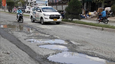
This is a group C project; type III agricultural and rural development works, level IV traffic works, implemented from 2025 to 2028, managed and implemented by the Bac Lieu Agricultural and Rural Development Construction Investment Project Management Board.
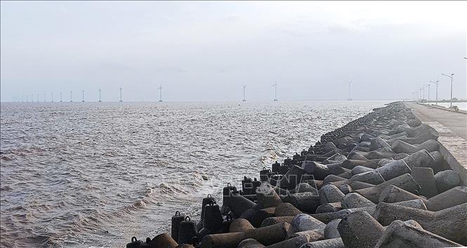
The project has a total dike length of 2,157m, dike width of 9m, dike crest elevation of +4.5m (the last section of the route connects to the existing road, elevation changes from +4.5 ÷ +2.7m), land use area of about 5.50ha.
The total investment cost is nearly 96 billion VND from the provincial budget and other legal capital sources for the 2021 - 2025 and 2026 - 2030 periods (of which, compensation, support and resettlement costs are 28.7 billion VND).
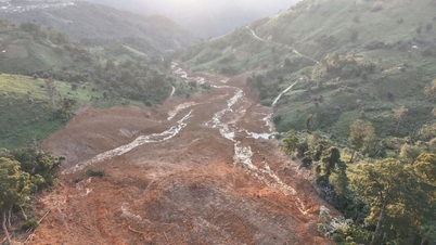
According to Vice Chairman of Ca Mau Provincial People's Committee Le Van Su, the immediate goal of the project is to restore and repair the dike slope, overcome landslides and upgrade the weak dike section (from Huyen Ke district towards Linh Ung Pagoda), in order to overcome landslides and withstand climate change impacts on the dike and coast.
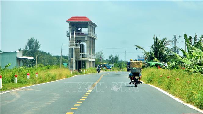
At the same time, forming a vital route to serve the relocation and evacuation of people in emergency cases, ensuring the safety of people's lives and property, helping people live in peace, thereby contributing to ensuring security and national defense for Long Dien commune, Ca Mau province.
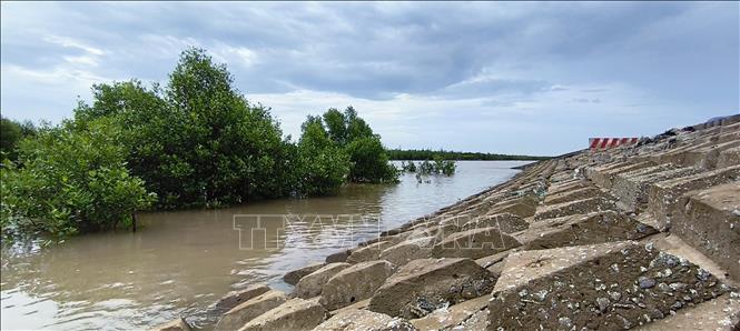
For the long-term goal, the project's completion will facilitate the re-planning of the coastal transport system in line with the province's overall goals and planning; adapting to climate change and sea level rise scenarios by 2100.
Along with that, it contributes to creating infrastructure suitable for socio-economic development planning, protecting the coastal ecological environment; gradually forming a coastal traffic axis to serve socio-economic development, eco-tourism, attracting investment and ensuring security and national defense.
Source: https://baotintuc.vn/xa-hoi/ca-mau-nang-cap-de-bien-dong-cap-bach-chong-bien-doi-khi-hau-20251114174349865.htm
![[Photo] Unique architecture of the deepest metro station in France](https://vphoto.vietnam.vn/thumb/1200x675/vietnam/resource/IMAGE/2025/11/14/1763107592365_ga-sau-nhat-nuoc-phap-duy-1-6403-jpg.webp)


![[Photo] Unique art of painting Tuong masks](https://vphoto.vietnam.vn/thumb/1200x675/vietnam/resource/IMAGE/2025/11/14/1763094089301_ndo_br_1-jpg.webp)


![[Photo] Special class in Tra Linh](https://vphoto.vietnam.vn/thumb/1200x675/vietnam/resource/IMAGE/2025/11/14/1763078485441_ndo_br_lop-hoc-7-jpg.webp)


Comment (0)