
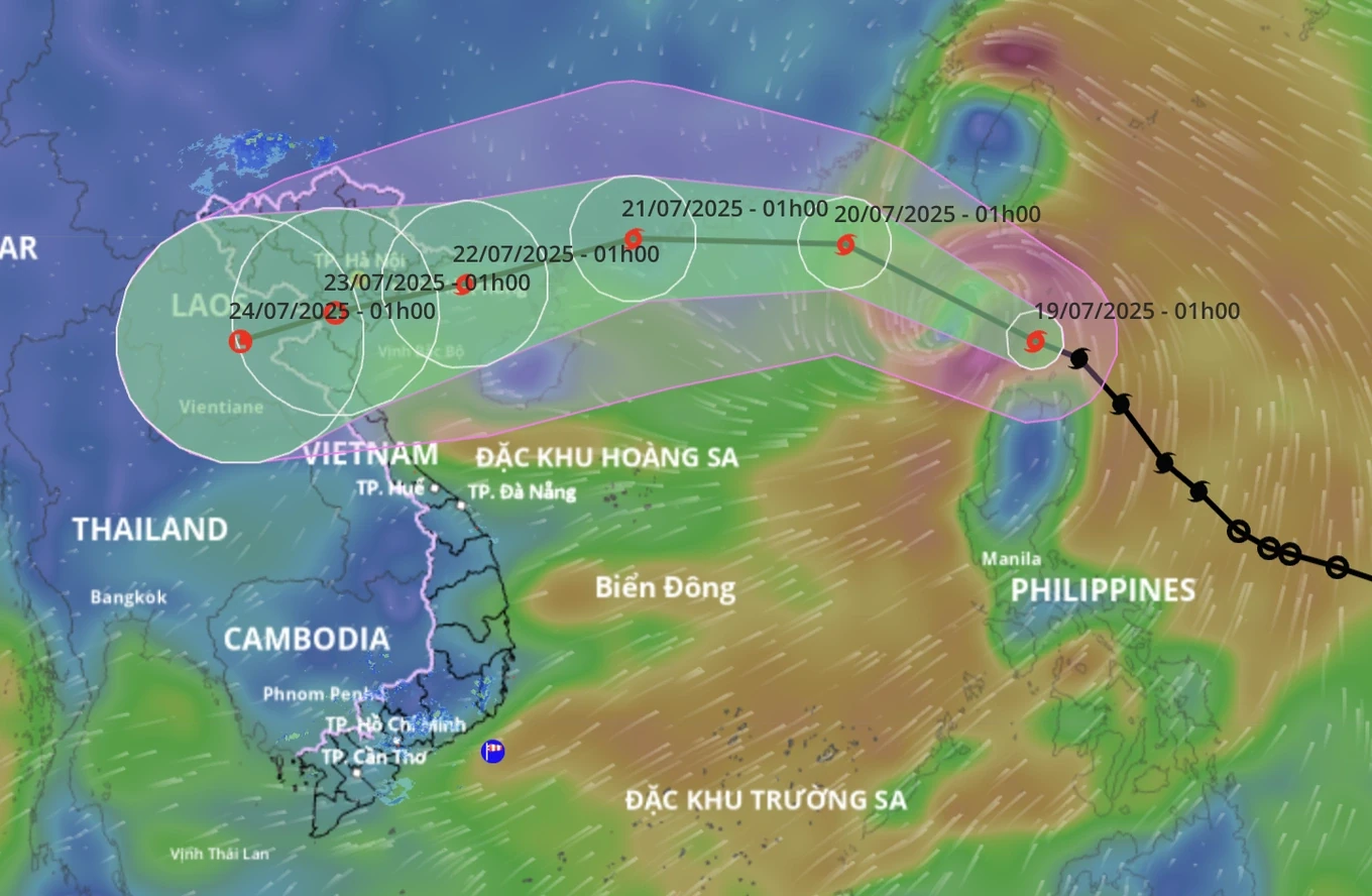
Storm Wipha will affect many places in the North and North Central regions, causing heavy rain (Photo: Disaster monitoring system).
Mr. Mai Van Khiem, Director of the National Center for Hydro-Meteorological Forecasting, said that at 7:00 a.m. on July 19, Typhoon Wipha entered the northeastern sea area of the North East Sea, becoming storm number 3. The storm moved northwest with the strongest wind speed of level 9 (75-88 km/h), gusting to level 12.
According to forecasts, after entering the East Sea, storm Wipha will continue to move rapidly in the West-Northwest direction and is likely to strengthen.
Storm Wipha will affect many places in the North and North Central regions, causing heavy rain (Photo: Disaster monitoring system).
At 1:00 a.m. on July 20, the center of storm Wipha was in the northeastern sea of the North East Sea, about 760 km east of Leizhou Peninsula (China). The storm's intensity is currently level 10, gusting to level 12.
Experts said that at 1:00 a.m. on July 21, the center of storm Wipha was about 210km east-northeast of Leizhou Peninsula (China), the storm's intensity now increased to level 11-12, gusting to level 14.
At 1:00 a.m. on July 22, the center of storm Wipha was in the Gulf of Tonkin, the storm's intensity had weakened to level 9-10, with gusts of level 13.
During the day and night of July 22, the storm moved mainly in the West-Southwest direction, entering the mainland of coastal provinces and cities in the North and gradually weakening.
Due to the influence of the storm, in the eastern sea area of the North East Sea, the wind gradually increases to level 6-7, near the eye of the storm, it increases to level 8-10, gusts to level 12, waves are 3-5m high. The sea is very rough.
Ships operating in the above mentioned dangerous areas are likely to be affected by storms, whirlwinds, strong winds and large waves.
According to Mr. Khiem, due to the impact of the storm, from July 21 to 24, the Northern and North Central provinces are likely to have widespread heavy rain with rainfall of 200-350mm, in some places over 600mm.
Mr. Nguyen Hoang Hiep, Deputy Minister of Agriculture and Environment , commented that Typhoon Wipha is the first typhoon to make landfall in our country this year and although the wind may not be as strong as Typhoon Yagi, rain is likely to occur over a large area, affecting 1,713 communes in 18 provinces and cities from Ha Tinh and beyond.
According to Dan Tri
Source: https://baothanhhoa.vn/canh-bao-mua-lon-18-tinh-thanh-khi-bao-nbsp-wipha-vao-bien-dong-255290.htm


Comment (0)