
To clarify the results in the construction and operation of the land database in the province, reporters of the Natural Resources and Environment Newspaper had an interview with Mr. Nguyen Tien Duong - Deputy Director of the Department of Natural Resources and Environment of Son La province.
Reporter: Could you please tell us about the results of building and operating the land database in the province up to now?
Mr. Nguyen Tien Duong: Son La is one of the leading provinces in implementing the Project to strengthen land management and land database with 8/12 districts and cities having completed the construction of the database. Of which, 6/8 districts are implementing the Project to strengthen land management and land database (VILG Project); 3/8 districts and cities are implementing the Project to survey and map, establish cadastral records, issue land use right certificates (GCNQSDĐ) and build land database (Overall Project). Mai Son district alone is implementing both projects at the same time, with 8/22 communes and towns implementing the Overall Project, 14/22 communes implementing the VILG Project. There are 4 districts that have not yet invested in building a land database, including: Bac Yen, Quynh Nhai, Thuan Chau, Sop Cop.
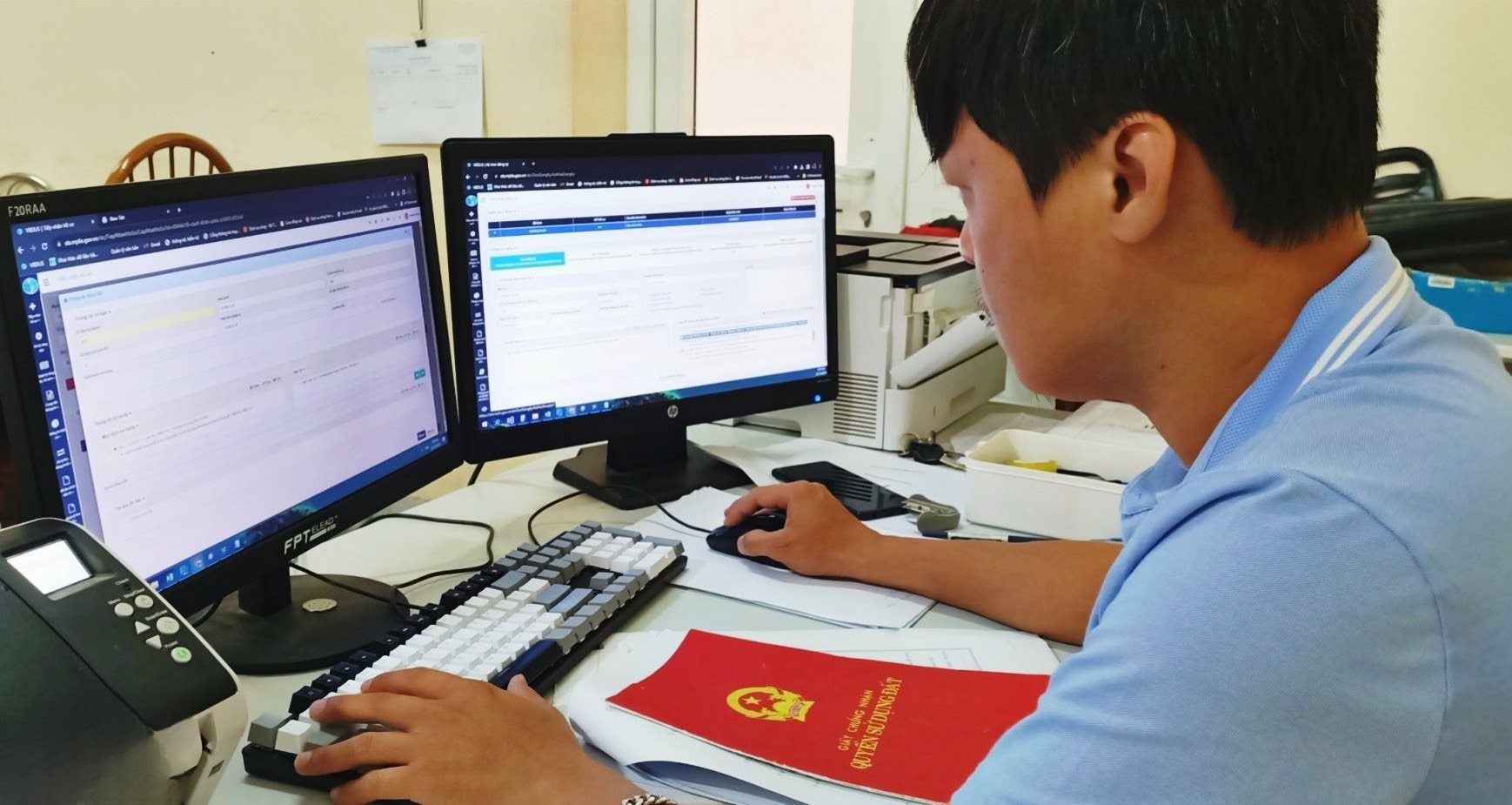
Currently, Son La is operating the land database of 11/12 districts and cities on VBDLIS software. Particularly, Muong La district and Son La city have built the database on Vilis software, and at the same time, converted to operate on VBDLIS software. For districts that have not invested in building a database, the Department has directed the Land Registration Office branches of the districts to proactively update data on the VBDLIS software system during the daily administrative procedure settlement process of the unit. Complete connection, integration, provision of online public services, data sharing from the National Population Database, interconnection of the land database system with the Tax authority.
Reporter: To operate the land database stably and effectively, what specific solutions has the Department of Natural Resources and Environment implemented, sir?
Mr. Nguyen Tien Duong: The land database is managed and operated in a centralized and unified model throughout the province. The Department of Natural Resources and Environment has proactively advised and promoted the construction and exploitation of the land database, granted accounts and decentralized the management of the land information system to the departments and units under the Department, the system of Land Registration Offices and the Department of Natural Resources and Environment of districts and cities.

The Land Registration Office is responsible for updating the cadastral database, statistical database, land inventory; operating the cadastral database according to current regulations. Strengthening the supervision of the operation and updating of the land database on the VBDLIS software system. The Land Registration Office has sent technical staff directly to instruct the officers of the Office branches on the skills of operating and updating the land database; promptly handling difficulties and problems in the operation and updating process.
At the same time, focus on digitizing records and archives to serve the task of digital transformation of the Natural Resources and Environment sector. Organize training on digital transformation solutions for the Natural Resources and Environment sector, including solutions on management, operation and exploitation of land databases. Regularly maintain and service information technology infrastructure, ensuring stable and continuous operation of the land information system.
Reporter: Sir, how has the construction and operation of the land database affected state management of land and local socio -economic development?
Mr. Nguyen Tien Duong: Building and operating the land database is considered an important step in the digital transformation process of the Natural Resources and Environment sector, creating a data platform to serve the implementation and operation of e-Government towards digital Government, digital economy and digital society. Improving the quality of decision-making and improving the effectiveness of state management of the land sector at the local level.
In particular, land database plays an important role in implementing land use planning and plans, and is the basis for developing reasonable land use plans, meeting the goals of socio-economic development and environmental protection.
Currently, Son La has deployed the sharing of data on land statistics, land use planning maps, and land use right certificates to the province's Intelligent Operation Center (IOC). Thereby, helping provincial leaders as well as departments and branches to effectively monitor and manage the field of natural resources and environment.
The completion of the land database also contributes to ensuring an accurate, safe, and seamless data system between management levels. Providing a centralized and consistent information access channel, avoiding errors in source data management. From there, organizations and individuals can quickly and accurately access land information (planning, land use plans).
PV: In the coming time, what key tasks will the Department of Natural Resources and Environment propose to improve the efficiency of land database operations, sir?
Mr. Nguyen Tien Duong:
The Department of Natural Resources and Environment will continue to promote administrative reform; apply information technology; build a synchronous database system on natural resources and environment. Issue regulations on management, operation, updating, exploitation and use of the Son La province land database.
At the same time, review, evaluate, and determine appropriate administrative procedures to implement online public services at levels 3 and 4 and publish a list of integrated public services provided on the National Public Service Portal. Promote the reception of online land administrative procedures to minimize travel for organizations and individuals.
In particular, currently, the Department of Natural Resources and Environment is establishing Technical Design - Surveying Estimates, cadastral mapping and database construction in Quynh Nhai and Sop Cop districts; and building additional land database in Yen Chau district.
Urge Thuan Chau and Bac Yen districts to proactively survey, establish Technical Design - Estimate for measurement, establish cadastral maps and build land databases. Thereby, contributing to achieving the goal by 2025, completing the construction of a digital database and a centralized, unified, synchronous, multi-purpose and interconnected land information system.
PV: Thank you very much!
Source


Comment (0)