|
The majestic mountain scenery along Highway 28B. |
Now that the Eastern Expressway has been completed, connecting Nha Trang to Ho Chi Minh City in a single lane, tourists consider National Highway 28B as the main route from the Western and Southeastern provinces to Da Lat, shortening the journey between the sea and flowers more than ever before and opening up many opportunities for tourism and service development in localities along the route.
Dream Route
For a long time, tourists from Ho Chi Minh City, Binh Duong, and Dong Nai provinces traveling to Da Lat had only one option: via National Highway 20 through Bao Loc Pass. However, due to the extremely high volume of traffic, especially heavy trucks and container vehicles carrying goods, travel time increased, averaging 7-7.5 hours for a 300km journey, not to mention the frequent traffic jams on the pass causing congestion lasting for many hours.
Mr. Trung, a tourist from District 12 (Ho Chi Minh City), still hasn't forgotten the experience of lying stranded on the mountain pass for hours, making the journey from Da Lat back home take 9.5 hours during his spring trip to Da Lat a few years ago.
However, many drivers now have an alternative route: taking the Eastern Expressway, driving straight from Ho Chi Minh City along the expressway to Dai Ninh Junction (approximately 205km), then turning left onto National Highway 28B to reach Da Lat (105km).
|
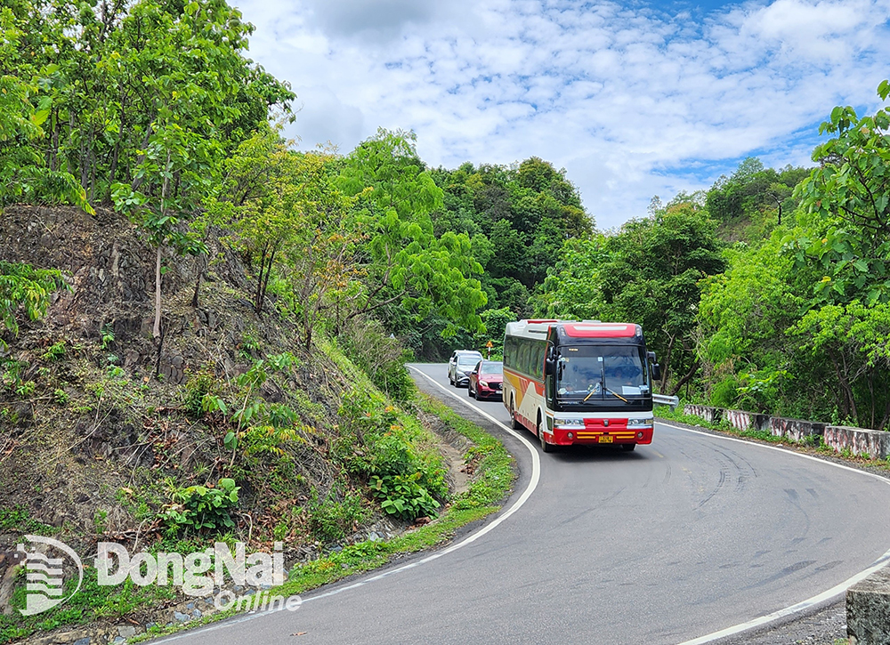
The scenic route on Dai Ninh Pass. Photo: V. Phong |
Meeting Mr. Hien, a resident of Thu Duc City (Ho Chi Minh City) who was on a caravan trip to Da Lat with his friends via National Highway 28B this past summer, he shared: “Recently, we often travel from Ho Chi Minh City through Phan Thiet to Da Lat in only about 5-5.5 hours, 1.5-2 hours faster than going via National Highway 20 over Bao Loc Pass.”
Although there are no statistics yet on the number of tourists traveling via the new route, if just 60% of tourists visiting Da Lat use this route, the amount of time and money saved for society would be significant.
Currently, National Highway 28B is undergoing an upgrade with a budget of over 1.4 trillion VND from public investment funds. Upon completion in 2026, travel time will be significantly shortened. Despite the severely degraded road conditions and numerous potholes, many bus companies have chosen National Highway 28B as their main route, replacing the previous routes via Phan Rang or National Highway 28. A driver from Phuong Trang bus company, specializing in the Da Lat - Nha Trang route, stated that due to the poor road conditions, the journey currently takes 4 hours, but after the upgrade, the travel time will be reduced to just over 3 hours for the 150km journey.
During the Lunar New Year or summer, the road becomes bustling with traffic.
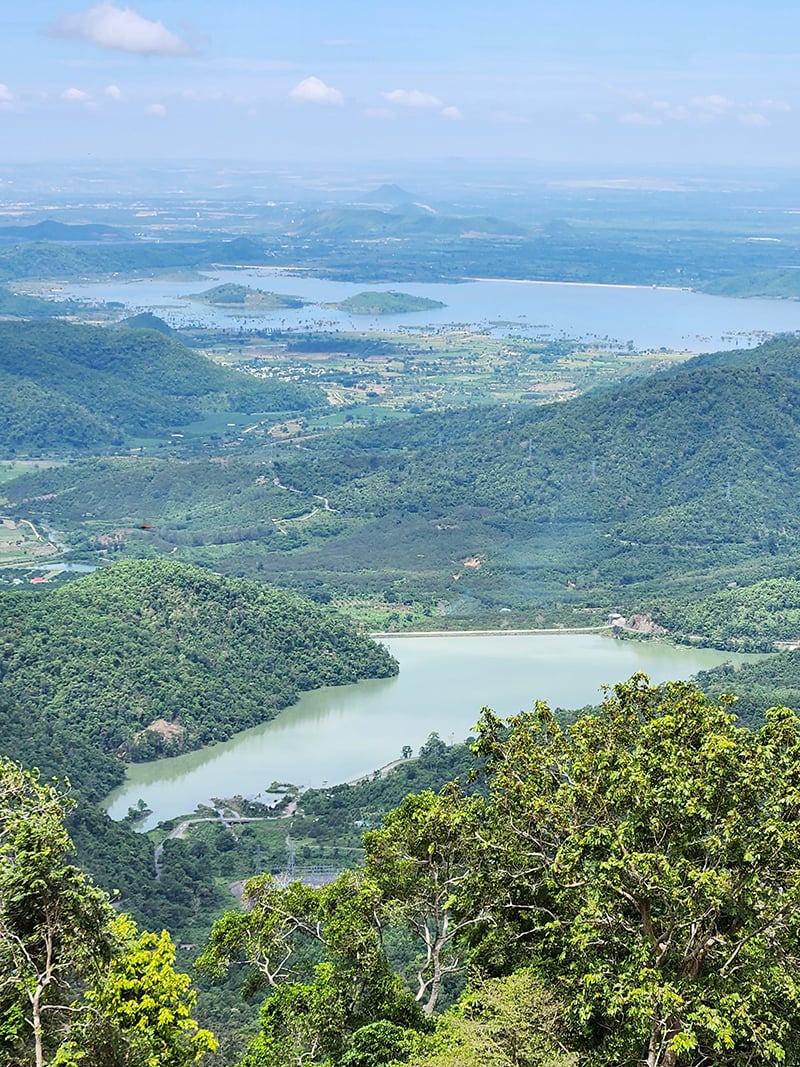
Admire the majestic mountains.
Among the national highways that serve as a branch connecting the highlands with the plains in Lam Dong and Ninh Thuan provinces, such as National Highways 27, 28, and 28B, none offer the majestic mountain scenery that National Highway 28B does. Due to the border between the plains and the mountainous region, and the well-protected natural forests, the Dai Ninh Pass boasts breathtakingly beautiful landscapes of lush greenery and crystal-clear waters.
|
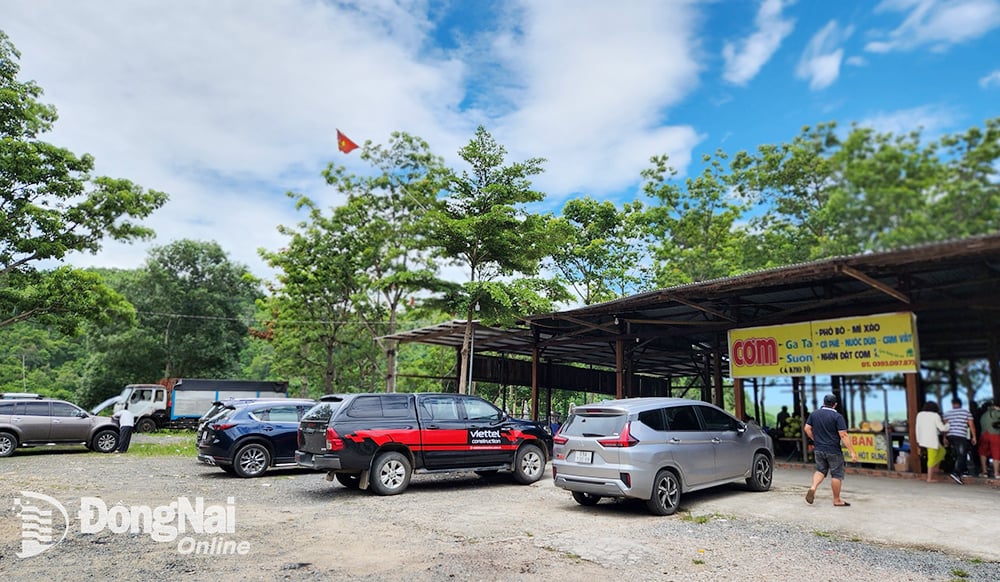
A rest stop at the foot of Dai Ninh Pass (in Phan Lam commune, Bac Binh district, Binh Thuan province). |
On rainy days, visitors can witness swirling clouds drifting over the mountain peaks. On sunny days, as they near the end of the pass, they can see the scenery of irrigation and hydroelectric reservoirs basking against the clear blue sky, creating captivating images. In particular, visitors can admire the two large, towering water pipes that carry water from the reservoir high in the mountains to power the turbines of the Dai Ninh Hydroelectric Power Plant.
Taking advantage of the scenic landscape, several rest stops have sprung up to serve travelers, offering opportunities to rest, eat, enjoy local cuisine, and take scenic photos, adding to the enjoyment of each tourist's trip. In Phan Lam commune, Bac Binh district, Binh Thuan province (at the foot of Dai Ninh pass), dozens of restaurants and viewpoints have appeared for tourists. At the top of the pass (connecting Binh Thuan and Lam Dong provinces), there are also 4 or 5 rest stops and viewpoints that consistently attract travelers, especially young people on motorbike and car trips.
In addition, the route passing through the villages of the Rac Lay, K'Ho, and Cham ethnic groups in Bac Binh district, Binh Thuan province, are also places where tourists can visit to learn more about the long-standing traditional culture of these ethnic minorities in the Vietnamese community.
Van Phong
>> Check out Hotels:
Source: https://baodongnai.com.vn/giai-tri/202501/con-duong-ngan-nhat-noi-bien-va-hoa-3db489e/


Comment (0)