
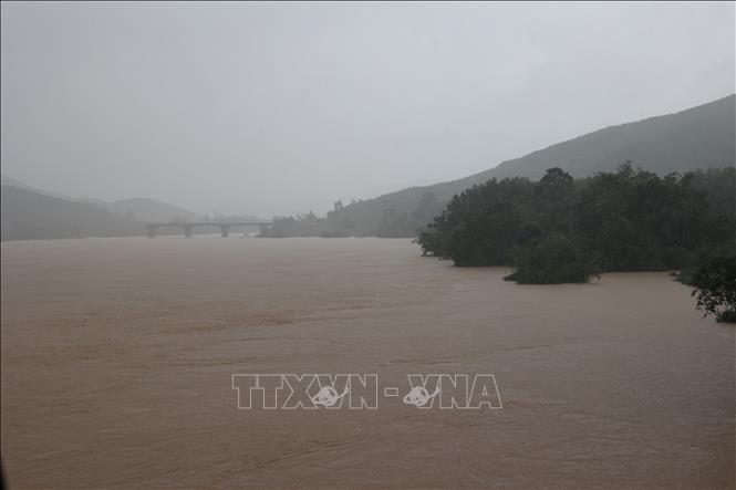
Currently, the water level on the Vu Gia - Thu Bon and Tam Ky rivers is slowly decreasing, while the upper Thu Bon river is showing signs of rising again.
Water levels at 7:00 a.m. on October 29 on rivers are as follows: Vu Gia River at Ai Nghia: 9.91 m - 0.91 m above alarm level 3.
Thu Bon River at Nong Son: 16.78 m – 1.78 m above alert level 3; at Giao Thuy: 9.24 m – 0.44 m above alert level 3; at Cau Lau: 5.20 m – 1.2 m above alert level 3; at Hoi An: 3.06 m – 1.06 m above alert level 3.
Han River at Cam Le: 2.75 m – 0.25 m above alarm level 3. Tam Ky River at Tam Ky: 2.32 m – 0.12 m above alarm level 2.
It is forecasted that in the next 24 hours, the flood on Vu Gia - Thu Bon river is likely to rise again. The flood peak on Vu Gia river at Ai Nghia may reach 10.15 m - 1.15 m above alert level 3.
On Thu Bon River at Cau Lau, the water level fluctuates at level 3 from 1.2 - 1.35 m. Han River continues to rise and fluctuates at level 3 from 0.3 - 0.65 m. Tam Ky River fluctuates at level 2 to level 3.
Deep, widespread flooding continues in low-lying riverside areas and inundation in urban areas.
In particular, the risk of severe flooding is concentrated in the communes and areas: Que Phuoc, Nong Son, Que Son, Tam Xuan, Lanh Ngoc, Duy Xuyen, Thu Bon, Xuan Phu, Thanh My, Thuong Duc, Ha Nha, Phu Thuan, Vu Gia, Dai Loc, Go Noi, Dien Ban Tay, Dien Ban Bac, Hoa Tien, Hoi An, Hoi An Tay, Hoi An Dong, Nam Phuoc, Duy Nghia, An Thang, Ban Thach ward, Huong Tra ward, Quang Phu ward, Tay Ho commune, Thang Dien, Thang Truong, Que Xuan, Hoa Xuan, Ngu Hanh Son, Cam Le, Ba Na, Thang An, Thu Bon...
There is a very high risk of flash floods and landslides on steep slopes in mountainous areas of Da Nang city. The flood risk warning level is level 3.
Source: https://baotintuc.vn/xa-hoi/da-nang-du-bao-lu-dac-biet-lon-tren-song-vu-gia-thu-bon-20251029103112689.htm


![[Photo] Urgently help people soon have a place to live and stabilize their lives](/_next/image?url=https%3A%2F%2Fvphoto.vietnam.vn%2Fthumb%2F1200x675%2Fvietnam%2Fresource%2FIMAGE%2F2025%2F12%2F09%2F1765248230297_c-jpg.webp&w=3840&q=75)


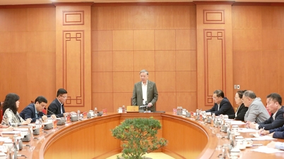
![[Photo] General Secretary To Lam works with the Standing Committees of the 14th Party Congress Subcommittees](https://vphoto.vietnam.vn/thumb/402x226/vietnam/resource/IMAGE/2025/12/09/1765265023554_image.jpeg)


Comment (0)