
According to the National Center for Hydro-Meteorological Forecasting, in the past 2 hours (from 6:00 to 8:00 a.m. on July 11), the provinces of Son La and Lao Cai had moderate to heavy rain such as: Nam Ty 40.2mm, Chieng Dong 31.4mm (Son La); Ban Ho 33.6mm (Lao Cai);...
Soil moisture models show that some areas in the above provinces are close to saturation (over 85%) or have reached saturation.
It is forecasted that in the next 3-6 hours, the above provinces will continue to have rain with accumulated rainfall ranging from 20-50mm, in some places over 80mm.
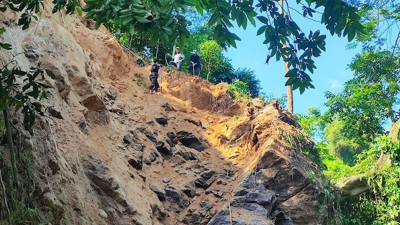
In the next 6 hours, there is a risk of flash floods on small rivers and streams, landslides on steep slopes in the above provinces, especially in the communes and wards: Chieng Hac; Chieng Sai, Doan Ket, Kim Bon, Muong Bang, Muong Coi, Muong Lan, Phu Yen, Pung Banh, Song Khua, Song Ma, Sop Cop, Suoi To, Tan Phong, Tan Yen, To Mua (Son La); Ban Ho, Chan Thinh, Lung Phinh, Muong Hum, Nghia Tam, Au Lau ward, Van Phu ward, Yen Bai ward, Pha Long, Simacai, Sin Cheng, Ta Van, Thuong Bang La, Viet Hong (Lao Cai).
Flash floods and landslides can have very negative impacts on the environment, threaten people's lives; cause local traffic congestion, affect the movement of vehicles; destroy civil and economic works, causing damage to production and socio-economic activities.
The meteorological agency recommends that local authorities pay attention to reviewing bottlenecks and vulnerable locations in the area to take timely prevention and response measures.
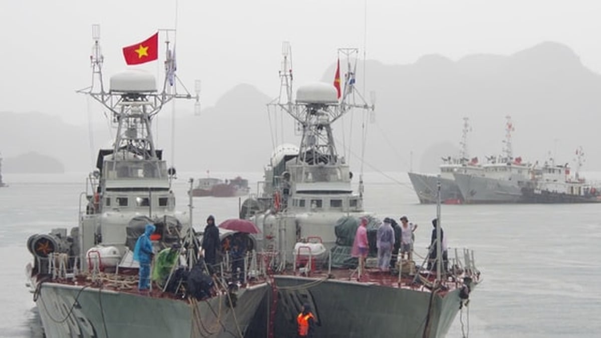
Ships operating at sea should be wary of level 7-8 winds and 2-4m high waves.
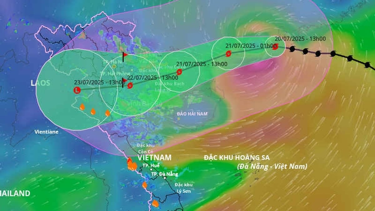
On the morning of July 11, the Gulf of Tonkin, the northern East Sea (including Hoang Sa special zone) and the Gulf of Thailand are experiencing showers and thunderstorms.
It is forecasted that during the day and night of July 11, there will be scattered showers and thunderstorms in the Gulf of Tonkin, the northern East Sea (including the Hoang Sa special zone) and the Gulf of Thailand. There is a possibility of tornadoes and strong gusts of wind during thunderstorms.
In addition, today and tonight, the sea area from Khanh Hoa to Ho Chi Minh City, the central area of the East Sea has strong southwest winds of level 5, sometimes level 6, gusting to level 7-8, waves from 2-4m high, rough seas.
All vessels operating in the above areas are at risk of being affected by tornadoes and strong gusts of wind.
Source: https://nhandan.vn/de-phong-lu-quet-sat-lo-dat-do-mua-lon-tai-cac-tinh-son-la-va-lao-cai-post893022.html


![[Photo] National Assembly Chairman Tran Thanh Man visits Vietnamese Heroic Mother Ta Thi Tran](https://vphoto.vietnam.vn/thumb/1200x675/vietnam/resource/IMAGE/2025/7/20/765c0bd057dd44ad83ab89fe0255b783)


Comment (0)