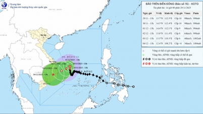
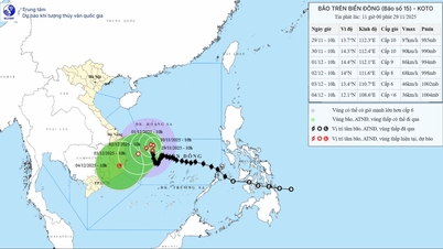
On the afternoon of November 26, Mr. Hoang Phuc Lam, Deputy Director of the National Center for Hydro-Meteorological Forecasting, provided the latest information on the developments of storm No. 15, international name Koto (named by Japan, meaning Harp).
At 4:00 p.m. today, the center of the storm was at about 12.5 degrees North latitude; 116.1 degrees East longitude, about 230km northeast of Song Tu Tay island. The strongest wind near the center of the storm was level 10 (89-102km/h), gusting to level 13. The storm moved in a West Northwest direction at a speed of about 20km/h.
“The next developments of storm No. 15 are still highly dispersive between models and international hydrometeorological agencies. There are currently two possible scenarios for the development of storm No. 15, we will closely monitor the developments of this storm,” said Mr. Lam.
According to Mr. Lam, there is a clear characteristic of this storm, first, coastal areas will certainly be affected, ships must move far away to avoid the influence of the storm circulation. Second, the impact of this storm is relatively long due to slow movement. In 2025, there were many storms moving quite quickly, at a speed of about 25-30km/h, moving about 2-3 days to reach the mainland. This storm in particular moves very slowly. From the afternoon of November 28 onwards, the storm is likely to move only about 5-10km/h, so the time to monitor this storm is still very long, not excluding the end of early December 2025. The development and monitoring of this storm can last 5-7 days.

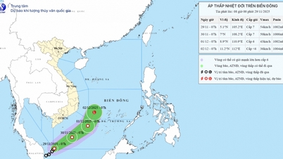
In addition, in a further forecast, Mr. Lam said that from now until the end of December 2025, there is still a possibility of a storm/tropical depression appearing in the East Sea. With storms appearing at this time, the affected area will be the South Central and Southern regions, so it is not excluded that after storm No. 15, another storm or tropical depression will continue to affect the South Central and Southern regions.
For cold air, the intensity of activity will gradually increase in December 2025 - January 2026. This year, the characteristics of cold air will penetrate relatively deep to the South and be active, causing severe cold around the second half of December 2025. There is a possibility that the Northern region will experience dry cold, meaning it will be cold at night and sunny during the day around December 2025 - January 2026. From the end of February - March 2026, there will be light rain and drizzle.
For the South, there is a warning of unseasonal rain in January, February, and March 2026 for both the Central Highlands and the South.
In the Central region, there is a warning of rain in late November-December 2025. From Quang Binh to Quang Ngai, there will still be rain.
Source: https://baophapluat.vn/diem-khac-biet-cua-con-bao-so-15.html


Comment (0)