

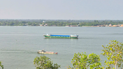
Of which, Nghe An province has 79 houses with roofs blown off. The entire affected area has about 107,000 hectares of rice flooded, of which Ninh Binh alone is flooded with more than 74,000 hectares, Hung Yen 26,000 hectares and Thanh Hoa more than 7,000 hectares. Localities are urgently implementing drainage pumping to prevent flooding. This is only a preliminary statistic, not the final figure.
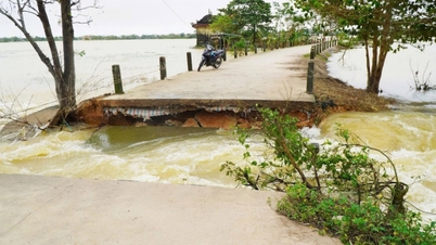
Landslides and dike cracks have appeared in some places. In Hanoi , the right dike of Cau River (through Da Phuc commune) has a 20m long crack, local authorities have had to ban vehicles from circulating.

In Thanh Hoa province, the dike on the left side of the Cung River (Hoang Chau commune) collapsed 65m long. In Ninh Binh province, the dike on the south side of the Quan Lieu River (Nghia Son commune) collapsed 5m long and has been covered with tarpaulin and reinforced with earthen sacks.
The Department of Dyke Management and Natural Disaster Prevention said that in response to the storm, a total of 12,485 people were evacuated. Of these, 2,052 people were evacuated from Quang Ninh, 4,994 from Hai Phong, 4,710 from Ninh Binh, and the rest were evacuated suddenly due to floods and landslides in Thanh Hoa (468 people) and Nghe An (261 people).

According to the Department of Dyke Management and Natural Disaster Prevention, the total rainfall up to 5 p.m. on July 22 in the coastal areas of Thanh Hoa ranged from 200-350mm, Ninh Binh and Nghe An from 100-250mm. Some stations had very heavy rainfall: Sam Son (Thanh Hoa) 374mm, Chau Nga (Nghe An) 308mm.
On July 23, Thanh Hoa - Nghe An is forecast to continue to have rain, locally over 200mm, South Phu Tho and Son La 40-80mm.
Currently, floods on rivers are rising rapidly. The water level on the Chu River at Cua Dat exceeds alarm level 1 by nearly 1m, and on the Ca River at Muong Xen reaches alarm level 3. On the evening of July 22, the National Center for Hydro-Meteorological Forecasting continuously issued warnings of flash flood risks in: Lao Cai, Son La, Phu Tho, Thanh Hoa, Nghe An, Ha Tinh...
Source: https://www.sggp.org.vn/hon-107000ha-bi-ung-ngap-gan-12500-nguoi-so-tan-tranh-bao-post804958.html
![[Photo] Unique architecture of the deepest metro station in France](https://vphoto.vietnam.vn/thumb/1200x675/vietnam/resource/IMAGE/2025/11/14/1763107592365_ga-sau-nhat-nuoc-phap-duy-1-6403-jpg.webp)


![[Photo] Unique art of painting Tuong masks](https://vphoto.vietnam.vn/thumb/1200x675/vietnam/resource/IMAGE/2025/11/14/1763094089301_ndo_br_1-jpg.webp)


![[Photo] Special class in Tra Linh](https://vphoto.vietnam.vn/thumb/1200x675/vietnam/resource/IMAGE/2025/11/14/1763078485441_ndo_br_lop-hoc-7-jpg.webp)


Comment (0)