
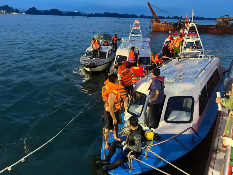
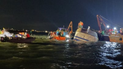
As reported by CAND Newspaper, on the afternoon of July 19, a sudden storm caused the tourist ship QN-7105, which was on its way to Ha Long International Passenger Port, to capsize in the area between Hon Ga Choi and Hon Co Don.
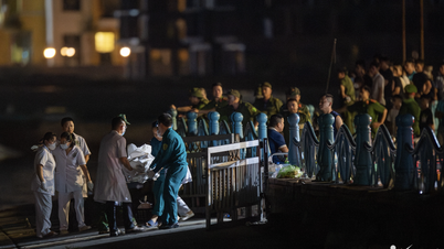
The Quang Ninh Provincial Search and Rescue Steering Committee has mobilized many professional divers to join the search for the missing victims. By 9 p.m., the authorities had rescued 12 people and found 34 bodies.
Late on the evening of July 19, the National Center for Hydro-Meteorological Forecasting (Department of Hydro-Meteorology - Ministry of Agriculture and Environment ) officially provided information on the developments of thunderstorms in Quang Ninh as well as the Northern region.
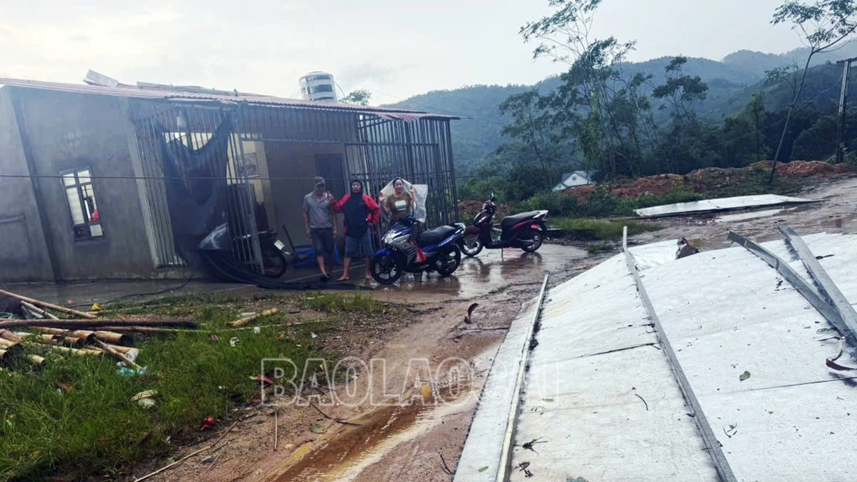
Specifically, on the afternoon of July 19, in the Northern region, there were widespread thunderstorms, many places had strong thunderstorms, tornadoes and strong gusts of wind, locally some places had heavy to very heavy rain. Some places had strong gusts of wind such as Cua Ong station (Quang Ninh) 16m/s (level 7), Bai Chay station (Quang Ninh) 26m/s (level 10), Bach Long Vi station (Hai Phong) gusts 18m/s (level 8) ...
Meanwhile, the center of storm No. 3 is at about 20.7 degrees North latitude; 118.4 degrees East longitude, (over 1000km east of Ha Long Bay), the storm circulation is about 200-300km (from the storm center). The strongest wind near the storm center is level 10 (89-102km/h), gusting to level 12 and has not directly affected the Gulf of Tonkin.
The cause of the heavy thunderstorms this afternoon in the North and the Gulf of Tonkin is the influence of the tropical convergence zone with its axis passing through the North, combined with the high temperature conditions in the North in the past 3 days, causing strong updrafts in the unstable conditions of the atmosphere, causing heavy thunderstorms.
These are Mesoscale Convective Systems (MCSs in the tropics) which are medium-sized thunderstorms that often produce very heavy rain and other dangerous weather phenomena.
Supercell thunderstorm systems range in diameter from a few kilometers to several hundred kilometers. They consist of multiple clusters of thunderstorms that combine to form a large system. They can last for hours, even 12–24 hours, and are stronger and longer lasting than individual thunderstorms.
In the marine weather forecast for the day and night of July 19 (released at 4:30 a.m.), the National Center for Hydro-Meteorological Forecasting predicted that the Gulf of Tonkin will have scattered showers and thunderstorms during the day and scattered showers and thunderstorms at night. There is a possibility of tornadoes and strong gusts of wind during thunderstorms.
According to the National Center for Hydro-Meteorological Forecasting, the Quang Ninh Provincial Hydro-Meteorological Station has fully implemented the procedures and regulations on forecasting, warning, issuing and transmitting forecasts and warnings of thunderstorms, tornadoes, lightning, hail and local heavy rains in a timely and complete manner to the prescribed addresses. Specifically:
Through monitoring weather radar images, when detecting developing convective clouds, the Station issued two bulletins at 11:45 and 1:30 p.m. on July 19. In particular, in the bulletin issued at 1:30 p.m., the Station warned of showers and thunderstorms for wards and communes in the province, including Ha Long ward.
Assessing the hydro-meteorological situation in the coming time, the National Center for Hydro-Meteorological Forecasting said that due to the influence of storm No. 3, from the night of July 19 and July 20, the Gulf of Tonkin, the North and Central East Sea (including the Hoang Sa special zone) will have showers and thunderstorms, especially the northern sea area of the North East Sea will have rain and storms, the Gulf of Thailand will have scattered showers and thunderstorms.
From the night of July 20 and July 21, the northern sea area of the North East Sea will have strong winds of level 8-9, near the storm center will have winds of level 10-12, gusting to level 15; waves 4.0-6.0m high; rough seas. The eastern sea area of the Northern Gulf of Tonkin from July 21 will have winds gradually increasing to level 6-7, then increasing to level 8-9, near the storm center will have winds of level 10-11, gusting to level 13; waves 2.0-4.0m high, near the storm center 3.0-5.0m; rough seas.
Source: https://cand.com.vn/Xa-hoi/mua-dong-gay-lat-tau-o-vinh-ha-long-la-sieu-dong-vung-nhiet-doi-i775323/


![[Photo] National Assembly Chairman Tran Thanh Man visits Vietnamese Heroic Mother Ta Thi Tran](https://vphoto.vietnam.vn/thumb/1200x675/vietnam/resource/IMAGE/2025/7/20/765c0bd057dd44ad83ab89fe0255b783)


Comment (0)