
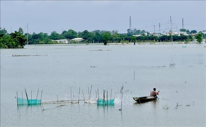
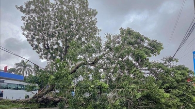
The highest water level forecast for the 3 days from November 12 to 14 on Hau River at Long Xuyen station (Long Xuyen ward, An Giang province) is to drop rapidly following the tide. The water level on November 12 was 2.38 m, on November 13 it dropped to 2.32 m and on November 14 it dropped rapidly to 2.27 m.
Although the water level in the downstream of Hau River in Long Xuyen is decreasing with the tide, many areas are still forecast to be flooded with a depth of 5-20 cm. The area of flooding and localized waterlogging in Long Xuyen ward is forecast to occur in the embankment area, along Hau River, Rach Gia Long Xuyen canal; Binh Duc ward is flooded in the area of Binh Khanh 5 and Binh Khanh 7 hamlets. My Thoi ward is flooded in the area of Hoi Dong canal, Rach Goi Be, Cai Sao-Bo Ho; My Hoa Hung commune is flooded in low-lying areas along the banks of Hau River.
Flooding is expected to occur from 11pm the previous night to 1am the following morning. Flood risk warning level 2.
The An Giang Province Hydrometeorological Station also warned that the Hau River area in Long Xuyen has a large width, deep river, and strong flow rate, so the area has a large and deep flood area. When strong winds occur, they can create large waves causing erosion and landslides on river banks, canals, and streams, affecting activities such as transportation, aquaculture, agricultural production, and local socio- economic activities.
Over the past 24 hours, the water level in the upstream area of Tien and Hau rivers in An Giang has been slowly decreasing, while the downstream area has been decreasing with the tide. By the end of November 11, the highest water level on Hau river in Long Xuyen was 2.46 m, 4 cm below alarm level 3. The highest water level on Tien and Hau rivers at Tan Chau and Chau Doc stations was 5 - 37 cm below alarm level 1. The downstream area of Tien and Hau rivers at Long Xuyen and My Thuan stations was 1 - 4 cm below alarm level 3 and at Can Tho station was 2 cm below alarm level 1.
Source: https://baotintuc.vn/van-de-quan-tam/muc-nuoc-tren-song-hau-tai-tramlong-xuyen-van-con-nguy-co-gay-ngap-lut-20251112212042519.htm

![[Photo] Prime Minister Pham Minh Chinh attends a conference to review one year of deploying forces to participate in protecting security and order at the grassroots level.](https://vphoto.vietnam.vn/thumb/1200x675/vietnam/resource/IMAGE/2025/11/12/1762957553775_dsc-2379-jpg.webp)

![[Photo] Highways passing through Dong Nai](https://vphoto.vietnam.vn/thumb/1200x675/vietnam/resource/IMAGE/2025/11/12/1762940149627_ndo_br_1-resize-5756-jpg.webp)


![Dong Nai OCOP transition: [Article 3] Linking tourism with OCOP product consumption](https://vphoto.vietnam.vn/thumb/402x226/vietnam/resource/IMAGE/2025/11/10/1762739199309_1324-2740-7_n-162543_981.jpeg)


Comment (0)