
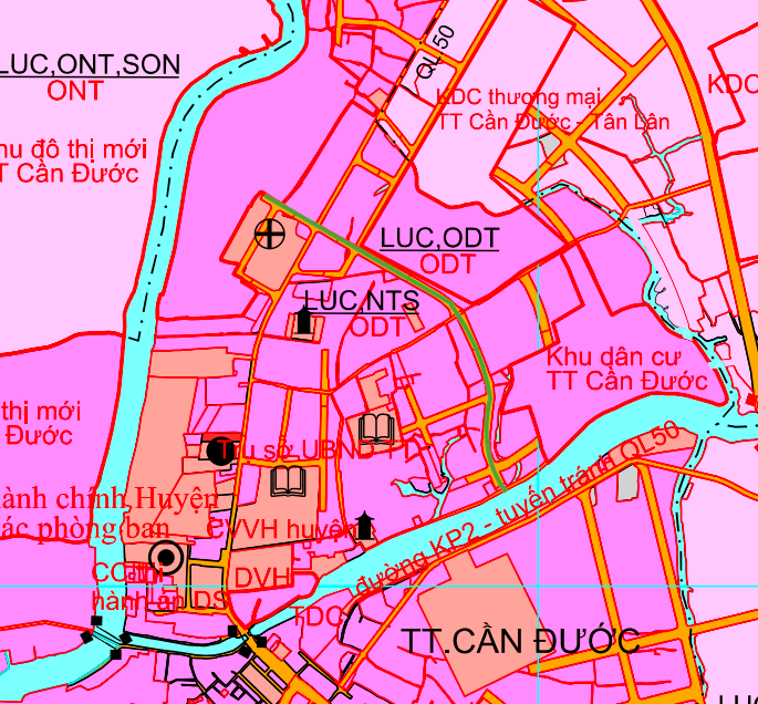
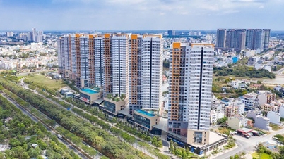
Overview of traffic planning of Can Duoc commune
According to the Land Use Planning Adjustment Map for the period 2021 - 2030 of Can Duoc district, Long An province (old), the new Can Duoc commune will have a number of new traffic routes deployed. This plan aims to complete the infrastructure network, promote regional connectivity and create momentum for local socio-economic development.
Can Duoc Commune is geographically adjacent to many neighboring areas: to the north it borders My Le Commune, to the east it borders Tan Lan Commune, to the south it borders Son Qui and Binh Xuan Wards, and to the west it borders Thuan My and Vam Co Communes. The opening of new routes is expected to resolve traffic congestion and enhance the commune's connectivity.
Details of key routes
Below are details of 3 notable routes that will be opened in the coming period in Can Duoc commune.
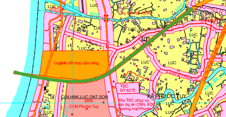
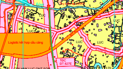
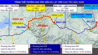
1. Provincial Road 827E
Provincial Road 827E is one of the most important infrastructure projects passing through the commune. The road section within Can Duoc commune has a total length of about 3.8 km.
This route starts at the Vam Co Dong River, then crosses Bo Moi Road, forming a new traffic axis connecting the area. The construction of Provincial Road 827E is expected to make an important contribution to connecting Can Duoc District (old) with other key economic areas of Tay Ninh Province.
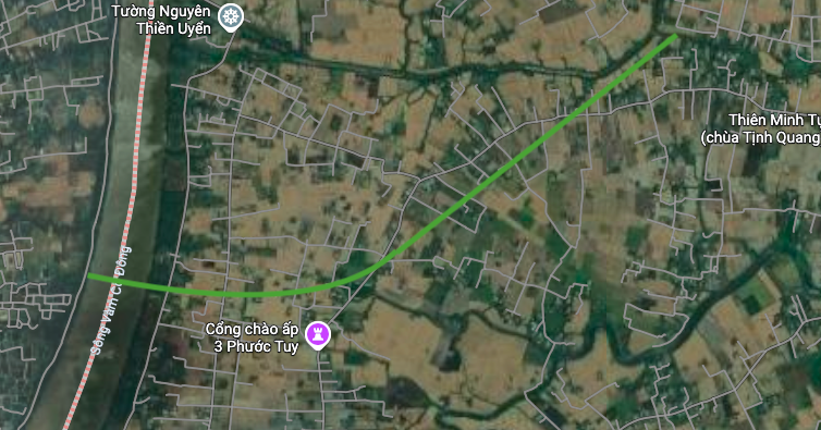
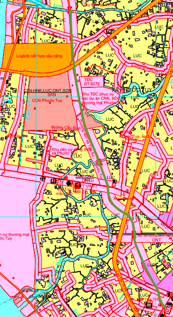
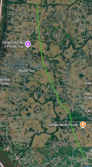
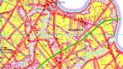
2. Tan An - Phuoc Tuy inter-commune road
This is the route that directly connects the two communes of Tan An (old) and Phuoc Tuy (old). The section passing through Can Duoc commune is about 5.3 km long.
The route starts from the intersection with District Roads 22 and 24, then goes straight and crosses a canal near Tuong Nguyen Thien Uyen area. When completed, this route will help shorten travel time between communes, serving the travel and freight needs of the people.
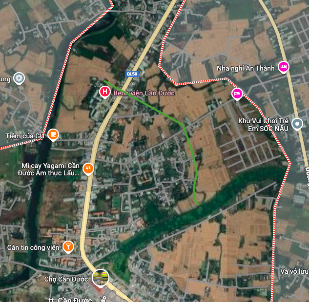
3. Road connecting National Highway 50
A short but important connecting route will be built to intersect with National Highway 50. This route will be about 1 km long.
The starting point of the route is located at Can Duoc Hospital and the end point is near Quang Minh Pagoda. This route is expected to help divert traffic, reduce the load on National Highway 50 and create convenience for people to access medical facilities and public services.
Note on planning
The information in the article is referenced from the Land Use Planning Adjustment Map for the period 2021 - 2030 of Can Duoc district, Long An province (old). The actual implementation roadmap and time may be adjusted by the authorities.
Source: https://baolamdong.vn/quy-hoach-3-tuyen-duong-moi-tai-xa-can-duoc-tay-ninh-406523.html

![[Photo] Parade to celebrate the 50th anniversary of Laos' National Day](/_next/image?url=https%3A%2F%2Fvphoto.vietnam.vn%2Fthumb%2F1200x675%2Fvietnam%2Fresource%2FIMAGE%2F2025%2F12%2F02%2F1764691918289_ndo_br_0-jpg.webp&w=3840&q=75)


![[Photo] Worshiping the Tuyet Son statue - a nearly 400-year-old treasure at Keo Pagoda](/_next/image?url=https%3A%2F%2Fvphoto.vietnam.vn%2Fthumb%2F1200x675%2Fvietnam%2Fresource%2FIMAGE%2F2025%2F12%2F02%2F1764679323086_ndo_br_tempimageomw0hi-4884-jpg.webp&w=3840&q=75)


Comment (0)