
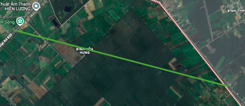
Overview of infrastructure planning of Binh Thanh commune
According to the land use planning adjustment map for the period 2021 - 2030 of Thanh Hoa district and Duc Hue district, Long An province, Binh Thanh commune will have a number of new routes deployed to complete the regional traffic network. These routes are expected to promote connectivity and local socio-economic development.
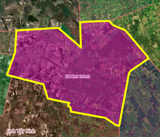
New main roads will be opened.
In the coming period, two notable routes will be built in Binh Thanh commune, including a section of National Highway N1 and an important connecting route.
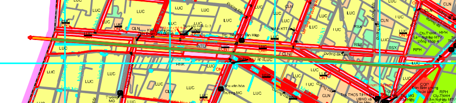
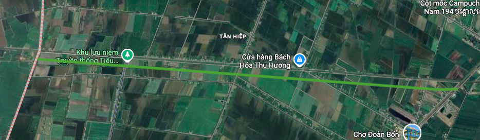
1. National Highway N1
This route is part of National Highway N1. The section passing through Binh Thanh commune is about 8 km long, located near Tan Hiep Primary School. The formation of this route will contribute to completing the national traffic axis, enhancing inter-regional connectivity.
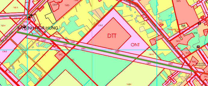
2. Route intersecting Provincial Road 839
The second route starts at Provincial Road 839, near the Binh Thanh Base Relic Site, and has a total estimated length of about 5.4 km. This route plays a role in connecting the main traffic axes in the area, facilitating travel and freight transport.
Note: The diagrams in the article are drawn relatively, based on the Land Use Planning Adjustment Map for the period 2021 - 2030 of Thanh Hoa district and Duc Hue district, Long An province. Planning information may change according to adjustment decisions of competent state agencies.
Source: https://baolamdong.vn/quy-hoach-giao-thong-xa-binh-thanh-long-an-den-nam-2030-408788.html


Comment (0)