
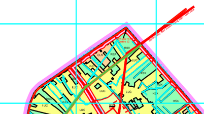
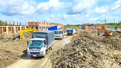
Overview of planning of Luong Hoa commune
Luong Hoa Commune, Ben Luc District, Long An Province, is oriented to develop transport infrastructure according to the land use planning adjustment map for the period 2021 - 2030 of the district. In particular, opening new routes is considered one of the top priorities to promote regional connectivity and local socio-economic development.
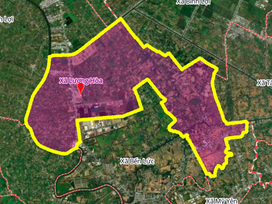
According to the plan, the commune will have at least two more notable routes, helping to solve people's travel needs and facilitate the exchange of goods.
Details of the 2 routes to be opened
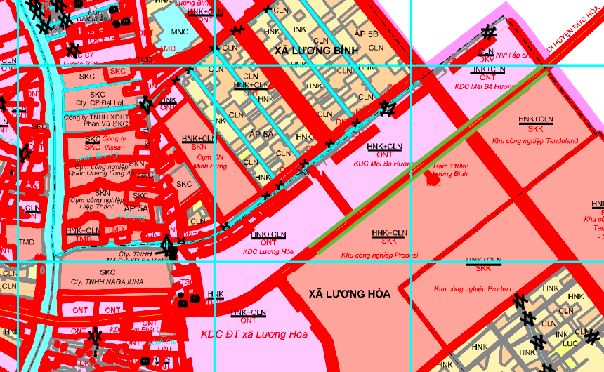
Based on the planning map, two main routes will be formed in the near future, connecting directly to important neighboring areas.
1. Road connecting Duc Hoa district
This route is expected to be about 2.8 km long, starting from the area near Nagajuna Co., Ltd. and heading straight towards Duc Hoa district. The formation of this route is expected to shorten travel time and strengthen economic links between Ben Luc and Duc Hoa districts.
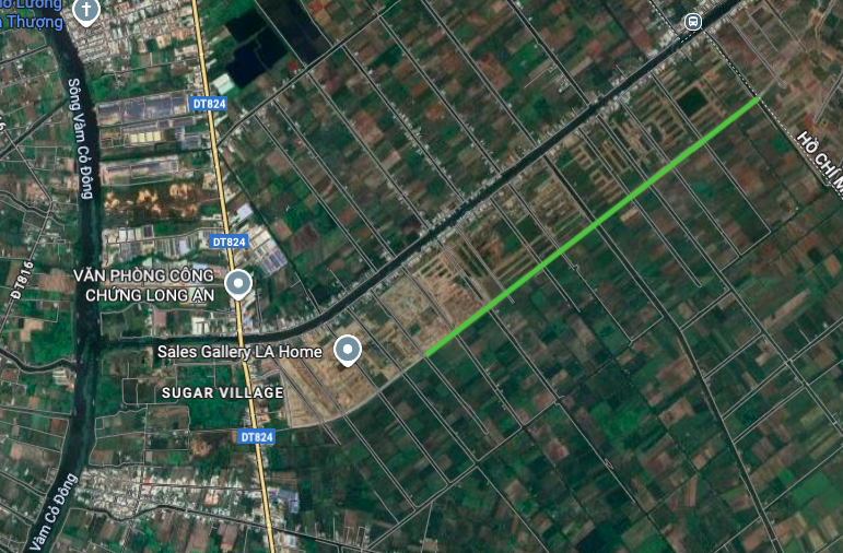
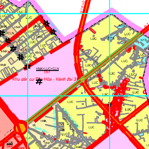
2. Route to Ho Chi Minh City
The second route is about 3.6 km long, located near the 7 Indian Bridge area and connects to Ho Chi Minh City. This is an important traffic axis, not only serving local people but also contributing to reducing the load on existing routes, creating a new, more convenient direction of travel to the largest economic center of the country.
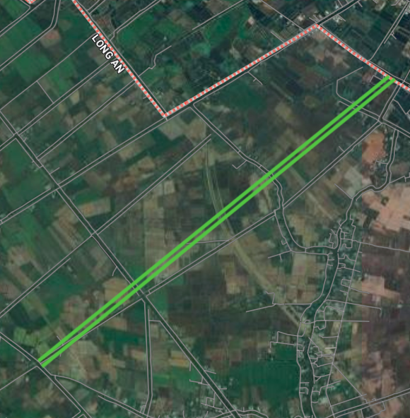
Note: The diagrams in the article are drawn relatively, based on the Land Use Planning Adjustment Map for the period 2021 - 2030 of Ben Luc district, Long An province. Detailed planning information needs to be verified at competent state agencies.
Source: https://baolamdong.vn/quy-hoach-luong-hoa-long-an-mo-2-tuyen-duong-moi-399390.html

![[Photo] President Luong Cuong receives US Secretary of War Pete Hegseth](https://vphoto.vietnam.vn/thumb/1200x675/vietnam/resource/IMAGE/2025/11/02/1762089839868_ndo_br_1-jpg.webp)


![[Photo] Lam Dong: Images of damage after a suspected lake burst in Tuy Phong](https://vphoto.vietnam.vn/thumb/1200x675/vietnam/resource/IMAGE/2025/11/02/1762078736805_8e7f5424f473782d2162-5118-jpg.webp)


Comment (0)