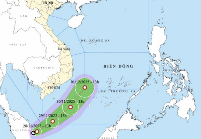
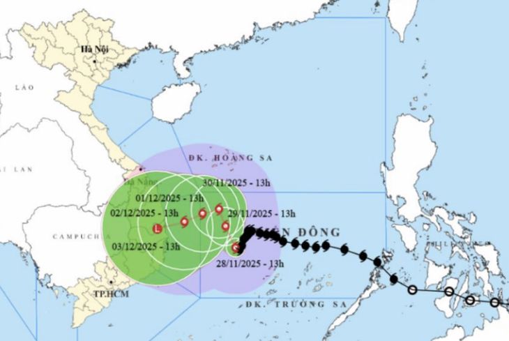
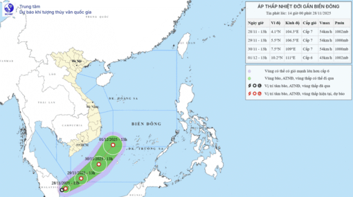
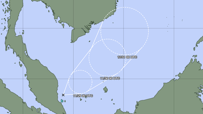
Storm No. 15 above and tropical depression from the equator threaten ships operating in the waters of Ho Chi Minh City and the South - Photo: NCHMF
The storm and low pressure forecast bulletin of the Southern Hydrometeorological Station said that due to the influence of the tropical depression and storm No. 15, the southwestern sea area of the southern East Sea will have winds gradually increasing to level 6-7, gusting to level 9, and waves 2.5-4m high. The sea will be rough.
Vessels operating in the above mentioned dangerous areas are susceptible to the impact of storms, whirlwinds, strong winds and large waves.
The Southern sea area and Ho Chi Minh City, including the sea area from Lam Dong (affected by storm No. 15) to Ca Mau, has northeast wind level 5, sometimes level 6, gusting to level 7-8, wave height 2-4m.
Sea area of Ca Mau - An Giang - Phu Quoc northeast wind level 4-5, gust level 6-7, wave height 1-2m, sea sometimes slightly rough.
In both seas, the weather will be showery and thunderstorms in some places. During thunderstorms, watch out for tornadoes and strong gusts of wind.
Meteorological experts especially warn ship and boat owners to pay attention to the forecast bulletins of the meteorological agency. Currently, some vessels from the central East Sea are running south to avoid the storm, encountering a tropical depression will be very dangerous, need to find safe shelter.
Tropical depressions from the equator up are considered rare in the history of world meteorology. Normally, storms and tropical depressions rarely form at latitudes below 5 because the Coriolis force - the force that causes objects to move in the wrong direction - is small here. That is also the reason why the South has fewer storms than the North and Central regions.
Source: https://tuoitre.vn/tp-hcm-va-nam-bo-bi-kep-giua-gong-kim-bao-so-15-va-ap-thap-nhiet-doi-mua-gio-may-ngay-toi-ra-sao-20251128162622536.htm
































Comment (0)