
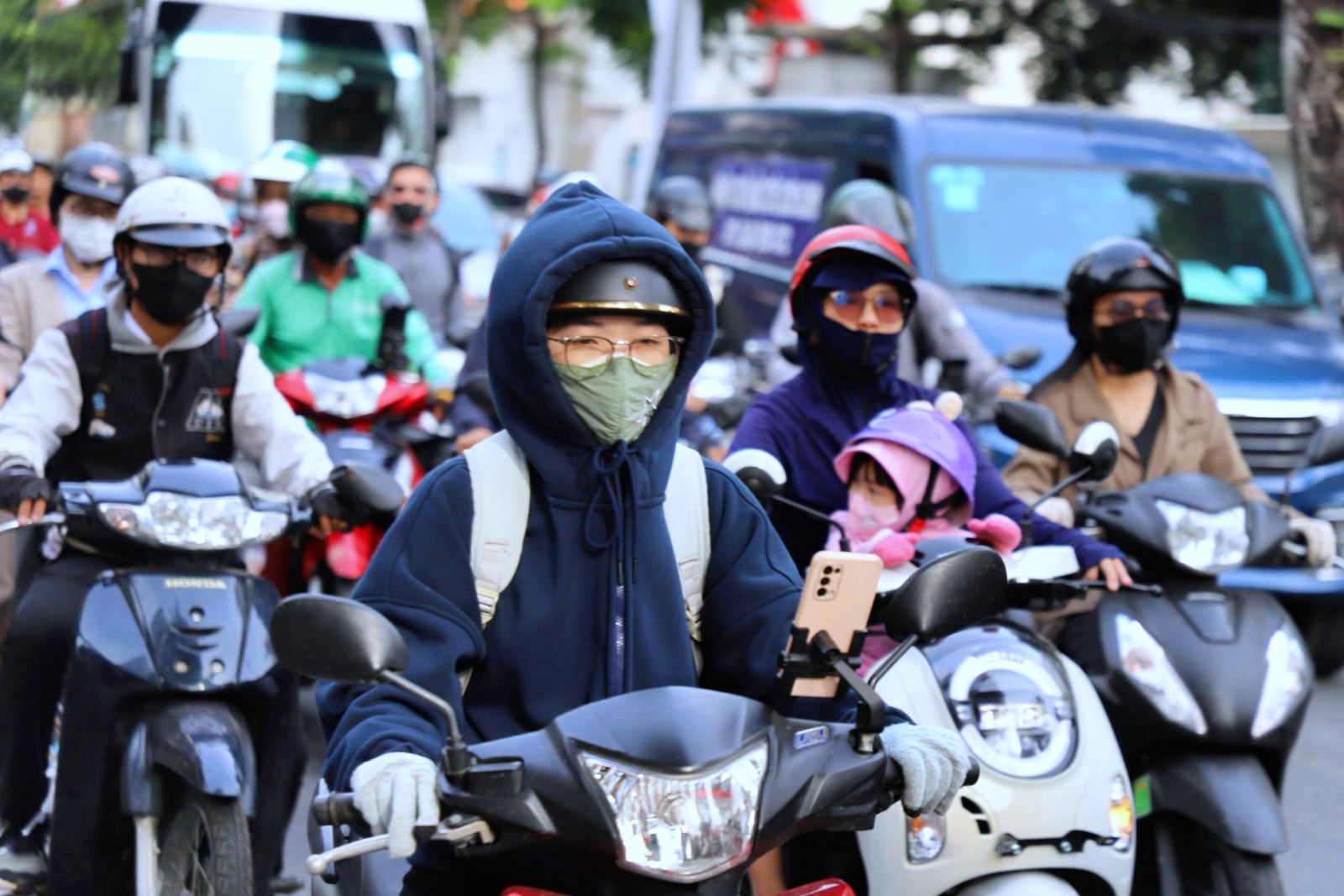
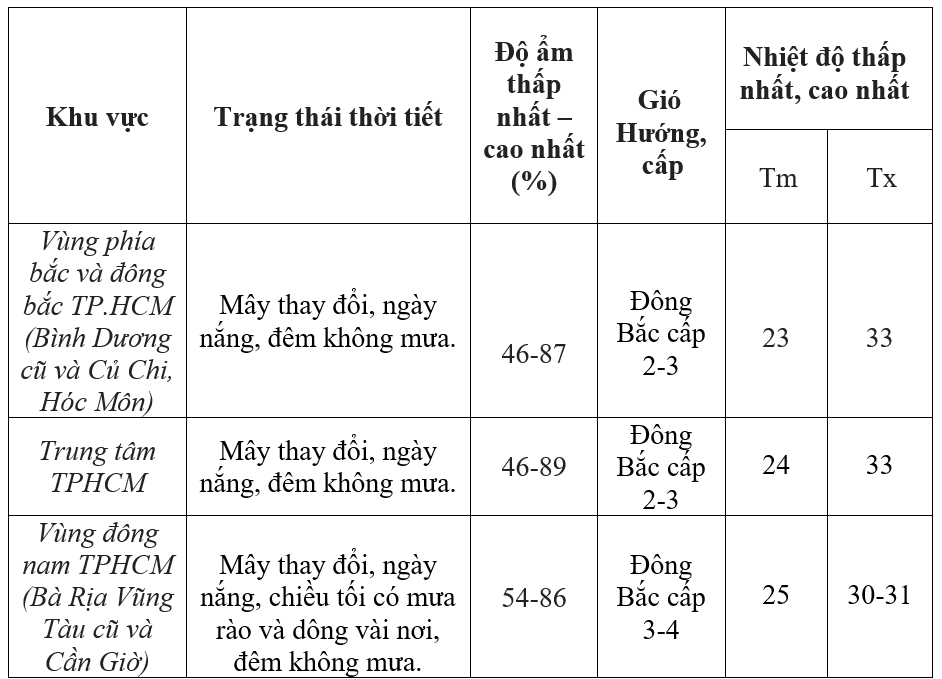
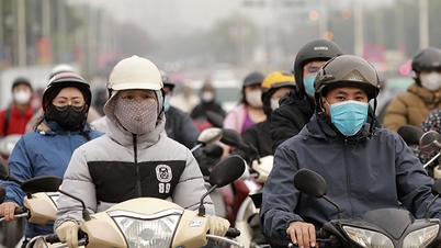
In Ho Chi Minh City, the weather remains cloudy, sunny during the day, no rain at night; daytime temperatures decrease slightly, nighttime temperatures increase by 1 - 3 degrees Celsius. The highest temperature reaches 29.4 - 32.4 degrees Celsius, the lowest from 21.5 - 23 degrees Celsius. Tan Son Nhat area recorded the highest temperature of 31 degrees Celsius, the lowest 23 degrees Celsius; humidity ranges from 43 - 89%; Northeast wind speed 2 - 3 m/s.
In the Southeast region, the highest temperature ranges from 29.4 - 32.5 degrees Celsius, some places recorded 29.7 - 33.3 degrees Celsius; the lowest temperature ranges from 19.5 - 23.4 degrees Celsius, some areas are lower such as Ta Lai 18.5 degrees Celsius, Phuoc Long 19.5 degrees Celsius, Long Khanh 19.5 degrees Celsius.
The Southwestern region has the highest temperature ranging from 28.6 - 31.2 degrees Celsius, the lowest recorded from 21.9 - 26.1 degrees Celsius; Cao Lanh alone is 21.9 degrees Celsius.
According to the Southern Hydrometeorological Station, the cold air tends to weaken and move eastward. The northeast wind slightly decreases in intensity over the southern sea. The low pressure trough with an axis from 6 to 9 degrees north latitude connecting with the low pressure area over the southern East Sea area is active again.
In the coming time, the Southern region will have variable clouds, sunny days; showers and thunderstorms in some places in the evening and at night. Nighttime temperatures will continue to increase slightly. The highest temperature is generally from 30 - 33 degrees Celsius, some places above 33 degrees Celsius. The lowest temperature at night in the Eastern region is 20 - 23 degrees Celsius, some places below 20 degrees Celsius; in the Western region from 23 - 26 degrees Celsius, some places below 23 degrees Celsius.
In the next two to three days, the cold air will weaken and move east, causing the northeast wind over the southern sea to gradually decrease; the low pressure trough at 6-9 degrees north latitude will remain, continuing to affect the weather in the South.
The cause is that above, the subtropical high pressure encroaches to the west, combined with stronger easterly wind disturbances and the northern edge of the low pressure trough at 6 - 9 degrees North latitude, causing significant impact on the weather in the region.
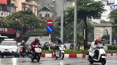
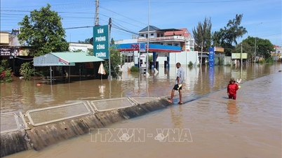
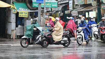
The South is forecast to have unseasonal rain, concentrated from December 10 to 13. Rainfall tends to increase, appearing sporadically, with moderate rain and locally heavy rain; rain mainly in the late afternoon and at night.
According to meteorological experts, in the context of the cold air weakening but the low pressure trough is still active, people in the South need to closely monitor weather forecasts to proactively respond to unseasonal rains.
Rain usually falls in the late afternoon and at night, so people should bring raincoats when traveling and avoid areas prone to flooding. Families planning to dry agricultural products or do outdoor activities should make reasonable arrangements to avoid the inconvenience of sudden rain.
At sea, fishermen should pay attention to changes in the northeast wind, even though it has decreased in intensity, and closely observe thunderstorms to ensure safety when fishing.
Source: https://baotintuc.vn/xa-hoi/tp-ho-chi-minh-se-co-mua-trai-mua-gia-tang-trong-nhung-ngay-toi-20251209110553584.htm


![[Photo] Urgently help people soon have a place to live and stabilize their lives](/_next/image?url=https%3A%2F%2Fvphoto.vietnam.vn%2Fthumb%2F1200x675%2Fvietnam%2Fresource%2FIMAGE%2F2025%2F12%2F09%2F1765248230297_c-jpg.webp&w=3840&q=75)


![[Photo] General Secretary To Lam works with the Standing Committees of the 14th Party Congress Subcommittees](https://vphoto.vietnam.vn/thumb/402x226/vietnam/resource/IMAGE/2025/12/09/1765265023554_image.jpeg)


Comment (0)