Satellite images have a resolution of tens or even hundreds of meters, meaning a large ship may occupy only 1 pixel or less - making it invisible to the naked eye. However, a team at the Dalian Naval Academy (China) has discovered a Nimitz-class aircraft carrier, a Ticonderoga-class cruiser and an Arleigh Burke-class destroyer from these images, according to the South China Morning Post on July 15.
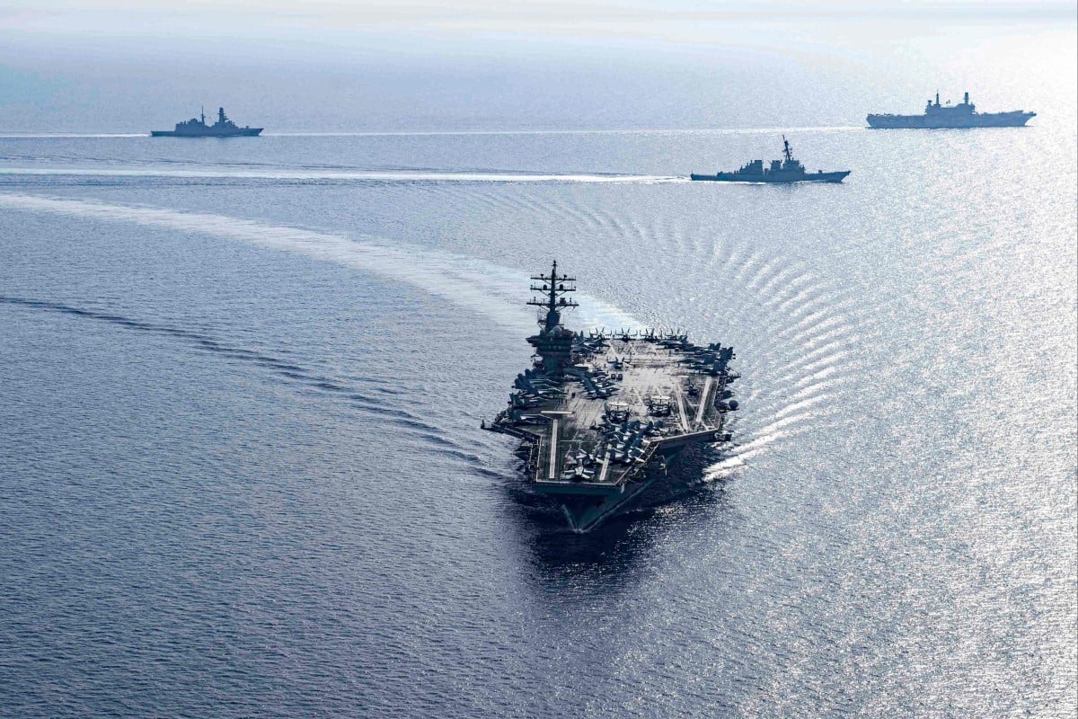
Dwight D. Eisenhower Carrier Strike Group in the Red Sea
The team said they tracked US Navy aircraft carriers, cruisers and destroyers by analyzing wave images — a simple technique that could be used by almost any country or organization in the world . Different ships create distinct wave patterns on the sea surface, similar to fingerprints.
According to the research team, accurately identifying US warship models requires the use of sensitive parameters.
In a study published in the Chinese academic journal Computer Simulation in April, the team revealed their physical parameters. "By using the parameters and algorithms mentioned in the paper, we can basically determine the model of the target warship under certain conditions," the team said.
In recent years, China has established a relatively large network of earth observation satellites. The resolution of these satellites can reach 0.1 meters. Chinese satellites not only track warships but also track high-speed F-22 stealth fighters through the clouds.
For countries or organizations that do not have this capability, they can still take advantage of platforms that provide real-time satellite imagery almost for free, but the image resolution is relatively low. For example, NASA's Worldview has a resolution of 250 m/pixel.
However, the method still faces many hurdles. According to the team, one of their challenges is how to extract useful information from environmental noise, as clouds and waves often obscure key features of a ship's wake.
The team also cautioned that the method is difficult when the target moves faster than 20 knots. Furthermore, under the influence of strong winds and waves, the overlapping relationship between the sea waves and the stern waves can significantly affect the analysis results. Therefore, the method still needs to be tested and refined with a large amount of real-world data.
Source: https://thanhnien.vn/trung-quoc-tiet-lo-cach-theo-doi-tau-chien-my-cuc-don-gian-185240715205958769.htm






![[Photo] National Assembly Chairman Tran Thanh Man visits Vietnamese Heroic Mother Ta Thi Tran](https://vphoto.vietnam.vn/thumb/1200x675/vietnam/resource/IMAGE/2025/7/20/765c0bd057dd44ad83ab89fe0255b783)
















Comment (0)