

Sông Hồng, sông Sài Gòn, sông Đuống, sông Đà là 4 trong nhiều con sông đã đi vào thơ ca và để lại trong lòng mỗi người những ký ức khó quên.
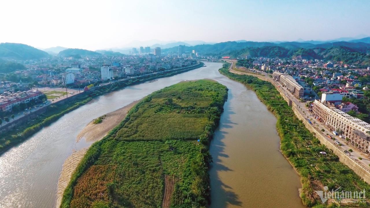
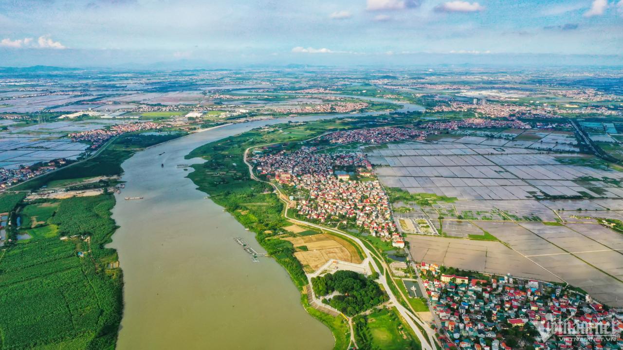
Sông Hồng là một tuyến sông lớn chảy dài hơn 500km trên lãnh thổ Việt Nam. Điểm đầu sông Hồng là huyện Bát Xát (Lào Cai), điểm cuối là cửa biển Ba Lạt (nằm giữa huyện Giao Thủy, tỉnh Nam Định và huyện Tiền Hải, tỉnh Thái Bình). Hệ thống sông Hồng gồm 3 nhánh sông lớn (sông Đà, sông Thao và sông Lô) hợp lưu tại Việt Trì và đổ ra biển tại cửa Ba Lạt, Trà Lý, Lạch Giang và cửa Đáy. Hình ảnh sông Hồng tại thành phố Lào Cai.
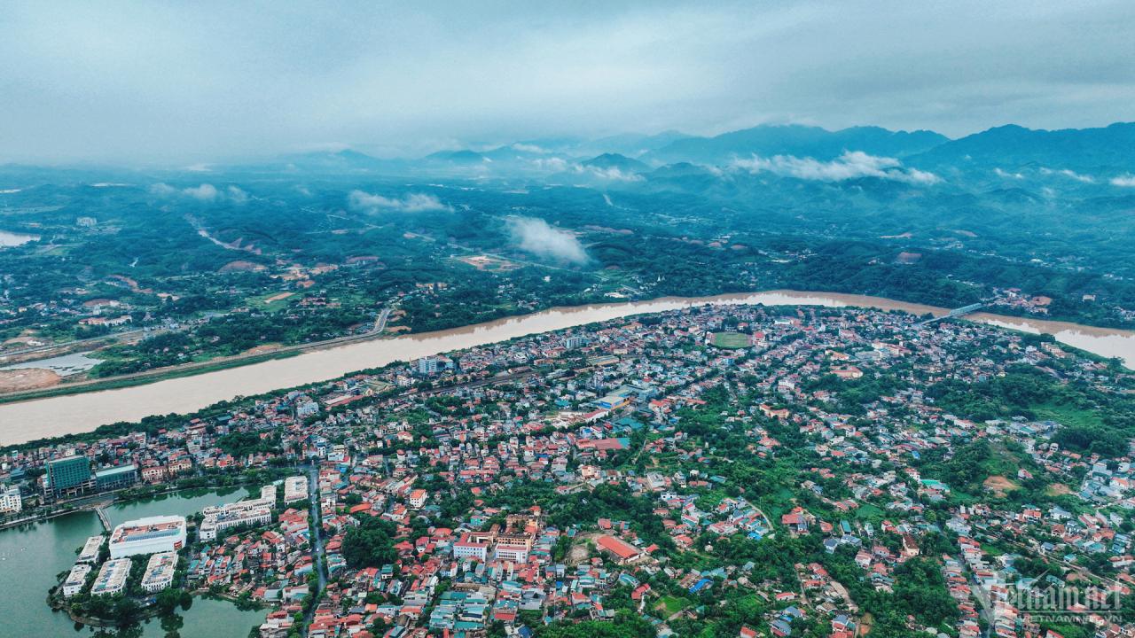
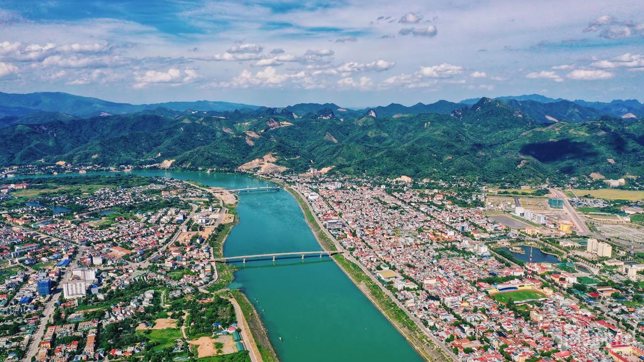
"Hỡi em yêu ở cuối sông Hồng, thấy dòng sông sóng ngầu lên sắc đỏ, biết là anh nhớ về em đó...". Hầu hết mọi người đều quen thuộc với câu hát này trong bài Gửi em ở cuối sông Hồng của nhạc sĩ Thuận Yến. Dòng sông gần như đã đi vào đời sống văn hóa, theo suốt chiều dài lịch sử của đất nước. Hình ảnh sông Hồng đoạn chảy qua thành phố Yên Bái (tỉnh Yên Bái).

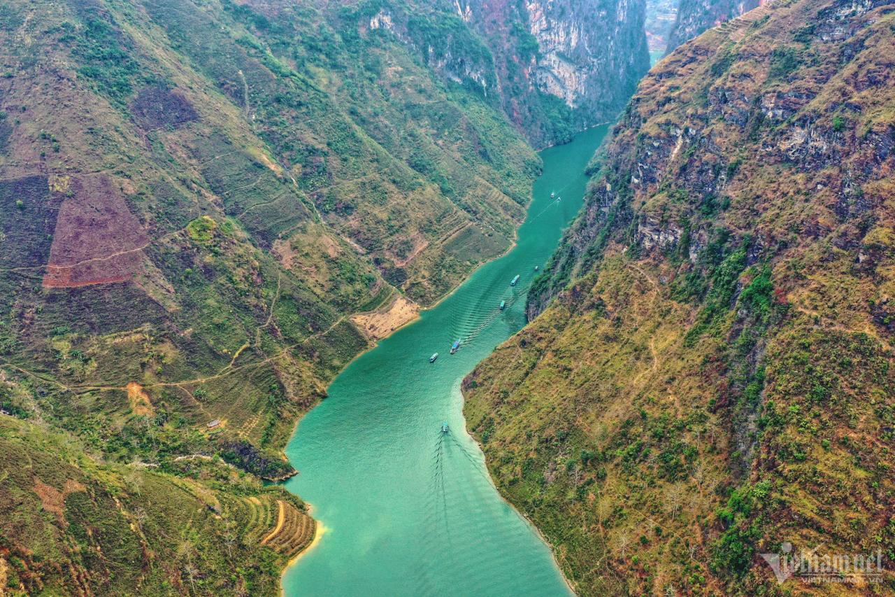
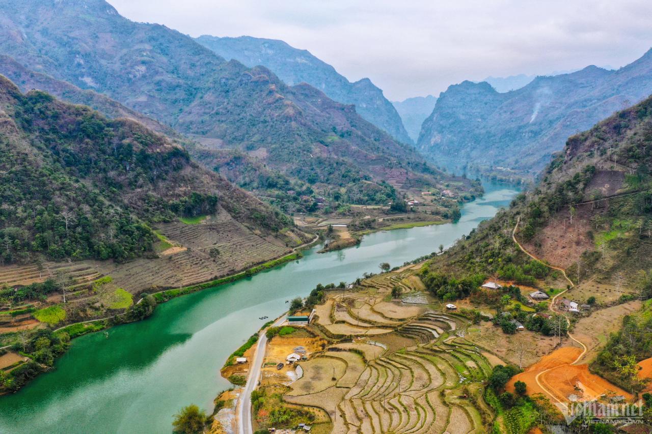
Sông Nho Quế bắt nguồn từ Vân Nam (Trung Quốc), chảy vào Việt Nam ở địa đầu cực Bắc thuộc xã Lũng Cú, huyện Đồng Văn, tỉnh Hà Giang. Phong cảnh nơi đây giữ nguyên sự trong lành, hoang sơ. Đâu đó trên các lưng núi vẫn có bản làng của người dân tộc sinh sống, dòng sông lúc mờ sáng lại đầy ắp những làn sương mù huyền ảo. Con sông này không chỉ chảy ở tỉnh Hà Giang mà còn chạy qua địa phận Cao Bằng. Tuy nhiên phần đầu sông chảy từ thôn Séo Lủng xã Lũng Cú đi qua Hẻm Tu Sản lại được xem là đoạn có cảnh sắc ngoạn mục, say đắm lòng người nhất. Năm 2009, Bộ Văn hóa, Thể thao và Du lịch đã xếp khu vực này là di tích danh lam thắng cảnh Việt Nam. Sông Nho Quế cũng được vinh danh là một trong những Thung lũng Kiến tạo độc nhất vô nhị của nước ta. 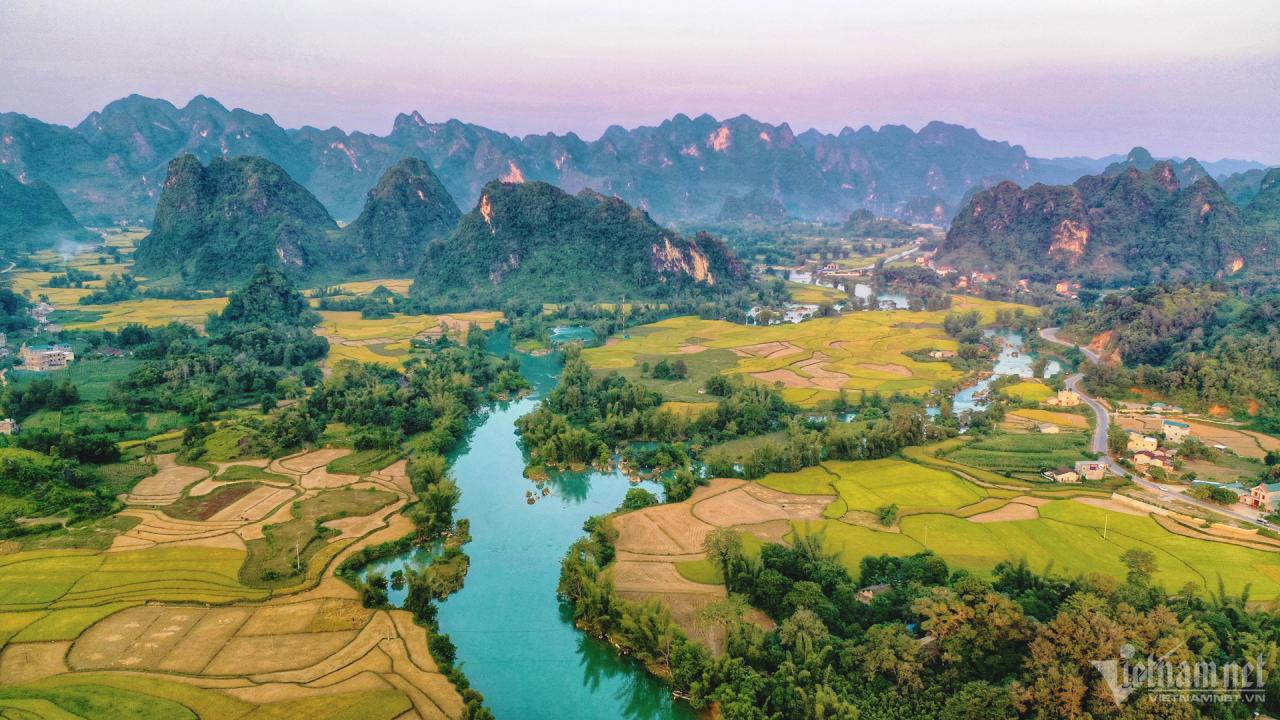
Giống như sông Nho Quế, sông Quây Sơn (Cao Bằng) có màu xanh ngọc bích uốn lượn trải dài qua nhiều khu vực, có nơi ôm ấp lấy chân núi đá vôi sừng sững tạo thành khung cảnh sơn thủy hữu tình, chỗ lại nép mình dưới những khóm tre xanh mướt, có khúc lại như dải lụa mềm mại vắt qua cánh đồng lúa chín Phong Nặm, Ngọc Côn… Đây là một trong số ít nơi sở hữu khung cảnh rất nên thơ, làm say lòng nhiều du khách phương xa. Sông Quây Sơn bắt nguồn từ Quảng Tây (Trung Quốc) với hai nhánh chảy vào Việt Nam hợp lưu nhau tại xã Ngọc Khê (huyện Trùng Khánh).
“Em ơi buồn làm chi/ Anh đưa em về bên kia sông Đuống...”. Đó là hai câu mở đầu bài thơ “Bên kia sông Đuống” của thi sĩ Hoàng Cầm gây tò mò cho người đọc. Có chuyện gì xảy ra ở bên kia sông Đuống? Phía nam sông xưa gọi là vùng Dâu, còn ngày nay là các huyện Thuận Thành, Gia Bình, Lương Tài thuộc tỉnh Bắc Ninh. Tuy sông Đuống thuộc Hà Nội và Bắc Ninh nhưng văn hóa lại không có địa giới. Trong vùng văn hóa Kinh Bắc mà nay thuộc Hà Nội có những ngôi làng cổ nằm bên bờ sông Đuống như làng Sủi, địa bàn cư trú của người Việt cổ thời Hùng Vương.
Sông Đáy qua địa phận huyện Thanh Oai (Hà Nội) có chiều dài khoảng 17km, có 9 xã nằm trong vùng. Trong định hướng phát kinh tế - xã hội của huyện giai đoạn 2021-2025, xác định phát triển vùng ven sông Đáy thành không gian du lịch sinh thái, hình thành tuyến du lịch thủy, quy hoạch toàn bộ khu vực bãi bồi sông Đáy là khu vực hỗn hợp du lịch sinh thái kết hợp nông nghiệp, kết nối tuyến du lịch đường thủy với du lịch làng nghề truyền thống ven sông. Ảnh: Khương Bino.
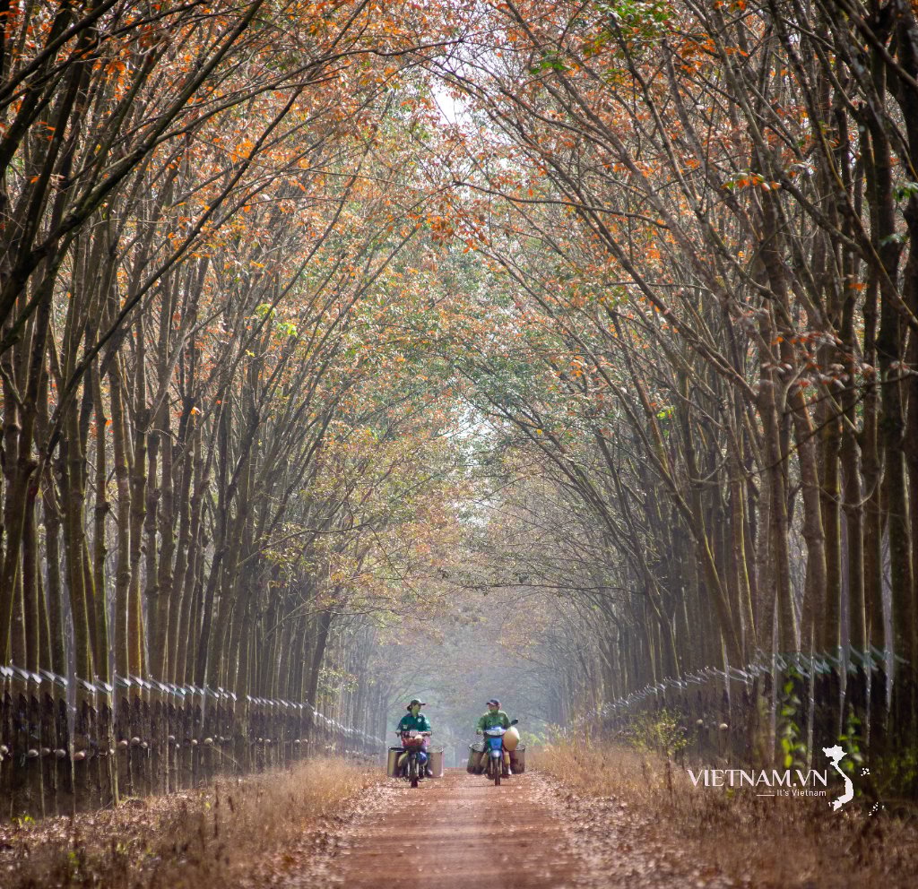
"Có những cái thác phải kéo thuyền cả mùa nước, cả mùa khô… Có quãng khiêng thuyền lên bờ, lật nghiêng thuyền ra mà kéo đến gần cây số. Có chỗ vừa kéo cạn, vừa lên dốc bờ đá dốc ngược. Sự hùng vĩ của con sông Đà không phải chỉ có thác đá mà nó còn là những cảnh đá bờ sông dựng vách thành. Có chỗ vách đá thành chẹt lòng sông Đà như một cái yết hầu. Cưỡi lên thác sông Đà, phải cưỡi đến cùng như là cưỡi hổ…". Đó là "tính nết" của một số thác trong 73 thác khét tiếng mà nhà văn Nguyễn Tuân đã kể rõ trong tác phẩm “Người lái đò sông Đà”. Sông Đà hay còn gọi là sông Bờ, sông Đen là phụ lưu lớn nhất của sông Hồng - dòng sông mẹ của đồng bằng Bắc Bộ. Sông Đà bắt nguồn từ tỉnh Vân Nam (Trung Quốc) với tổng chiều dài hơn 910km, có tên gọi Lý Tiên Giang- đoạn sông Đà chảy vào Việt Nam dài 543km. Sông Đà không chỉ được biết đến như một dòng sông năng lượng lớn nhất Việt Nam với hàng loạt hệ thống thủy điện Hòa Bình, Sơn La, Lai Châu... mà còn là dòng sông mẹ của hàng chục dân tộc anh em ở vùng Tây Bắc. 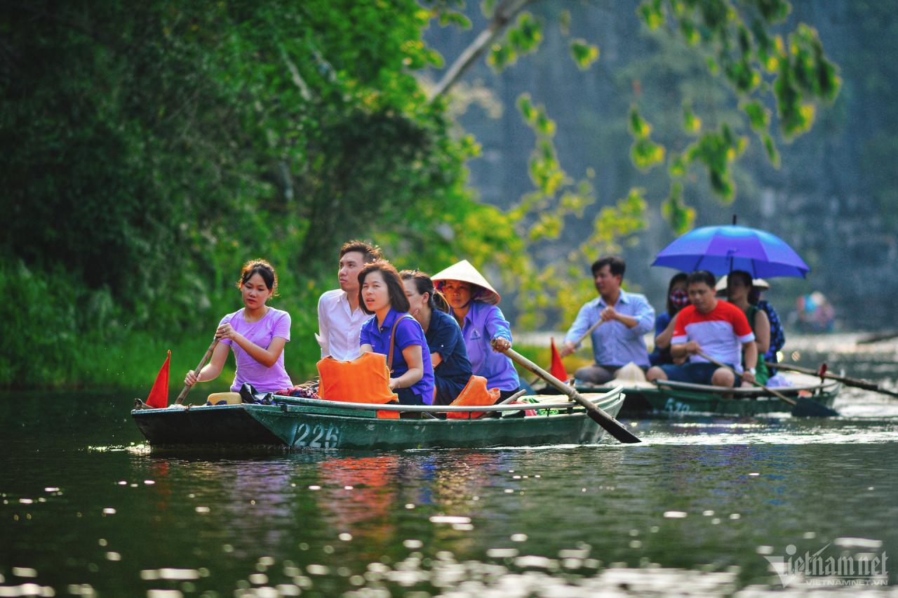


Đi thuyền trên sông Sào Khê (Ninh Bình) quả là một trải nghiệm thú vị. Hoa súng nở bung hai bên sông như muốn chào mời lữ khách tiếp tục khám phá. Người lái đò dường như đều tay chèo hơn, con đò nhịp nhàng rẽ nước, tạo thành gợn sóng tỏa ra, rồi chiếc đò sau lại tiếp nối. Cảm giác thiên nhiên kỳ thú càng kích thích, với tiếng nước róc rách nghe thật vui tai. Theo sử sách, sông Sào Khê có từ thời Đinh Bộ Lĩnh, nối giữa sông Hoàng Long và sông Đáy. Cái tên “Sào Khê” là do vua Lý Công Uẩn đặt vào năm 1005. Ông từng đi trên con sông này để ra sông Đáy rồi về thành Đại La (kinh thành Thăng Long) năm 1010.
Cùng với đèo Ngang, sông Gianh là biểu trưng địa lý của tỉnh Quảng Bình. Sông dài 160km, bắt nguồn từ ven núi Cô Pi cao 2.017m thuộc dãy Trường Sơn. Sông Gianh chảy qua các huyện Minh Hóa, Tuyên Hóa, Quảng Trạch, Bố Trạch và đổ ra biển Đông ở cửa Giang. Là một trong những biểu tượng của thiên nhiên miền Trung nói chung và Quảng Bình nói riêng, sông Gianh tạo ấn tượng bởi diện tích lưu vực đạt 4.680km2 và độ cao trung bình đạt 360m. Ảnh: Trần An.
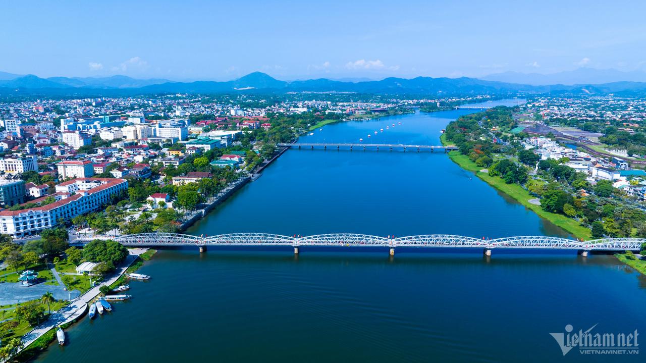
Đặt chân đến mảnh đất cố đô Huế, du khách không thể không tới tham quan dòng sông Hương thơ mộng, hiền hòa chảy qua những cánh rừng từ ngã ba Bằng Lãng đi sâu vào giữa lòng thành phố, rồi tiếp tục uốn lượn qua các miền quê ở hạ lưu trước khi ra biển. Sông còn được ví như cô gái Huế e ấp nụ cười dưới vành nón lá. Ảnh: Lê Huy Hoàng Hải.
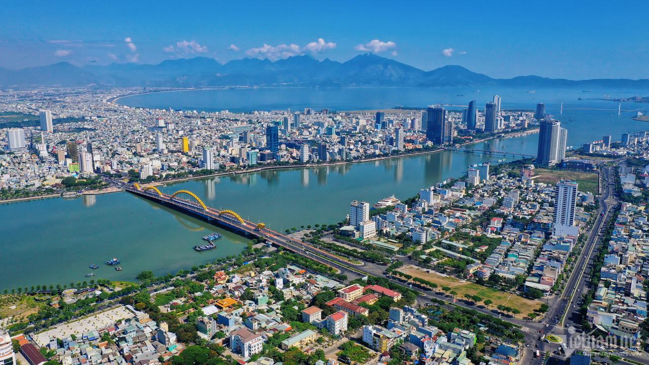
Sông Hàn - dòng sông gắn liền với vô vàn kỷ niệm của biết bao người dân Đà Nẵng, là một bộ phận của quê hương thân yêu, là tặng vật thiên nhiên vô cùng quý báu của mảnh đất miền Trung. Gọi sông Hàn là “dải lụa xanh biếc giữa lòng thành phố Đà Nẵng” không phải là không có căn cứ. Sông Hàn có chiều dài 7,8km, chiều rộng khoảng 400-700m (chỗ rộng nhất 700m, hẹp nhất 300m), độ sâu trung bình 7-10m.
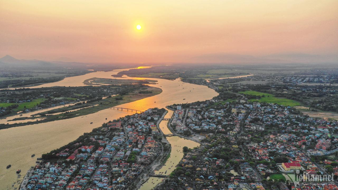
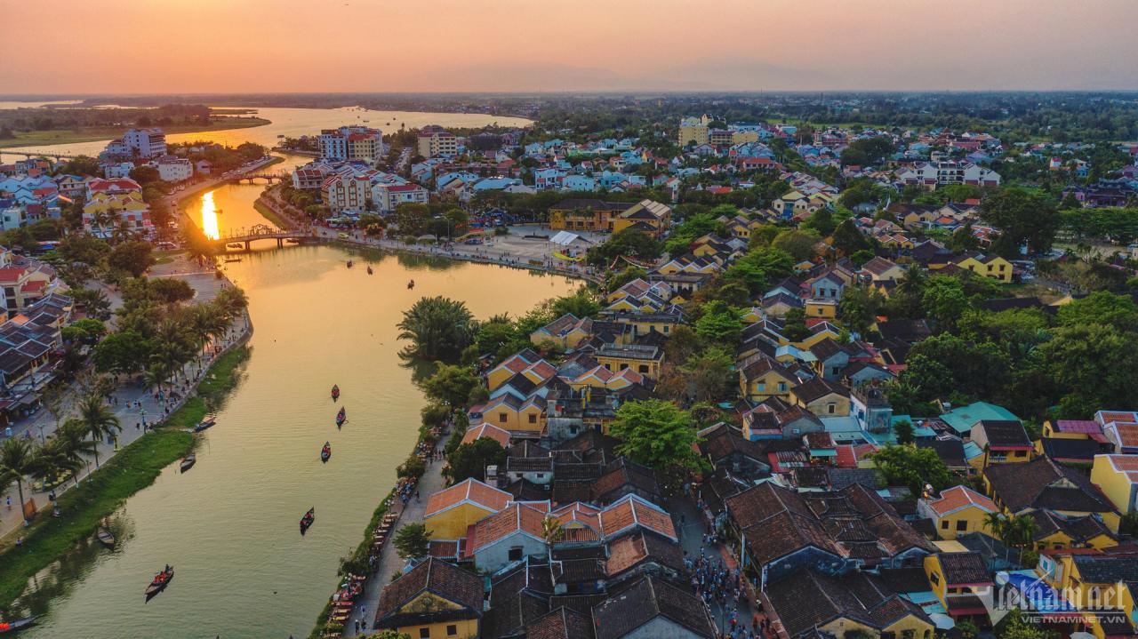
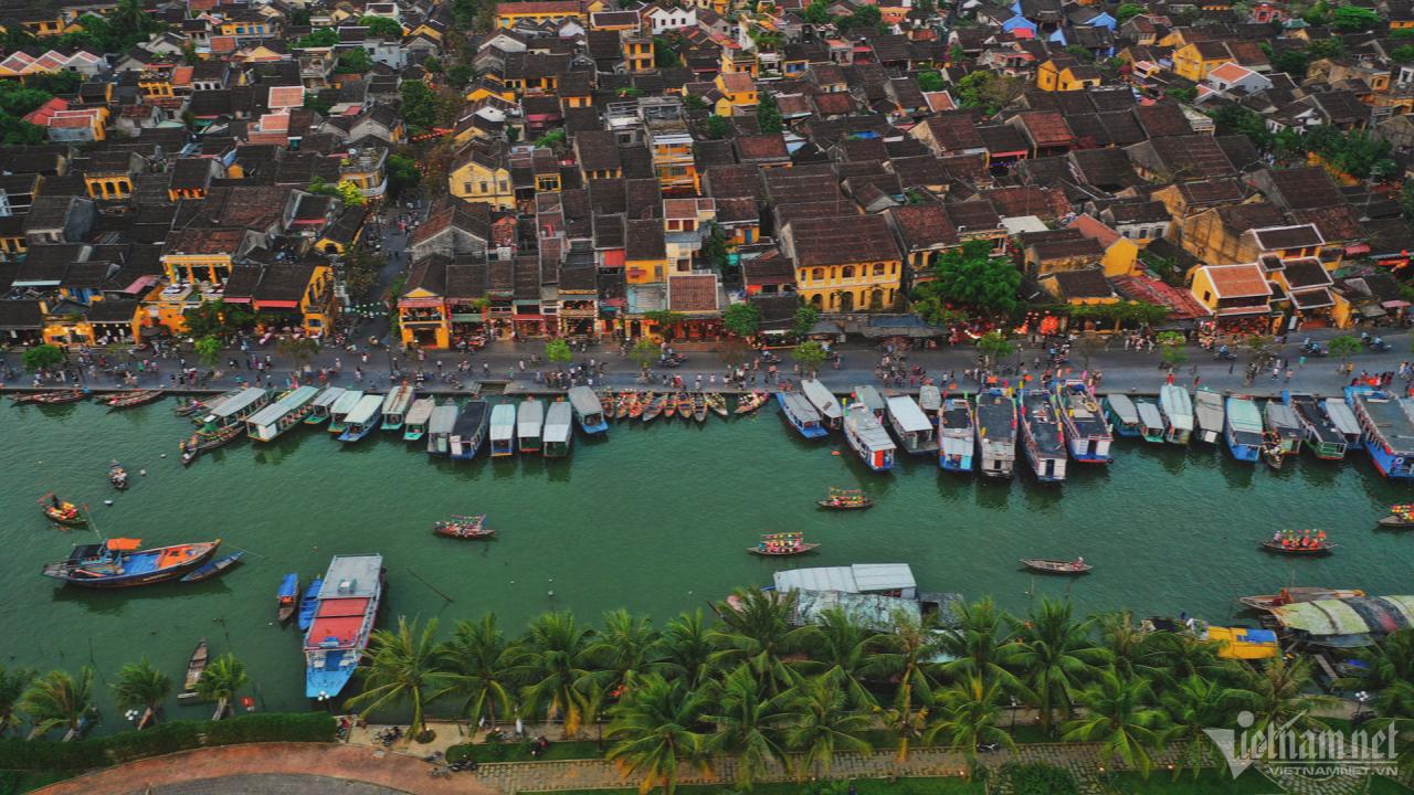
Sông Thu Bồn là dòng sông nội địa có lưu vực lớn nhất nước với 10.350km², tập trung chủ yếu tại địa phận tỉnh Quảng Nam và một phần nhỏ của tỉnh Kon Tum, Đà Nẵng, Quảng Ngãi. Thượng nguồn sông Thu Bồn từ trên dãy núi Ngọc Linh (Kon Tum), kéo dài chừng 200km tới Cửa Đại rồi trôi ra biển Đông. Đoạn sông chảy qua Hội An rộng mênh mang, sóng lăn tăn và miên man gió. Vào mỗi buổi chiều, mặt sông xanh ngắt phẳng lặng soi bóng cây, bóng núi, đẹp như tranh vẽ.
Sông Sài Gòn dài 256km, bắt đầu từ Bình Phước sau đó qua Tây Ninh, Bình Dương và TP. Hồ Chí Minh. Đoạn sông chảy qua TP. Hồ Chí Minh dài khoảng 80km được ví như "dải lụa mềm" uốn lượn trong lòng thành phố tạo ra những bán đảo đẹp như Thanh Đa hay Thủ Thiêm. Dòng sông uốn lượn hình rồng vắt qua thành phố không chỉ là biểu tượng của đô thị sông nước mà còn là chứng nhân của quá trình 325 năm hình thành và phát triển Sài Gòn - Chợ Lớn - Gia Định - TP. Hồ Chí Minh. Ảnh: Phạm Doanh.
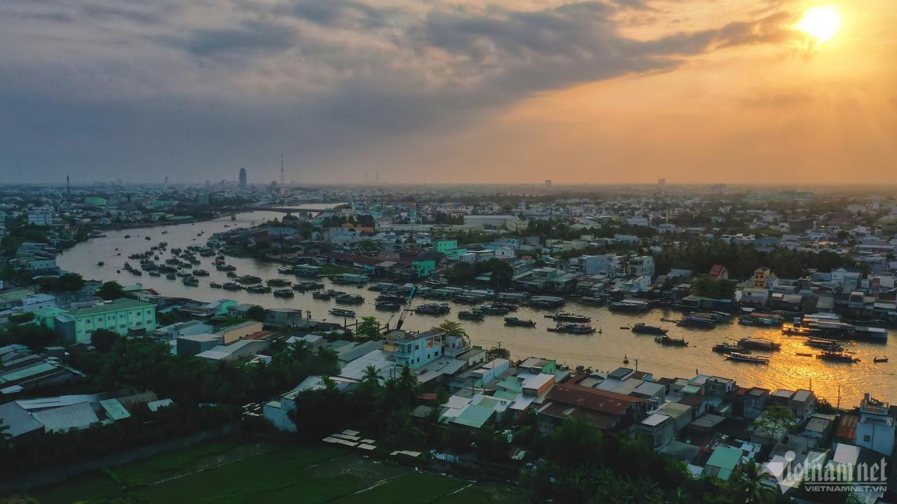
Cùng với sông Tiền, sông Hậu là một trong hai phân lưu của sông Mekong, hệ thống sông bồi đắp lên đồng bằng sông Cửu Long của Việt Nam. Sông Hậu còn mang tên gọi khác là sông Ba Thắc, bắt nguồn từ tên Bassac theo cách gọi của người Khmer. Sông này chảy qua tỉnh An Giang và là ranh giới tự nhiên giữa các tỉnh Đồng Tháp và Cần Thơ, Vĩnh Long và Cần Thơ, Hậu Giang và Vĩnh Long, Trà Vinh và Sóc Trăng. Sông đổ ra biển Đông qua cửa Trần Đề và cửa Định An. Đoạn rộng nhất của sông Hậu nằm giữa huyện Cầu Kè (Trà Vinh) và huyện Long Phú (Sóc Trăng), gần 4km. Ảnh: Hoàng Giám.
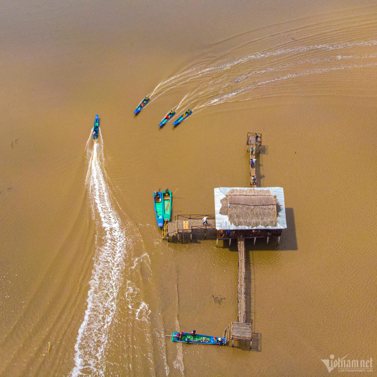
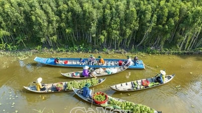
Sông Cần Thơ bắt nguồn từ khu vực nội đồng tây sông Hậu, dài khoảng 16km, rộng 280-350m, đi qua các quận Ô Môn, huyện Phong Điền, quận Cái Răng, quận Ninh Kiều và đổ ra sông Hậu tại bến Ninh Kiều. Nét nổi bật ở sông Cần Thơ là điểm du lịch chợ nổi Cái Răng - Di sản văn hóa phi vật thể quốc gia năm 2016. Chợ được hình thành từ những năm đầu thế kỷ 20, chủ yếu buôn bán các loại nông sản, trái cây, đặc sản của vùng đồng bằng sông Cửu Long.
Cà Mau có hệ thống sông ngòi, kênh rạch chằng chịt và đan xen như mạng nhện với tổng chiều dài hơn 7.000km, mật độ trung bình 1,34km/km², tổng diện tích mặt nước 15.756ha, chiếm 3,02% diện tích tự nhiên của tỉnh. Nơi đây có nhiều con sông chính đổ ra biển Tây (vịnh Thái Lan) như sông Bảy Háp, sông Ông Đốc, sông Trèm Trẹm, sông Cái Tàu, sông Bạch Ngưu, sông Đồng Cùng. Trong đó, sông Bảy Háp dài hơn 50km. Cửa Bảy Háp còn còn tên gọi khác như cửa Gò Công, cửa Rạch Chèo nối liền Mũi Cà Mau (huyện Ngọc Hiển). Ảnh: Hoàng Giám.


Bình luận (0)