Overview of the geography of Vinh Long province
 Việt Nam•01/08/2023
Vinh Long Province is situated between the two main branches of the Mekong River: the Tien River and the Hau River. The provincial capital, Vinh Long, is 100 km south of Ho Chi Minh City via National Highway 1 and 33 km north of Can Tho via National Highway 1. Vinh Long Province lies within the coordinates of 9°52'40'' to 10°19'48'' North latitude and 105 ° 41'18'' to 106 ° 17'03'' East longitude. From a broader perspective, Vinh Long province resembles a rhombus situated in the center of the lower Mekong Delta:
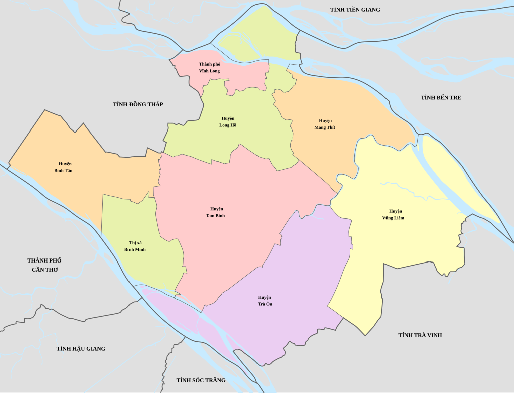
- To the east, it borders Ben Tre.
- To the southeast, it borders Tra Vinh.
- To the west, it borders Can Tho.
- To the northwest, it borders Dong Thap.
- To the northeast, it borders Tien Giang.
- To the southwest, it borders Hau Giang and Soc Trang provinces.
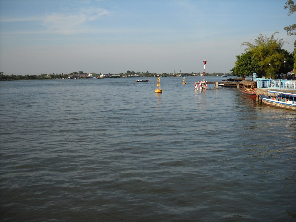
The Co Chien River, the section flowing through Vinh Long city.
Natural conditions
Vinh Long province has a relatively flat terrain with a slope of less than 2°. With a relatively low elevation compared to sea level, and a floodplain topography at the river mouth, the province's micro-topography takes the form of a basin in the center, gradually rising towards the banks of the Tien River, Hau River, Mang Thit River, and along major rivers and canals. Vinh Long province is located in a tropical monsoon climate zone, with two distinct seasons: the rainy season and the dry season. The average annual rainfall is 1,400-1,450 mm, lasting from April to December, accounting for 85% of the total annual rainfall. Temperatures are relatively high and stable, with an average temperature of 27°C, a small annual temperature range, average humidity of 79.8%, and an average annual sunshine duration of up to 2,400 hours. .

Vietnam encourages US businesses to expand investment in high technology.On the morning of June 26th, at the Government Headquarters, Deputy Prime Minister Ho Quoc Dung received Mr. Jeff Place, Supply Chain Director of Coherent Group (USA). During the meeting, the Deputy Prime Minister affirmed that Vietnam encourages US businesses to expand investment, especially in high-tech, innovation, and semiconductor industries.

Encourage U.S. businesses to expand investment in high-tech sectors.Deputy Prime Minister Ho Quoc Dung said that Vietnam welcomes US businesses to continue expanding their operations in Vietnam, especially in high-tech industries and sectors with high added value.

Vietnam and the United States strengthen cooperation in addressing the consequences of war.VTV.vn - On June 22, General Secretary and President To Lam received Acting Secretary of the US Navy Hung Cao.
Vinh Long has a geological structure similar to the region, mainly consisting of marine sediments from the Quaternary period of the Cenozoic Era. Although Vinh Long has a large area of acid sulfate soil, with a very deep acid sulfate layer and low acid content, the soil is of high quality and among the most fertile compared to other provinces in the region. In particular, the province has tens of thousands of hectares of freshwater alluvial soil along the Tien and Hau rivers (average alluvial content is 374 g/m³ of river water during the flood season), which is good, highly fertile, and suitable for growing two or more rice crops, yielding high productivity and large biomass. It also has favorable transportation links, both by water and land. Vinh Long also has abundant river sand and clay for construction materials. River sand reserves are approximately 100-150 million m³, mainly used for leveling, while clay reserves of about 200 million m³ are used as raw materials for brick and pottery production. .
Vinh Long is a province particularly poor in mineral resources, both in quantity and quality. The province only possesses sand and clay as construction materials; this is its greatest advantage compared to other provinces in the region in terms of economic exchange and the development of trade and tourism. Located between the two largest rivers of the Mekong Delta, Vinh Long has a year-round supply of freshwater, a priceless gift from nature. Vinh Long's intricate network of rivers and canals forms a fairly complete natural water distribution system, coupled with high average annual rainfall, creating favorable conditions for production and daily life for its people.


![[Image] National conference summarizing one year of operation of the overall organizational model of the political system, the three-tiered government model.](https://vphoto.vietnam.vn/thumb/1200x675/vietnam/resource/IMAGE/2026/07/01/1782882811691_ndo_br_1-jpg.webp)


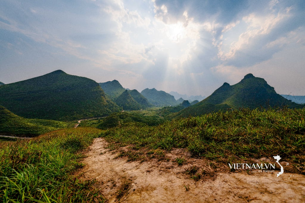
Light on the summit of Ba Quang

The billionaire village of the Xoi Dang ethnic group in Tra Linh commune.
