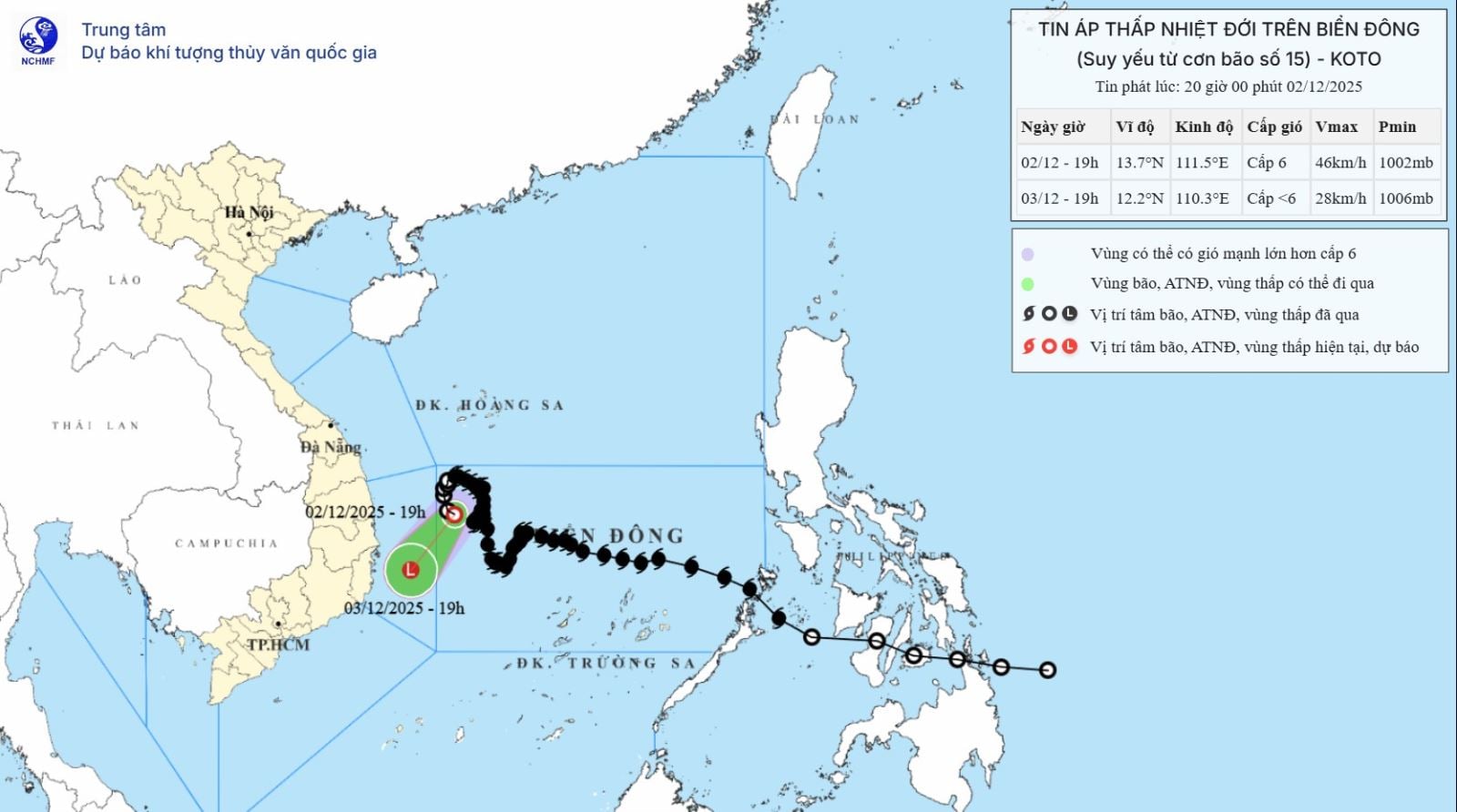
Accordingly, at 7 PM on December 2nd, the center of the tropical depression was located at approximately 13.7 degrees North latitude and 111.5 degrees East longitude, in the northwestern part of the central South China Sea. The strongest winds near the center of the tropical depression were at level 6 (39-49 km/h), with gusts up to level 8. The tropical depression was moving slowly in a south-southeast direction at a speed of about 5 km/h.


As of 7 PM on December 3rd, a tropical depression was located over the sea off Dak Lak and Khanh Hoa provinces. The tropical depression moved south-southwest at a speed of approximately 5-10 km/h and gradually weakened into a low-pressure area. Wind speeds were below level 6. The affected area was the northwestern part of the central East Sea, and the offshore waters of Gia Lai and Dak Lak provinces; the level of natural disaster risk was level 3.
Due to the influence of the tropical depression, the northwestern sea area of the central East Sea and the sea off the coast of Gia Lai - Dak Lak provinces will experience strong winds of level 6, gusting to level 8; sea waves will be 2-4m high, and the sea will be rough.
Vessels operating in the aforementioned hazardous areas are susceptible to the effects of thunderstorms, tornadoes, strong winds, and high waves.


Source: https://baotintuc.vn/van-de-quan-tam/ap-thap-nhiet-doi-doi-huong-di-chuyen-cham-20251202202552650.htm