
16 locations with localized flooding.
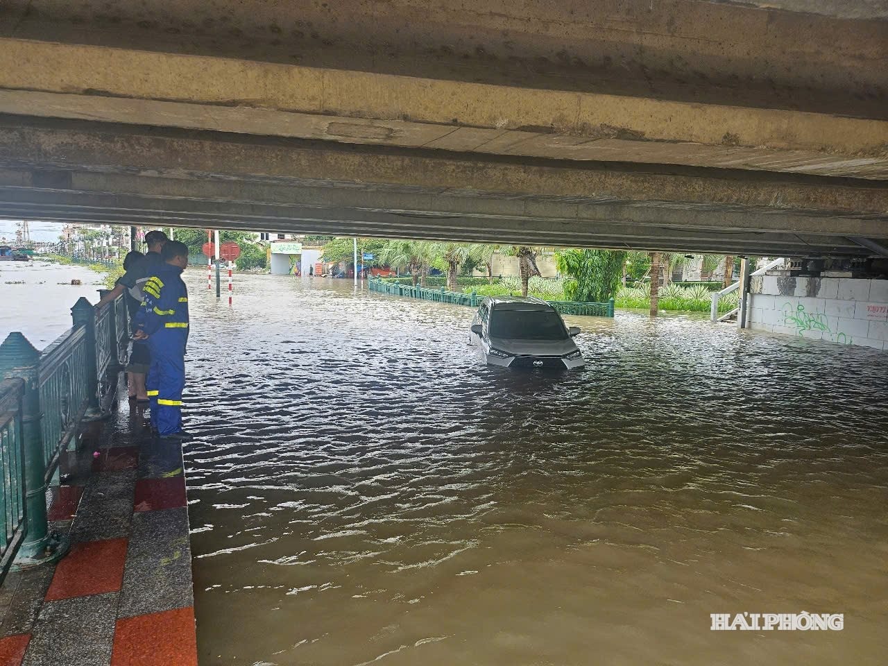
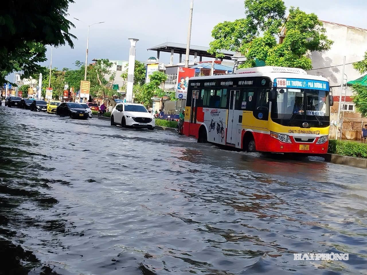
On the afternoon of August 16th, a sudden heavy rain lasting only about an hour caused the entire area around 312 Hung Vuong Street to be flooded, with some areas submerged up to 30-40 cm. In many low-lying areas, large trucks created waves that flooded into houses along the road. Some vehicles, such as electric bicycles, motorbikes, and four-seater cars, were forced to turn around and find alternative routes…
Ms. Le Thi Thanh, the owner of a beverage stall in the area, said that even light rain causes flooding, a situation that has persisted for decades and is becoming increasingly serious. The People's Committee of Hong Bang Ward has identified this as one of the long-standing "flood hotspots" for which no comprehensive solution has yet been found. The main reasons are the low-lying terrain and the drainage system, which has not been upgraded in a timely manner to keep up with the pace of urban development.
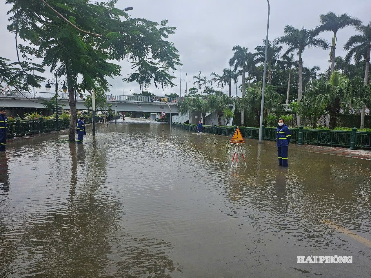
The Hai An ward area is considered the "waterlogged heart" of the eastern part of the city. Heavy rains over the past three years have caused localized flooding in many areas. Some of these "hotspots" include: the Do Nhuan street area, 333 Van Cao street, the Tay Trung Hanh, Trung Luc, and Tran Don areas, and the 833 Thu Trung road project area… According to Vu Doan Dung, Vice Chairman of the Hai An Ward People's Committee, the drainage system in the area is mostly old, and since the ward was upgraded and merged, no major projects have been invested in. The main drainage method is surface water drainage through canals, ponds, and lakes. However, with the rapid pace of urbanization, ponds and lakes are being filled in, and canals are narrowing and hardening, limiting drainage capacity. The entire ward only has one regulating lake, Cat Bi Lake, with an area of 5.3 hectares, making the installation of additional pumping stations difficult…
Besides Hai An and Hong Bang, other wards in the eastern part of the city such as Le Chan, Do Son, Hung Dao, and Gia Vien are also affected by urban flooding. According to the Department of Construction, when heavy rain exceeding 50 mm coincides with high tides, approximately 16 "hotspots" of localized flooding will appear in the city, with average flood levels ranging from 30 to 80 cm.
Upgrading drainage infrastructure must be a priority.
Recently, the City People's Council's monitoring team conducted a field survey of drainage and wastewater treatment, assessing the drainage system in the eastern part of Hai Phong, which was built during the French colonial period. Despite renovations and upgrades, the system remains largely fragmented, inconsistent, and has small cross-sections, failing to meet the demands of rapid urbanization. Many areas have low-lying terrain with ground levels below sea level; while ponds, lakes, canals, and vacant land, which were originally surface water drainage areas, have been filled in, concreted, or replaced with box culverts, limiting drainage capacity. Furthermore, the drainage system is affected by tidal patterns; heavy rains combined with high tides, rising sea levels, and upstream flooding cause localized flooding in many streets and residential areas.
According to Deputy Director of the Department of Construction Nguyen Minh Tuan, to overcome the current urban flooding situation, Hai Phong needs to invest in a new pipeline system, add regulating reservoirs and rainwater pumping stations. For flood-prone areas, more decisive solutions are needed, even a complete renovation of the drainage system on major traffic arteries. This is a difficult task, requiring significant investment and directly impacting traffic and people's lives, but it cannot be delayed. In the context of rapidly expanding urban space, upgrading drainage infrastructure must be a step ahead to meet the city's development needs.
Since 2018, the eastern area of Hai Phong has had a drainage plan. After the merger, it needs to be reviewed and updated to suit the population size, urbanization rate, and ensure overall consistency with the city's master plan currently being implemented. The plan must clearly define the land allocation for regulating lakes and drainage systems, and simultaneously mark boundaries for management to preserve the land and prevent encroachment that would lead to future costs.
Prior to the merger, in order to fundamentally address the flood-prone areas in the eastern part of the city, the Department of Construction advised including four projects with a total budget of approximately 1,560 billion VND in the medium-term public investment plan for the period 2026-2030. In addition, there are two projects funded by foreign loans: the Hai Phong City Climate Change Adaptation Development Project and the Sustainable Development Project for the Southeast Hai Phong City Area. Local authorities requested the city to continue reviewing and assessing the feasibility of these projects, and to prioritize the allocation of public investment funds for the period 2026-2030 to improve the flooding situation in this area as soon as possible.
NGOC LANSource: https://baohaiphong.vn/thap-thom-khi-mua-lon-521480.html
![[Photo] National Assembly Chairman Tran Thanh Man attends the policy seminar to promote Vietnam-Türkiye cooperation.](https://vphoto.vietnam.vn/thumb/1200x675/vietnam/resource/IMAGE/2026/04/16/1776351415367_vna-potal-chu-tich-quoc-hoi-tran-thanh-man-du-toa-dam-chinh-sach-thuc-day-hop-tac-viet-nam-tho-nhi-ky-8705791-jpg.webp)


![[Image] Bridges and roads connecting the eastern part of Ho Chi Minh City](https://vphoto.vietnam.vn/thumb/1200x675/vietnam/resource/IMAGE/2026/04/16/1776328595108_ndo_br_bh-vt5-jpg.webp)


![[Infographic] Details of the Hanoi-Quang Ninh High-Speed Railway Project](https://vphoto.vietnam.vn/thumb/402x226/vietnam/resource/IMAGE/2026/04/16/1776338188424_anh-man-hinh-2026-04-16-luc-18-16-10.png)

![[Photo] National Assembly Chairman Tran Thanh Man meets with the Speaker of the Georgian Parliament](https://vphoto.vietnam.vn/thumb/402x226/vietnam/resource/IMAGE/2026/04/16/1776338494029_anh-man-hinh-2026-04-16-luc-18-21-21.png)


Comment (0)