Shift from "project-driven" to "proactive management"
According to the Ho Chi Minh City Department of Construction, the city's current drainage and flood control planning system, approved in 2001 and 2008, has expired and is no longer suitable for the new context. Meanwhile, Project 299 on flood control and wastewater treatment was previously designed only for the old Ho Chi Minh City area, covering more than 2,000 km² .

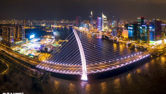
For the first time, Ho Chi Minh City's water management problem is being solved based on natural and inter-regional river basins, instead of being limited by administrative boundaries.
Photo: Pham Huu
Following the merger of Ho Chi Minh City with Binh Duong and Ba Ria- Vung Tau , the urban area has expanded to an enormous scale. This new megacity is a space for interconnected development of industry, services, and seaports, but it exhibits significant differences in topography, hydrology, and urbanization levels. Comprehensive statistics show that the entire city currently has 159 frequently flooded areas, including 76 in the former Ho Chi Minh City area, 52 in the former Binh Duong area, and 31 in the former Ba Ria-Vung Tau area.
Meanwhile, in recent years, extreme rainfall events have occurred frequently, exceeding the design capacity of the drainage system. Tidal levels at the Phu An and Nha Be stations have repeatedly set new records, exceeding 1.8 meters. Simultaneously, serious land subsidence is occurring, coupled with rapid urbanization and the filling in of ponds and lakes, which destroys the natural water infiltration capacity.
Besides the pressure of flooding, the problem of environmental pollution is also at an alarming level. Currently, the entire region generates approximately 1.97 million m³ of domestic wastewater per day, but the existing infrastructure only treats about 340,000 m³ (equivalent to 17%) to meet standards. The majority of the remaining wastewater is still discharged directly into the Saigon- Dong Nai river system and coastal areas.
The Department of Construction frankly acknowledges that the old approach still heavily focuses on eliminating localized flooding hotspots, lacks integrated risk management, and has not synchronized investment between key infrastructure projects and the collection system. In the new context, flood control in Ho Chi Minh City requires a more long-term strategic mindset.
Based on the above analysis, the Ho Chi Minh City Flood Control and Wastewater Treatment Project for the period 2026-2060 (along with the action plan 2026-2036) is being implemented by the Department of Construction using a completely new approach: studying the overall relationship between the upstream area, the low-lying central urban area, and the coastal estuary region within a unified system.


The assessment of the current situation, scenario development, and risk zoning will be based on drainage basins rather than administrative boundaries. This helps to accurately identify flow direction, hydraulic bottlenecks, and flood spread impacts. The overall strategy will operate on the "retain - store - drain" principle, redefining the role of each type of infrastructure.
Specifically, for traditional "grey infrastructure," the focus will be on improving sewers, dikes, pumping stations, and wastewater treatment plants; while for green and blue infrastructure, the emphasis will be on nature-based solutions such as regulating lakes, water storage spaces, permeable surfaces, restoration of canal systems, and ecological depressions to reduce the burden on technical infrastructure.
Besides engineering solutions, the project focuses on non-engineering measures such as: building a digitized GIS map database, an early warning system, controlling encroachment on drainage corridors, and raising community awareness. Ho Chi Minh City will study 2-3 options for organizing city-level flood control coordination to meet the management requirements of a multi-regional megacity.
Most importantly, follow the natural order.
Highly appreciating the innovative thinking of the new plan, Dr. Pham Viet Thuan, Director of the Institute of Resource and Environmental Economics in Ho Chi Minh City, commented: the new plan comprehensively changes the approach thanks to three groundbreaking foundational strategies. First, it addresses the drainage problem according to natural and inter-regional river basins. While the old plan – typified by Project 299 – was limited to the administrative boundaries of over 2,000 km² of the city, the new plan is designed to connect the spatial areas after urban mergers to comprehensively address the river network of the entire Southeast region and the Mekong Delta. The nature of water is a continuous flow, not separated by administrative boundaries; therefore, inter-provincial cooperation is the only way to rescue the megacity.
The second breakthrough strategy is the shift from relying solely on "grey infrastructure" such as dikes, pumping stations, and sewers to a close integration with "green infrastructure." The concept of "retention - storage - drainage" is introduced as a guiding principle, in which the city will focus on building regulating lakes, maximizing the protection of natural permeable surfaces, and restoring ecological lowlands. The goal is to retain water in place instead of placing all the drainage pressure on the already overloaded pipeline system.
In particular, the third strategy involves a comprehensive update of parameters related to climate change and land subsidence. The new plan has completely overcome the use of outdated rainfall and tidal peak parameters, instead relying on calculations based on scenarios of sea level rise and increasing extreme rainfall over time.
Based on these fundamental changes, Dr. Pham Viet Thuan believes the new plan has the potential to overcome most of the basic shortcomings of the old plan. Specifically, regarding the "problem" of outdated parameters that caused newly constructed buildings to become obsolete before heavy rainfall and high tides, the new plan has addressed this by designing a load-bearing system based on extreme scenarios up to 2050 and a 100-year vision. The ability to overcome this shortcoming is considered high because it accurately reflects the current complex weather patterns.
Furthermore, the plan also integrates the water infrastructure directly into the city's master plan. This integration offers a high capacity to resolve and completely eliminate conflicts regarding urban infrastructure. Regarding the problem of an overloaded drainage system due to rapid urbanization and concrete construction, the plan proposes solutions such as allocating urban space specifically for water, protecting river and canal corridors, and developing reservoirs on a large scale.
Dr. Pham Viet Thuan also frankly noted several obstacles. The first is the extremely high financial pressure. To fundamentally address the 159 flooded areas across the region by 2030, the city needs capital amounting to 348,000 billion VND. Mobilizing and disbursing this enormous amount of capital in a short period of time is an extremely challenging problem.
Besides the funding issue, the rate of localized land subsidence is directly threatening the lifespan of flood control structures. Forecasts indicate that the average subsidence rate of Ho Chi Minh City could reach 0.52 - 0.7 m by 2050, depending on the geological area. Without strict control over planning, construction, and land reclamation, especially in riverside and coastal areas like Can Gio, the city's flood control infrastructure will quickly become ineffective.


Dr. Pham Viet Thuan emphasized: To realize all the goals of the new project, Ho Chi Minh City needs a breakthrough disbursement mechanism and absolute discipline in construction management and handling encroachment on canals and waterways. Most importantly, it is necessary to work in harmony with nature to have a suitable flood control plan.
The key to drainage infrastructure lies in pipe size. Currently, the urban drainage system in most cities only has a certain diameter.
800 mm is completely insufficient to handle the volume of water during heavy rainfall. Therefore, it is imperative to upgrade the drainage system to an average capacity of up to 2,200 mm. Simultaneously, the urban drainage system for the entire city, including the East Canal and other irrigation canals, must be maintained according to its natural flow patterns as they were before 2010. This is the most fundamental element in achieving sustainable flood reduction.
Dr. Pham Viet Thuan, Director of the Institute of Resource and Environmental Economics, Ho Chi Minh City
Source: https://thanhnien.vn/tphcm-len-phac-do-dieu-tri-dut-diem-ngap-185260702211148993.htm