The unusual flow of the Mekong River, with flood levels in the western region about one meter lower than in previous years, has led to a decrease in sediment and fish and shrimp populations, while also increasing the risk of early saltwater intrusion.
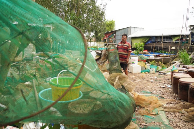
Mrs. Phung's family is mending the fishing nets they use to catch fish during the flood season. Photo: Hoang Nam
In early September, the fishing village of Tan Lap, Moc Hoa district (Long An province), with about 10 houses, was bustling with people preparing their fishing rods and nets. Sitting close to the bank of Canal 79, 49-year-old Nguyen Thi Phung used a needle to mend holes in old fish traps. Each trap costs 500,000-800,000 VND and can be used for two seasons.
Mrs. Phung's family, originally from Hong Ngu ( Dong Thap province ), lacked arable land and had to travel by boat to Long An province to seek shelter on a strip of land along the riverbank. For nearly 20 years, they have made a living by setting traps and raising snakehead and catfish. During the dry season, they set traps in the river, relying on the few months of flooding each year to improve their income.
In previous years, before the major floods, with 40 fishing nets, Mrs. Phung's family caught 50-70 kg of eels, catfish, snakehead, and crabs daily. "This year, the floodwaters are low, and the fish supply has decreased by about half," Mrs. Phung said. Every day, from 4 am, her husband and two sons have to travel more than 10 km by motorboat, but still don't have enough bait fish (small, unwanted fish), so they have to spend extra money buying industrial feed to fatten their school of over 10,000 snakehead and catfish.
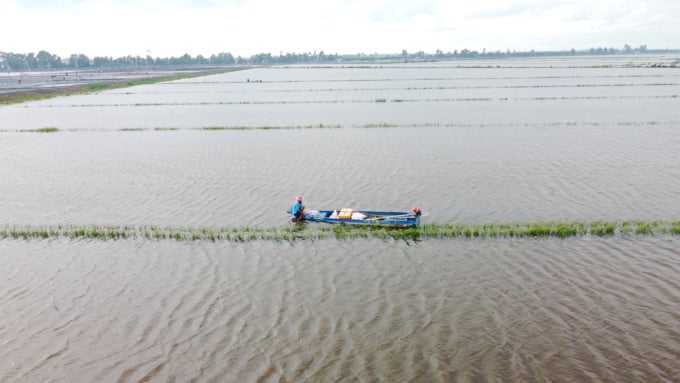
Locals use motorboats to cast fishing nets in flooded fields in Kien Tuong town, Long An province, on September 4th. Photo: Hoang Nam


One hundred kilometers away, in Hong Ngu district (Dong Thap province), many rice fields for the third crop, recently sown, are lush green. Mr. Nguyen Van Thai from Thuong Thoi Tien commune said that in previous years, the fields would have been flooded by this time. However, in recent years, the floods have been slow and often low, so he and other local people have proactively planted a third crop to improve their income.
"Each hectare of rice costs about 20 million VND in fertilizer and pesticide expenses per season. In seasons with heavy floods, thanks to the alluvial deposits that wash away pests and diseases, the cost of fertilizer and pesticides can be reduced by about 20-30%," Mr. Thai said.
In the border districts from Hong Ngu to Tan Hong, many rice fields, after harvesting, have begun to open their sluice gates to welcome the floodwaters. However, contrary to people's expectations, the fields, lacking water, are overgrown with weeds and rice stubble, becoming grazing grounds for buffaloes and cattle.
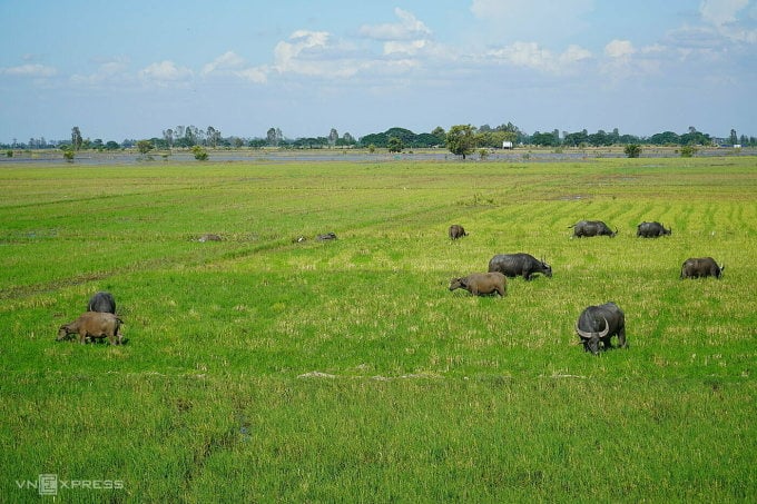
The fields in the Tan Hong border region remain dry this season, serving as grazing grounds for buffalo and cattle. Photo: Ngoc Tai
Mr. Vo Kim Thuan, Head of the Rural Development and Irrigation Sub-Department of Long An province, reported that this year's flood season is similar to previous years, but the water level is lower. By the end of August, floodwaters in the Dong Thap Muoi region ranged from 0.54 m to 1.57 m; lower than the same period last year and in 2000 and 2011 by 0.02 m to 1.69 m. In Tan Chau, the water level of the Tien River at the end of August and beginning of September was about one meter lower than the multi-year average.
Associate Professor Dr. Nguyen Nghia Hung, Deputy Director of the Southern Institute of Water Resources Science (SIWRR), stated that the 2023 flood forecast by the Institute was low, with the highest water level at Tan Chau around 3.2-3.4 m (below the first warning level), lower than the multi-year average by about 0.2-0.42 m. The flood peak occurred around the end of September or beginning of October, coinciding with the high tide period at the mouths of the Mekong River.
According to Mr. Hung, the low flood levels are partly due to the influence of El Nino, which resulted in less rainfall in the basin, with the total flood flow reaching the Kratie station (Cambodia) being approximately 360 billion cubic meters. In addition, water storage at hydropower reservoirs in the Mekong River basin (currently around 65 billion cubic meters, accounting for 13-29%) has significantly reduced the total flood flow by one level.


"The unusual flow of the Mekong River has resulted in consistently low flood levels in the western region over the past 20 years, except for 2011," Mr. Hung said.
The low water levels and early end of the flood season also mean that saltwater intrusion will come earlier this year. SIWRR advises farmers to plant their winter-spring rice crop early to avoid drought and salinity. Areas at risk of drought and salinity intrusion, such as Can Duoc and Can Guoc (Long An), Go Cong (Tien Giang), Ben Tre, Tra Vinh, and Soc Trang, should switch to dryland crops.
Ngoc Tai - Hoang Nam
Source link