
- Enjoy the scenery at Khai Long beach.
- Third Amendment to the Khai Long Wind Power Plant Project
According to legend, Khai Long is the birthplace of dragons. Many dragons were born here. Thousands of years ago, a group of adult dragons flew out and submerged themselves in Ha Long Bay, one landed in Bai Tu Long Bay, another flew into Thang Long Bay and landed in Long Bien Bay. The dragons' tails lashed, creating waves that brightly illuminated Bach Long Vi Island. Another group of dragons visited Long Xuyen, Vinh Long, Long Ho, and some stopped in places like Long An, Phuoc Long, Long Thanh, Long Binh, and Long Dat. The rest followed the Mekong River upstream, continuously stirring up the river's sediment, carrying a huge amount of silt to the East Sea, which then deposited sediment to make Ca Mau Cape a "fresh, young land!"
Over the past few years, at Khai Long beach, on the way to Ca Mau Cape, two enormous, vibrant yellow dragons have been sculpted, marking the traces of a thousand years ago, stretching out to welcome tourists from all over the country to this land and forest at the southernmost tip of Vietnam.
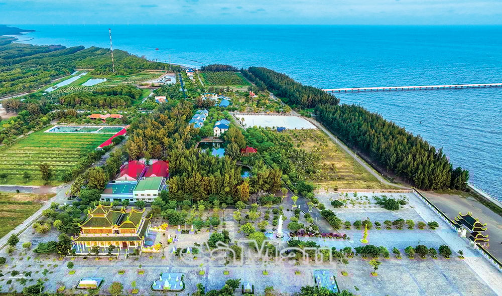
Located 130 km from Ca Mau city, Khai Long boasts an attractive tourist area situated along the mangrove ecosystem of the Ca Mau Cape World Biosphere Reserve, featuring diverse flora and fauna. Upon arriving at Ca Mau Cape, after visiting the National Landmark (GPS0001) – the southernmost point on the mainland of Vietnam and a significant geographical symbol – visitors can explore many exciting activities such as traversing pristine mangrove forests with characteristic tree species like Rhizophora apiculata, Avicennia marina, and Sonneratia caseolaris. Visitors can experience life as fishermen, paddling canoes through the mangrove forest, and engaging in activities like wading through the forest to catch shrimp, snails, crabs, and fish, and casting nets to appreciate the richness of this land.
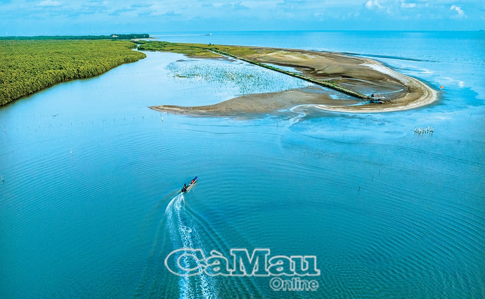
Standing on Khai Long beach, visitors can admire the pristine beauty of the majestic Hon Khoai island cluster, where communist soldier Phan Ngoc Hien and his comrades achieved victory in the Hon Khoai uprising on December 13, 1940. Here, visitors can also see the first phase of the Khai Long Tourist Area Wind Power Plant project, which received investment approval from the Prime Minister on January 14, 2016. The project covers an area of over 2,000 hectares of land and sea on the continental shelf, with a capacity of 100 MW and a total investment of over 500 billion VND.
What is particularly unique and unlike anywhere else is the saying, "the land expands and the forest moves." This is a humorous saying, but the truth is that every year, the alluvial deposits from the Southeast and Southwest ocean currents accumulate a vast sandbank at Ca Mau Cape, and the forest extends into the sea by about 100 meters. At the Ca Mau Cape Tourist Area, there is a map called "An Nam Dai Quoc Hoa Do" (Map of the Great Annam Kingdom), drawn and published in 1838 by Bishop Jean Louis Taberd. This map was printed in his Latin-Vietnamese dictionary and recorded the Hoang Sa and Truong Sa archipelagos of Vietnam (*). Visitors will understand that in the southernmost region of the country, the land and forest are constantly expanding, never remaining in their original position. In less than 200 years, from "Mui Ong Doc," now "Mui Ca Mau," its length has increased by nearly 20 km.
Along with the rest of the country, the southernmost region of Vietnam is facing a historic moment, a once-in-a-thousand-years event, as a series of large-scale projects are being implemented by the central government, opening up many new development opportunities in the coastal region of Ca Mau... Following the path of development of our ancestors, we are constructing historical projects at Khai Long beach, Dat Mui, Hon Khoai... Indeed, this is a destination that has been the aspiration of our nation for generations. Joy and excitement surge powerfully in the hearts of every Ca Mau resident and every Vietnamese person. The more we understand the past, the more steadfast our belief in a bright future.
Eastern Truong Son
(*) This is a special map, firstly because of its name. The map was made by a French bishop, but the map's title is written in three languages: Chinese, An Nam Dai Quoc Hoa Do (Vietnamese Quốc ngữ script), and Tabula Geographicaimperii Anamitici (Latin script), while all place names on the map, including those in China, Laos, and Cambodia, are written in Vietnamese Quốc ngữ script, and the legend uses both Vietnamese Quốc ngữ, Latin script, and French.
Source: https://baocamau.vn/khai-long-diem-hen-cua-khat-vong-a122097.html


![[Image] National Assembly discusses the implementation of the socio-economic development plan.](https://vphoto.vietnam.vn/thumb/1200x675/vietnam/resource/IMAGE/2026/04/20/1776696707422_ndo_br_img-20260420-185419-jpg.webp)

![[Photo] General Secretary and President To Lam meets with National Assembly delegates from ethnic minorities.](https://vphoto.vietnam.vn/thumb/1200x675/vietnam/resource/IMAGE/2026/04/20/1776696701056_a1-bnd-8331-3342-jpg.webp)

![[PHOTO] The most beautiful sidewalks in Saigon that captivate people, captured with smartphones.](https://vphoto.vietnam.vn/thumb/402x226/vietnam/resource/IMAGE/2026/04/21/1776707735189_anh14_rlcz.jpeg)


Comment (0)