
2 PM:
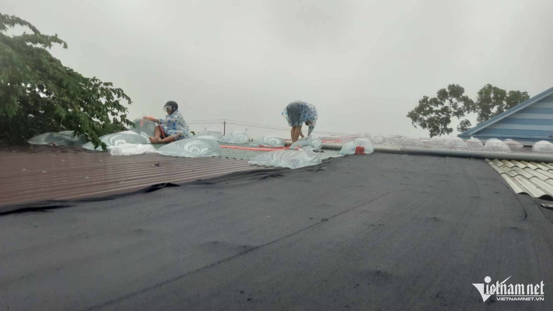
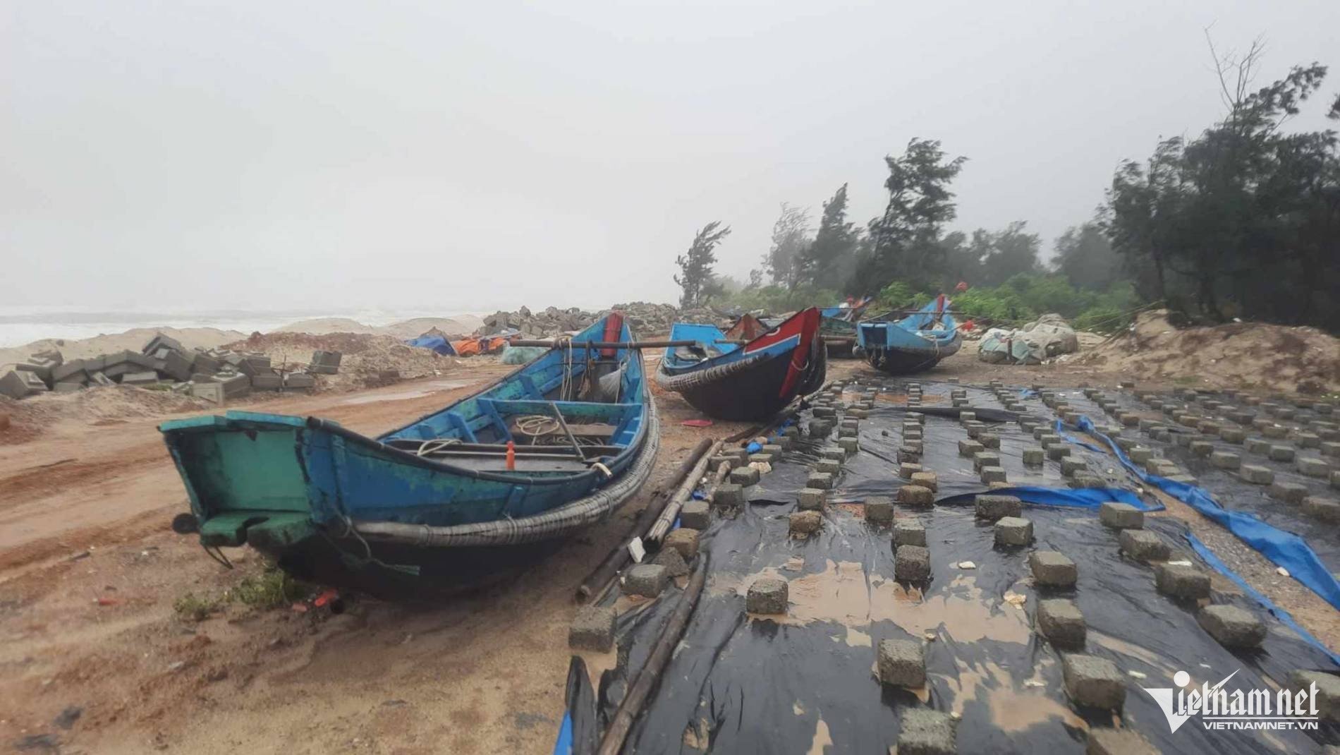
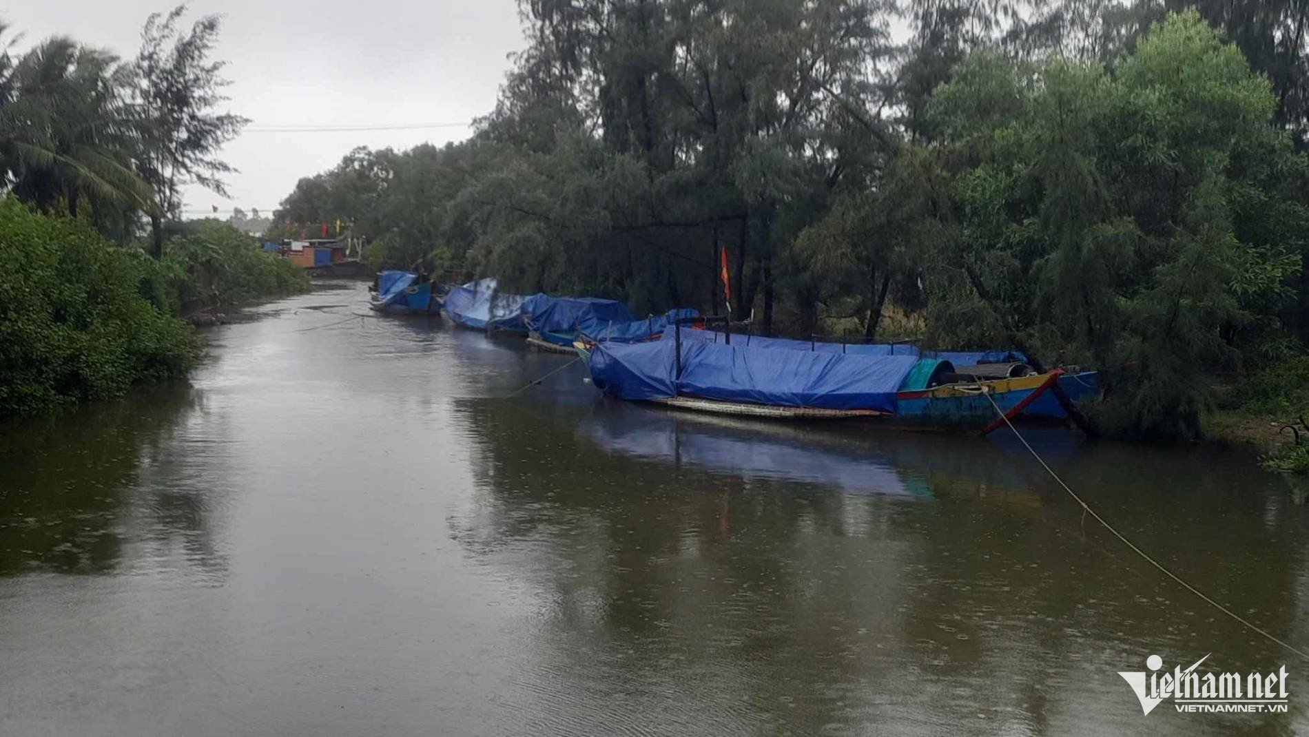
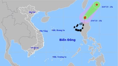
At 2 PM, the center of the weakened tropical depression from Typhoon No. 4 was located at approximately 16.9 degrees North latitude and 106.9 degrees East longitude, over the land of Quang Binh and Quang Tri provinces. Maximum wind speed: Level 7 (50-61 km/h), gusts up to level 10.
The forecast for the next 3 hours is that the tropical depression will move in a west-southwest direction at a speed of approximately 15-20 km/h.
Images of the storm in Quang Tri:

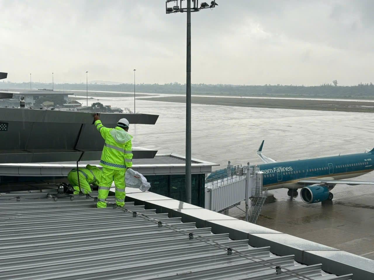
Airports respond to storms.
Central Vietnam airports such as Phu Bai, Da Nang, Dong Hoi, and Chu Lai airports have implemented preventive measures to ensure the safety of operations and protect airport infrastructure.
Rescue and relief equipment and flood response teams have also been mobilized and are on duty 24/7, closely monitoring the storm's developments to deal with any emergency situations. Airports have also prepared evacuation plans and passenger assistance in case of prolonged bad weather.
Source: https://vietnamnet.vn/bao-so-4-do-bo-quang-binh-quang-tri-2323873.html
![[Photo] My Son at night: A thousand-year-old heritage site amidst the Milky Way](https://vphoto.vietnam.vn/thumb/1200x675/vietnam/resource/IMAGE/2026/04/15/1776261039184_ndo_br_chon6-jpg.webp)


![[Photo] Mrs. Ngo Phuong Ly meets and exchanges views with Mrs. Peng Li Yuan](https://vphoto.vietnam.vn/thumb/1200x675/vietnam/resource/IMAGE/2026/04/16/1776277858080_phu-nhan-1-jpg.webp)
![[Photo] National Assembly Chairman Tran Thanh Man attends the opening session of IPU-152](https://vphoto.vietnam.vn/thumb/1200x675/vietnam/resource/IMAGE/2026/04/16/1776277863731_ctqh5-jpg.webp)
![[Photo] The General Secretary, President and his wife meet with Vietnamese-Chinese friendship leaders.](https://vphoto.vietnam.vn/thumb/1200x675/vietnam/resource/IMAGE/2026/04/15/1776264829725_vna-potal-tong-bi-thu-chu-tich-nuoc-to-lam-gap-mat-nhan-sy-huu-nghi-viet-nam-trung-quoc-8703641-3130-jpg.webp)


Comment (0)