On the afternoon of July 25th, the National Center for Meteorological and Hydrological Forecasting announced that Typhoon No. 4 (Comay) had moved out of the East Sea and reached the waters north of Luzon Island (Philippines). This typhoon only reached level 8-9, continuing to move in a North-Northeast direction at a speed of approximately 20-25 km/hour and is unlikely to return to the East Sea.
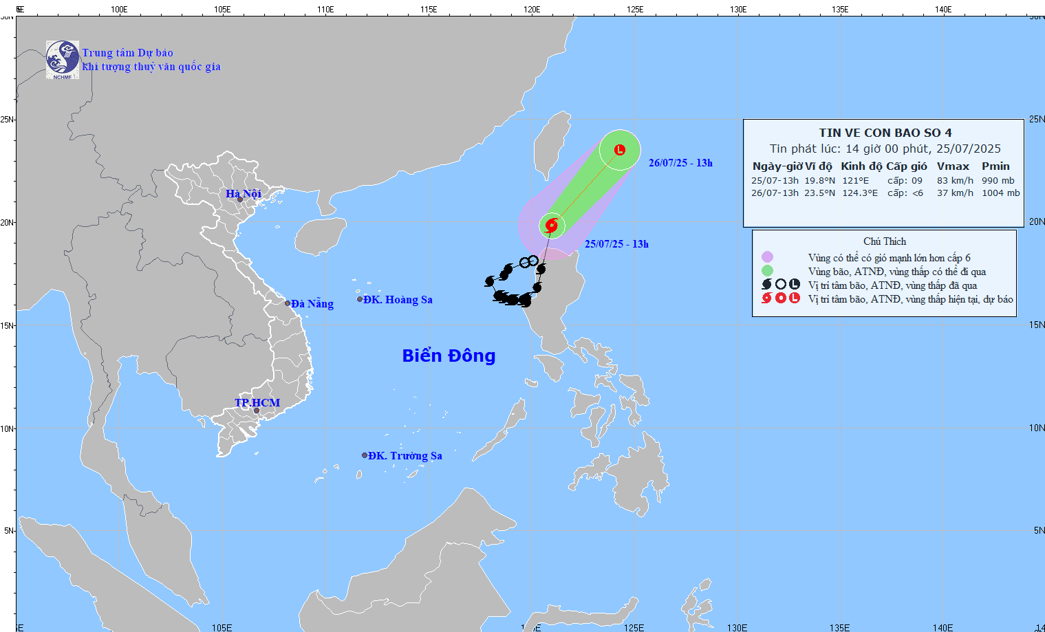
The location of Typhoon No. 4 on the afternoon of July 25th, according to the National Center for Meteorological and Hydrological Forecasting.
However, according to Deputy Minister of Agriculture and Environment Nguyen Hoang Hiep, the ENSO phenomenon (a climate phenomenon affecting global weather through changes in sea surface temperature in the central Pacific Ocean) will remain in a neutral state with a 70-90% probability from now until October 2025 and continue in this state with a 50-60% probability until January 2026.
According to long-term forecast data from the National Center for Meteorological and Hydrological Forecasting, Deputy Minister Nguyen Hoang Hiep stated that from now until the end of 2025, the East Sea still has the potential for 8-11 typhoons and tropical depressions. Of these, about 3-5 could directly affect the Vietnamese mainland.
The period from August to October is considered the peak of the typhoon season, with 6-8 typhoon types active in the East Sea, of which 2-3 may make landfall. November-December may see an additional 2-3 typhoons or tropical depressions, of which 1-2 will directly affect the mainland of Vietnam.
According to the Ministry of Agriculture and Environment, natural disasters have caused 114 deaths and 553 billion VND in damage since the beginning of the year.
ANGEL
Source: https://www.sggp.org.vn/bao-so-4-da-thoat-ra-khoi-bien-dong-khong-quay-lai-post805435.html


![[Photo] General Secretary and President To Lam presides over a meeting on preparations for the review of one year of operation of the three-tiered government system.](https://vphoto.vietnam.vn/thumb/1200x675/vietnam/resource/IMAGE/2026/06/02/1780391821195_a1-bnd-4595-9717-jpg.webp)


Comment (0)