
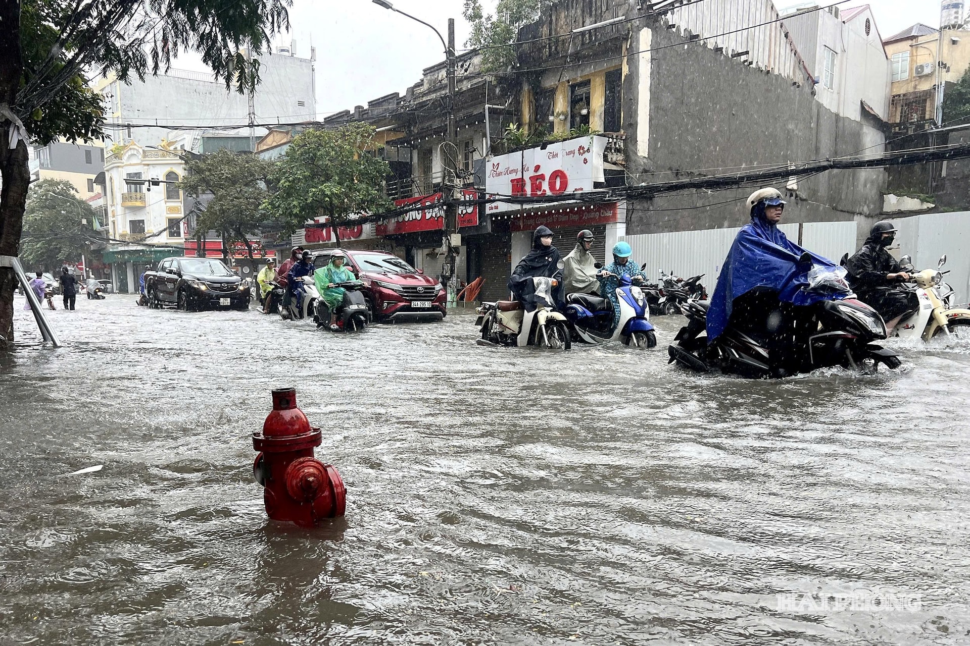
Every rainy season, the issue of urban flooding resurfaces. Just a few heavy rains coinciding with high tides can cause localized flooding on many central city streets such as Cau Dat, Le Loi, Lach Tray, To Hieu, Luong Khanh Thien, etc., affecting traffic, daily life, and business activities.
Localized flooding is caused not only by heavy rainfall but also by a combination of factors. These include low-lying terrain, the impact of rising sea levels, rapid urbanization reducing natural water infiltration capacity, and the deterioration of drainage systems in many areas due to their construction decades ago.
Notably, scientific forecasts indicate that pressure on Hai Phong will continue to increase in the coming decades. According to studies by the Institute of Meteorology, Hydrology, Environment and Marine Sciences, by the middle of the 21st century, sea levels in the Hai Phong area could rise by approximately 19.7 cm, or even 24.3 cm if land subsidence is taken into account.
By the end of the century, under a high-emission scenario, sea levels could rise by approximately 50.7 cm, or up to 59.4 cm when combined with geological subsidence.
In particular, if sea level rise, high tides, storm surges, and large waves occur simultaneously, extreme water levels can put immense pressure on the city's sea dike system and coastal infrastructure.
Meanwhile, monitoring data also shows that sea levels in Hai Phong have risen by approximately 4.8 mm per year between 1993 and 2023. High tides are constantly occurring, while rainfall tends to be concentrated over shorter periods. Even a single rainfall of around 100-150 mm coinciding with a high tide can overload the drainage system, causing widespread flooding.
These warnings indicate that flood control is no longer just a matter of dealing with problems after each rainstorm, but must become a long-term urban development strategy.
In the context of increasingly extreme climate change, traditional flood control methods, which focus only on expanding sluices, dredging canals, or installing more pumping stations, will hardly be able to meet long-term development requirements.


That is also why the recent scientific conference "Applying technology to urban planning to prevent and mitigate flooding and the impacts of climate change in Hai Phong city" received great attention from managers and scientists.
The highlight of the workshop was not the identification of "flood-prone areas," but rather a completely new approach to urban planning. Instead of addressing individual buildings, experts unanimously agreed on the need to build resilient cities that can adapt to climate change right from the spatial planning, infrastructure development, and urban governance stages.
This direction was also emphasized by the city's Department of Construction leaders in their opening remarks at the workshop, stating that planning must be one step ahead, fully integrating elements of disaster risk management, flood management, and climate change adaptation.
The good news is that Hai Phong is not choosing the old approach, but is boldly seeking new solutions based on digital transformation and the achievements of the Fourth Industrial Revolution.
For the first time, many technologies such as Digital Twin, artificial intelligence (AI), Internet of Things (IoT), Geographic Information Systems (GIS), and Big Data are being discussed as tools to directly support urban flood planning and management.
If implemented comprehensively, these platforms will allow for the simulation of the entire drainage infrastructure system, predicting flooding patterns based on rainfall events and tidal cycles, and supporting management agencies in making faster and more accurate decisions.
Along with digital transformation, experts also suggest that Hai Phong needs to change its approach to infrastructure development towards harmony with nature. Instead of just expanding the underground drainage system, it is necessary to simultaneously develop "green infrastructure" solutions such as: regulating lakes, wetland parks, rain gardens, permeable road surfaces, preserving natural water storage areas, and restoring riverside and coastal ecosystems.
Furthermore, the "sponge city" model has proven effective in many countries and is considered by urban planning and geological experts to be suitable for Hai Phong's conditions in the long term.
From a management perspective, it is noteworthy that the city is not only researching technology but is also gradually integrating flood control solutions into its master plan, ground elevation planning, surface drainage, and technical infrastructure development. This is a necessary step to ensure that all new development projects take into account scenarios of climate change, sea level rise, and extreme weather events.


However, the journey from idea to practice is a long one. Investing in monitoring systems, shared databases, digital city replicas, or comprehensively upgrading drainage infrastructure requires enormous resources. But any delay will result in a much higher price to pay as climate change continues to unfold unpredictably, while the pace of urbanization accelerates.
Hai Phong is accelerating its efforts to become a modern industrial city, a national logistics and maritime economic hub. This requires urban infrastructure that is resilient to the new challenges of climate change.
Therefore, proactively seeking solutions to the flood control problem reflects the city's modern governance mindset. It also reflects the expectations of the city's residents for concrete flood control solutions, which will soon be realized through smart infrastructure projects and management platforms.
NGUYEN DUONGSource: https://baohaiphong.vn/chong-ngap-do-thi-bang-tu-duy-moi-546396.html


