
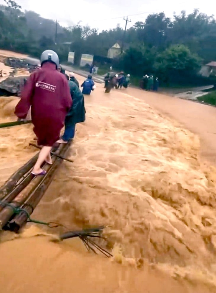
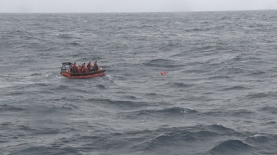
The group of teachers crossed the floodwaters on a temporary bridge - Screenshot from a video clip.
On November 3rd, a video circulated on social media showing a group of people crossing a makeshift bridge constructed from four wooden logs, with a muddy, fast-flowing floodwater below. This image went viral, highlighting the devastating impact of the natural disaster. Many people expressed concern about the danger the group might face if something unfortunate were to happen.
After crossing the temporary bridge, the group was assisted by local forces and guided to safety.
Later that same day, Ms. Thai Thi Nga, Chairwoman of the People's Committee of Khe Sanh commune ( Quang Tri province ), confirmed that the image was taken at the overflow bridge in Van Ri village.
The video shows a group of teachers stationed in a remote village. Due to heavy rain, the area was cut off, and students were given time off from school. They braved the floods to return home, fearing that the heavy rain might continue for several days.
By the afternoon of the same day, the Van Ri bridge was completely submerged, cutting off traffic. Ms. Nga reported that the commune's police force had set up checkpoints, preventing people and vehicles from crossing.
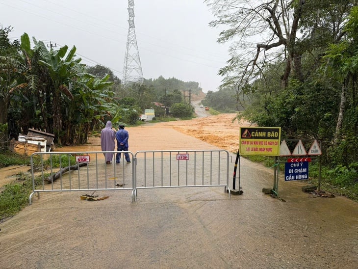
Police officers from Khe Sanh commune set up a checkpoint at Van Ri bridge that afternoon - Photo: TTN
Besides Khe Sanh commune, heavy rains have also caused flooding and disruption to many communes and national highways in Quang Tri province.
According to the Quang Tri Provincial Civil Defense Command, there are currently over 136 flooded areas throughout the province; more than 3,763 households with nearly 12,000 people are affected by flooding; and 127 flooded areas include culverts in mountainous regions and inter-communal and village roads.
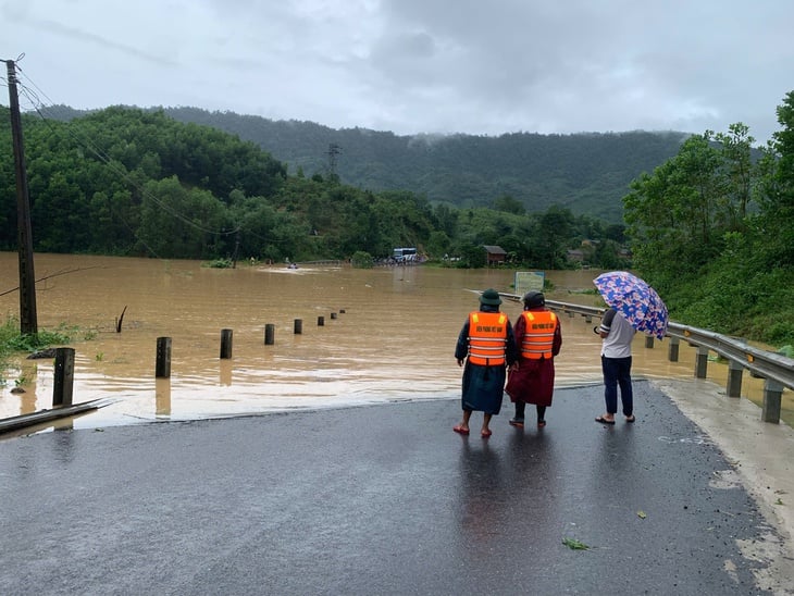
At kilometer 23 of the western branch of the Ho Chi Minh Highway, passing through Dakrong commune, traffic was cut off, with water levels exceeding 0.5 meters for over 500 meters.
Quang Tri traffic police also warned of landslide areas and high risk of landslides from km42 to km56 of National Highway 9, in Dakrong commune; km277, km287+500, km295+800 of the western branch of the Ho Chi Minh Highway, in Ta Rut commune; km302+100, km304+200 of the western branch of the Ho Chi Minh Highway, in La Lay commune…
The western branch of the Ho Chi Minh Highway is flooded and cut off - Photo: DUY THÁNH
Source: https://tuoitre.vn/giao-vien-cam-ban-vuot-lu-บน-cau-tam-tu-4-cay-go-20251103152756537.htm


Comment (0)