
08:43, 10/09/2023
That Son (or Bay Nui) is the name given to the semi-mountainous region located in the two districts of Tri Ton and Tinh Bien, near the southwestern border of An Giang province.
In fact, this area has over 40 mountains of varying sizes scattered throughout, but only seven representative mountains are used as the common name. These mountains are: Thien Cam Son (Cam Mountain), Ngoa Long Son (Dai Lon Mountain), Ngu Ho Son (Dai Nam Gieng Mountain), Phuong Hoang Son (Co To Mountain), Thuy Dai Son (Nuoc Mountain), Anh Vu Son (Ket Mountain), and Lien Hoa Son (Tuong Mountain). Among them, Ngoa Long Son is the written name of Dai Lon Mountain, which is approximately 8,000 meters long and 580 meters high, located in the three communes of Chau Lang, Luong Phi, and Le Tri, and the town of Ba Chuc in Tri Ton district.
Recently, we took a trip to Tri Ton to conquer and explore Ngoa Long Son – the longest mountain range of the legendary That Son Mountains. From Ba Chuc town, we went to O Sinh ("O" in Khmer means stream) and up Dai Mountain. The steep, winding mountain trail, paved with concrete, was only wide enough for two cars to pass each other. The scenery of the pristine mountain forest was stunning, with lush green trees. Along the way, there were sections densely covered with bamboo forests, sections full of ancient mango trees, and stretches of dark, dense golden wattle trees.
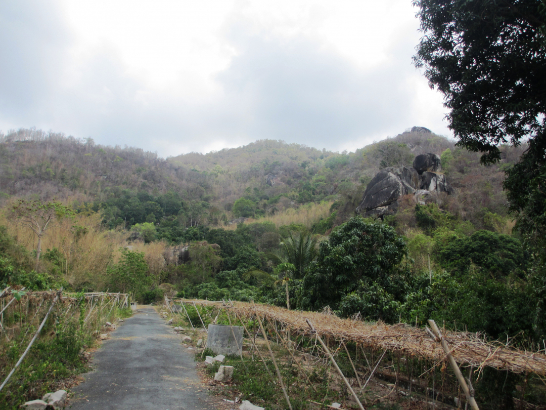 |
| Ngoa Long Son. |
About 4 km from O Sinh is O Vang. This is a gathering point for agricultural products from local farmers who are then transported to other places. The produce is abundant and diverse, including mangoes, jackfruit, bananas, star apples, persimmons, tamarind, and fresh vegetables. At the foot of O Vang are the Vang Stream and the Bac Stream. In the past, there was a small amount of gold dust mixed in the sand here, but today it is no longer there, only the place names remain. The water of the Vang and Bac Streams flows gently in the dry season and rushes and surges during the rainy season.
Leaving O Sinh and O Vang, we headed west towards Dai Mountain to visit the O Ta Soc historical site in An Ninh hamlet, Luong Phi commune, Tri Ton district. Along the small paved road to the former battlefield, both sides were lined with pristine bamboo forests, layer upon layer. A few houses of the Khmer ethnic minority people could be seen nestled among the lush gardens. O Ta Soc is a wild mountainous area located on the Sa Lon peak of Dai Mountain. The scenery along the road is wild and picturesque. Visitors will encounter small streams with crystal-clear water trickling through the rocks. Interspersed among the rocks and wild forest trees are surprisingly lush green mango, cashew, jackfruit, and banana trees.
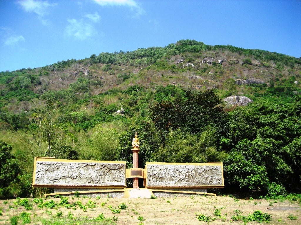 |
| Ma Thien Lanh - O Ta Soc historical site. |
During the war against the Americans, the An Giang Provincial Party Committee's base was located in O Ta Soc. Dien Troi Gam served as the command headquarters; various agencies and organizations were scattered throughout a system of interconnected caves with a radius of nearly 3 km. The caves in O Ta Soc were very sturdy and could accommodate many people. Visiting Dien Troi Gam, Phu Nu Cave, Quan Y Cave, Hau Can Cave, etc., everyone was amazed by the grandeur of nature, the enormous granite blocks (Jurassic period) piled on top of each other, intertwined like a mysterious labyrinth!
Visiting Ma Thien Lanh Hill, tourists will hear the touching story of the soldiers who sacrificed their lives in the cave. Ma Thien Lanh is a rocky hill with only one road leading up from the west. In 1969, enemy planes bombed and sealed the cave entrance, trapping seven soldiers of the 61st Regiment, the main force of the Southern Region. Initially, the unit supplied food by using bamboo tubes to deliver milk and thin porridge into the cave. A few days later, the enemy launched a fierce attack, forcing the unit to retreat to the U Minh forest. Those seven soldiers remained forever in the cave… Thirty-eight years later, on June 14, 2007, the An Giang Provincial Military Command proceeded to break open the Ma Thien Lanh cave entrance to find the remains of the seven martyrs. Currently, a memorial plaque for the martyrs has been erected at the entrance of Ma Thien Lanh cave. From the top of Ma Thien Lanh, one can observe a vast area from O Ta Soc, through Xom Moi hamlet, up to Xom Thung hamlet of Luong Phi commune. Scattered across the hills are many ancient trees such as crape myrtle, star anise, oil palm, forest fig, mountain fig… and numerous climbing plants clinging tightly to the mountain rocks.
Visiting That Son, exploring Ngoa Long Son, climbing O Sinh and O Vang, visiting O Ta Soc - Ma Thien Lan to see the old battlefield, exploring the caves, strolling around, and visiting the villages of the Khmer ethnic minority will leave you with many unforgettable impressions!
Dang Hoang Tham
Source


![[Photo] High-altitude schools proactively take measures to protect students from the cold.](/_next/image?url=https%3A%2F%2Fvphoto.vietnam.vn%2Fthumb%2F1200x675%2Fvietnam%2Fresource%2FIMAGE%2F2026%2F01%2F08%2F1767883787301_a34-9332-jpg.webp&w=3840&q=75)
![[Photo] Prime Minister Pham Minh Chinh attends the ceremony commemorating the 80th anniversary of the establishment of May 10 Garment Corporation.](/_next/image?url=https%3A%2F%2Fvphoto.vietnam.vn%2Fthumb%2F1200x675%2Fvietnam%2Fresource%2FIMAGE%2F2026%2F01%2F08%2F1767888283715_ndo_br_tttrao-jpg.webp&w=3840&q=75)

![[Photo] High-altitude schools proactively take measures to protect students from the cold.](https://vphoto.vietnam.vn/thumb/402x226/vietnam/resource/IMAGE/2026/01/08/1767883787301_a34-9332-jpg.webp)


![[Infographics] Implementation Plan of the National Program on Energy Saving and Efficiency in Can Tho City in 2026](https://vphoto.vietnam.vn/thumb/402x226/vietnam/resource/IMAGE/2026/01/09/1767917992356_1767917621.webp)


Comment (0)