"The link" in inter-district regional development.
Việt Nam•14/03/2024
Seamless Eastern regional link strip
Vo Chi Cong Road – coastal corridor
The eastern region of the province has been identified as the driving force for the province's development. According to the Provincial Planning for the period 2021-2030, with a vision to 2050, the eastern region will comprise coastal plain districts, towns, and cities, with a focus on marine economy, industry, trade, services, and tourism. This will be the area concentrating major urban centers and administrative and political hubs that will be crucial to the province's development.
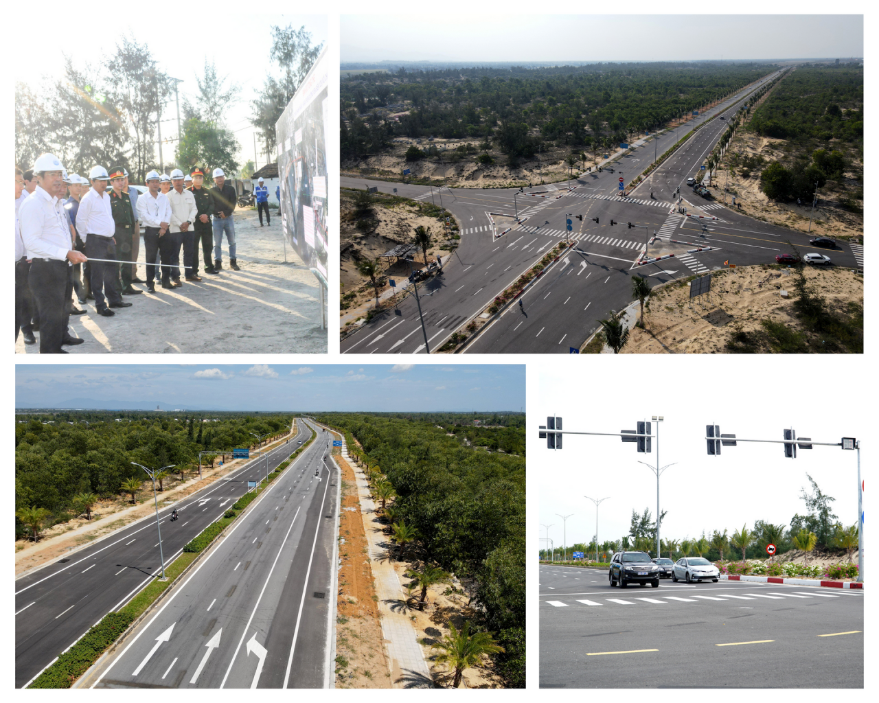
With its planning closely aligned with the sea and the Co Co and Truong Giang rivers flowing north-south, the eastern region is undergoing a strong transformation. A notable example is the investment in key transportation projects connecting the region and inter-regions. Among these is the 69km stretch of the Vo Chi Cong coastal road through Quang Nam province, running from Hoi An city to Chu Lai airport.
In March 2022, this route was fully connected from Cua Dai Bridge to Chu Lai Airport. By September 2023, the dual carriageway from Cua Dai Bridge to the intersection with National Highway 40B (Tam Phu commune, Tam Ky) was completed according to the plan. And in early January 2024, Component Project 1, completing the Vo Chi Cong road with a length of 26.5km passing through Tam Phu commune (Tam Ky city) and the communes of Tam Tien, Tam Hoa, Tam Hiep, Nui Thanh town, Tam Giang, Tam Nghia, Tam Quang (Nui Thanh district), officially commenced construction, and is expected to be completed in 2025.
The Vo Chi Cong coastal road plays a crucial role in the development of the eastern region of the province. Photo: QT
This is not only a vital transportation route for coastal localities, but also connects the inter-regional areas between Da Nang , Quang Nam, and Dung Quat Industrial Park (Quang Ngai). Mr. Nguyen Tri An – Secretary of the Nui Thanh District Party Committee – believes this is the most beautiful road in the province and plays an important role in the development of infrastructure in the eastern region.
"
Before the Vo Chi Cong road was built, people's lives and transportation were very difficult. Recently, although the road is only partially completed, the appearance of Nui Thanh has changed rapidly, and people's lives have begun to develop. Trade with other localities has become more convenient.
Mr. Nguyen Tri An - Secretary of the Nui Thanh District Party Committee
[ VIDEO ] - The appearance of Vo Chi Cong road today:
Driving projects
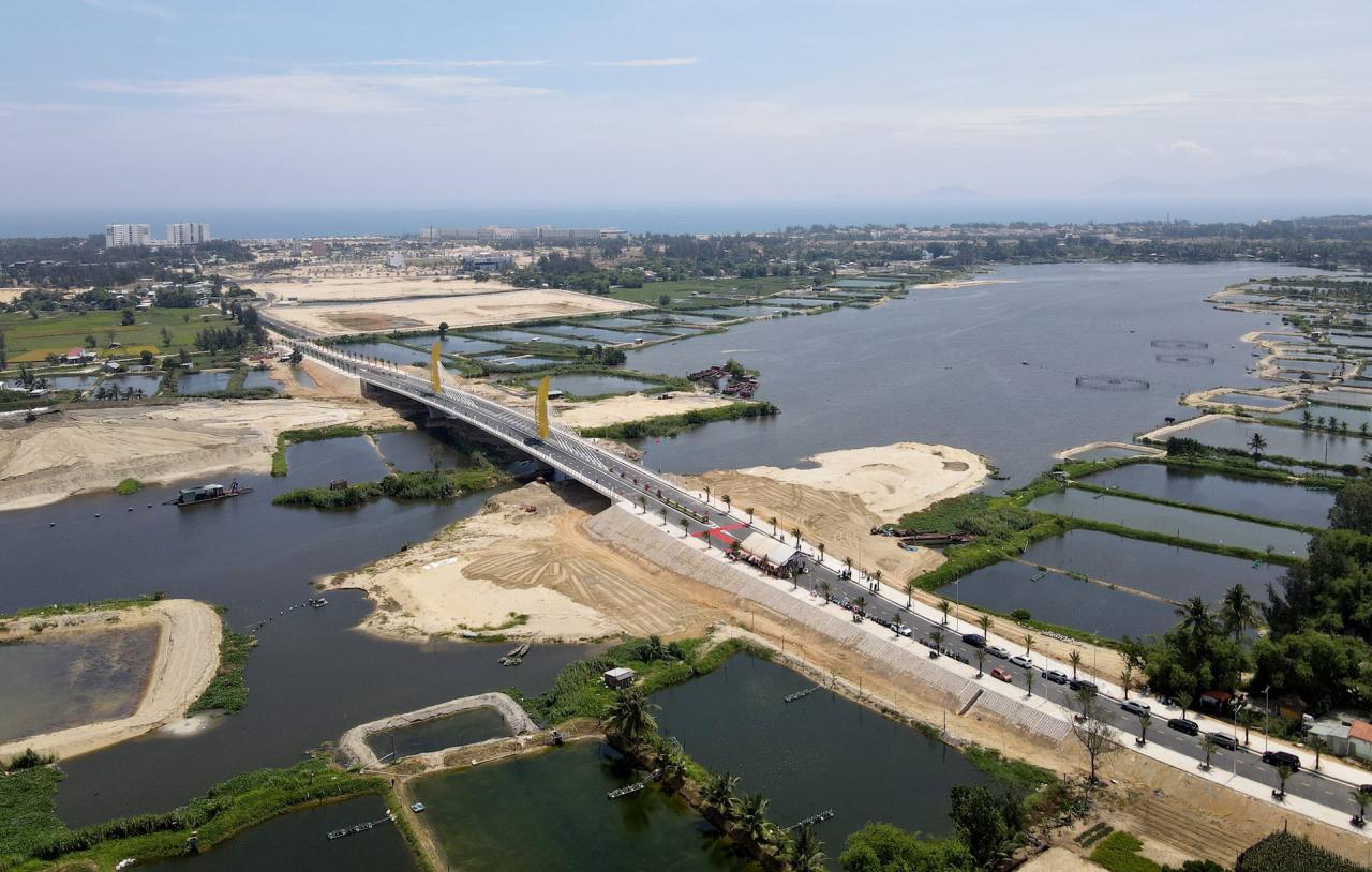
Besides the Vo Chi Cong coastal road, the development of the eastern region is significantly influenced by the Co Co, Truong Giang, and lower Thu Bon river systems. Key projects currently underway and those planned for the future, such as the Co Co River dredging and flood control project and the Truong Giang River dredging project, will boost waterway transportation, foster urban development, promote riverside and coastal tourism, and effectively address climate change.
Ong Dien Bridge spans the Co Co River. Photo: QT
The Co Co River connects Hoi An City and Dien Ban town with Da Nang City. The dredging of the entire route will create new urban development stretching from Da Nang to Hoi An. In 2022, Quang Nam province inaugurated the Ong Dien Bridge across the Co Co River, connecting Hoi An City and Dien Ban town. Several other bridges across this river are currently under construction.
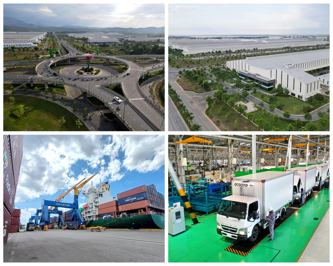
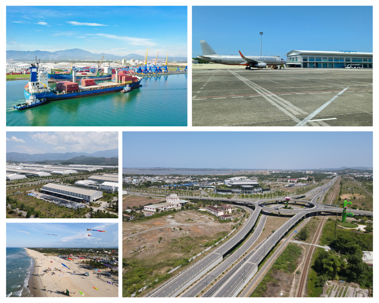
Chu Lai Open Economic Zone. Photo: QT
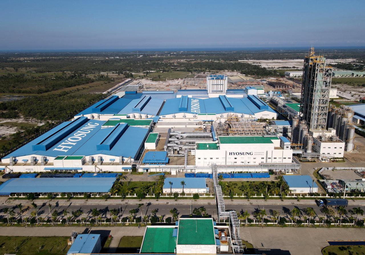
Along with transportation infrastructure, tourism and industrial park projects in the eastern region have been and are being implemented. Typical examples include the Nam Hoi An Resort, the Vinpearl Nam Hoi An complex, and many industrial projects in the Chu Lai Open Economic Zone and the Tam Thang Industrial Park.
Hyosung Group at Tam Thang Industrial Park. Photo: QT
Mr. Park Chan, General Director of Hyosung Company in Tam Thang Industrial Park, said that the gradual investment in industrial park infrastructure has facilitated the production and circulation of goods for businesses.
[VIDEO] - Chu Lai Open Economic Zone plays an important role in the socio-economic development of the province:
Opening the way to the West
East-West connecting axis
According to the provincial plan, the Western region, comprising the mountainous districts of the province, is designated as a conservation area for natural forest ecosystems, a national source of forest products and medicinal herbs, and a region for developing horticultural and farm-based economies, livestock farming, hydropower, and mineral exploitation.
Kham Duc town (Phuoc Son). Photo: QT Thach My town (Nam Giang). Photo: QT
The towns of Kham Duc (Phuoc Son) and Thanh My (Nam Giang) are transitional urban areas, connecting and facilitating development between the Quang Nam province delta region and Da Nang city with the Central Highlands and countries along the East-West Economic Corridor.
To create momentum for the development of this region, investment will be made in connecting the East and West regions, linking the airport and seaport with the Nam Giang International Border Gate and the Central Highlands, as well as countries in the region. The provincial plan includes upgrading and expanding routes 14D, 14B, 14G, 14H, 40B, 24C and completing the North-South corridor.
National Highway 14D. Photo: QT National Highway 14G. Photo: QT National Highway 14B. Photo: QT National Highway 14H. Photo: QT
According to Mr. Van Anh Tuan, Director of the Department of Transport, these horizontal arterial routes play an extremely important role, but most have not yet reached the planned scale. In particular, National Highways 14G and 14D, constructed from 2004 to the present, have deteriorated and have not been upgraded or repaired, failing to meet transportation needs. National Highway 14H still has many weak bridge structures. The road surface of National Highway 40B, the section passing through Nam Tra My, is deteriorating.
Mr. Tuan stated that the Department of Transport will advise the Provincial People's Committee to continue requesting the Central Government to allocate investment capital for key transport projects and works in the province. This will focus on expanding National Highways 14D and 14G. Simultaneously, they will review and select transport projects according to the provincial plan until 2030 to propose to the Provincial People's Council for investment capital allocation during the 2026-2030 period.
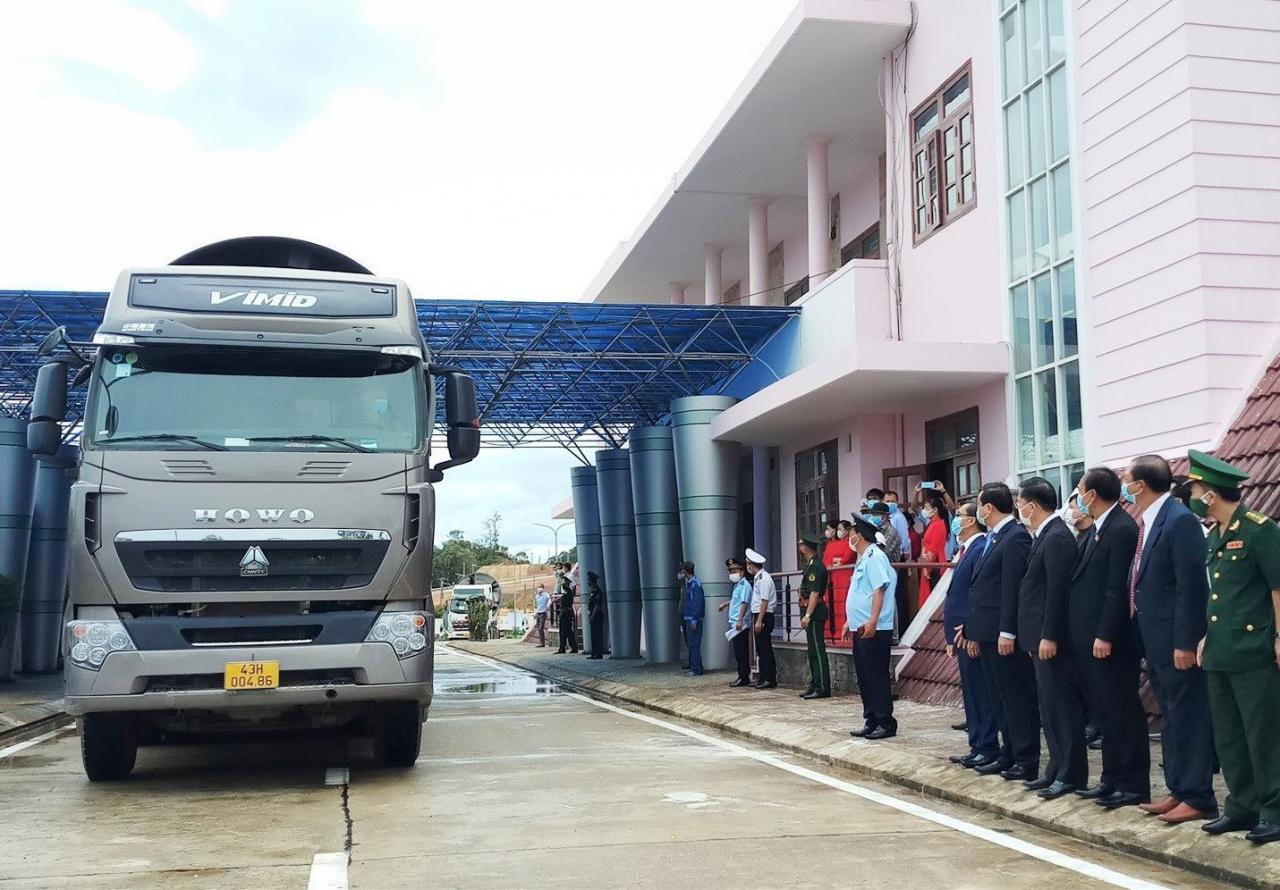
Nam Giang International Border Gate. Photo: QT
Along with the east-west development axis, the corridor along the Eastern Truong Son mountain range and the Ho Chi Minh Highway also plays a crucial role in the development of the western region. In the provincial planning, this corridor will focus on the development of hydropower, mining and mineral processing, agriculture, and forestry; serving as a gateway for trade with the Central Highlands provinces and Thua Thien Hue province.
Launch key projects
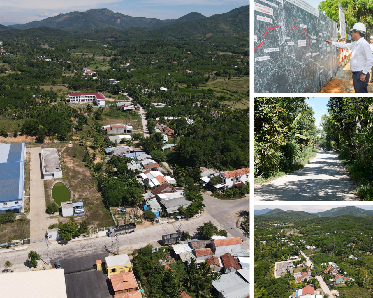
Currently, the Ministry of Transport is implementing two infrastructure projects related to the east-west axis: the construction of two bridges on National Highway 40B; and the expansion and upgrading of National Highway 14E. National Highway 14E has a total length of approximately 90km. Recently, the section from Km0 to Km15 has been upgraded. In 2023, the Ministry of Transport commenced the project to upgrade and renovate the remaining section of the highway, from Km15+270 to Km89+700, a length of 74km passing through three districts: Phuoc Son, Thang Binh, and Hiep Duc.
National Highway 14E, the section passing through Thang Binh and Hiep Duc districts, is under construction. Photo: QT
Minister of Transport Nguyen Van Thang stated that National Highway 14E is an important road transport corridor, serving the travel and transportation of goods from the Chu Lai Open Economic Zone and the Dung Quat Economic Zone to Laos via the Nam Giang international border gate and vice versa.
[VIDEO] - Bustling activity at the construction site of National Highway 14E:
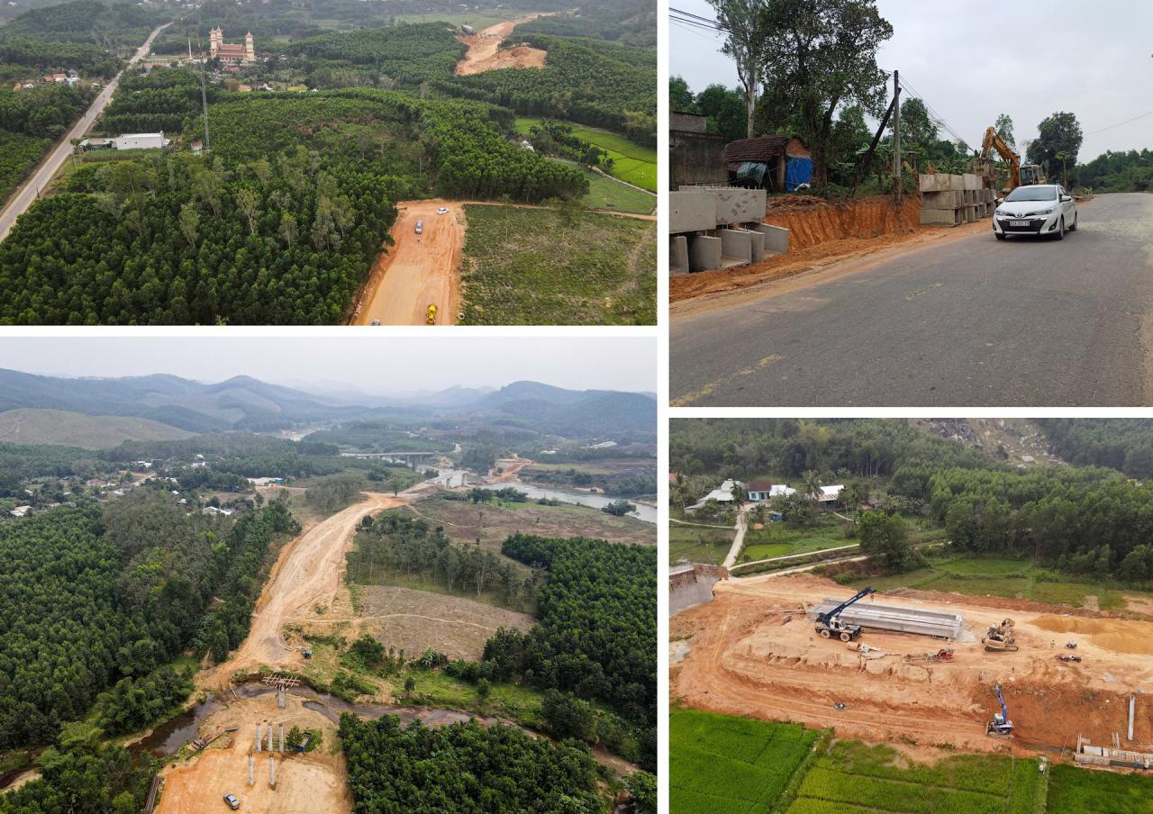
Along with projects implemented by the Ministry of Transport, Quang Nam also focuses on investing in several inter-regional projects, connecting with national highways leading to the western region. A notable example is the Central Region Linkage Project, passing through five localities: Thang Binh, Tam Ky, Phu Ninh, Tien Phuoc, and Bac Tra My, with a total length of over 31.8 km.
Upon completion, the project will contribute to the completion of the transportation network connecting the Central region and the Central Highlands provinces, through the Bo Y international border gate to Laos, providing seamless connectivity with Ky Ha seaport, Chu Lai international airport, Chu Lai Open Economic Zone, and Dung Quat Economic Zone.
The regional connectivity project section passing through Tien Phuoc district is currently under construction. Photo: QT
According to Vice Chairman of the Provincial People's Committee Nguyen Hong Quang, after the project is completed, together with the completed National Highway 40B upgrade project, it will form a dynamic axis connecting the east and west in the southern part of the province.
[VIDEO] -Provincial Party Secretary Luong Nguyen Minh Triet inspects the progress of the Central Region Linkage Road project.
Boosting the performance of the two powertrains.
One of the highlights in Quang Nam province's planning for the period 2021-2033, with a vision to 2050, is the formation of two dynamic clusters, playing a crucial role in the development of the northern and southern poles of the province.
Completing the infrastructure framework in the North.
The northern economic cluster includes the localities of Dien Ban - Hoi An - Dai Loc. This area will connect with the economic spaces of Da Nang City. Simultaneously, it will form a chain of riverside and coastal urban areas via road networks and the Vu Gia, Thu Bon, and Co Co river systems; developing a tourism corridor based on waterway transportation.
Provincial Road DT603B connects Hoi An and Dien Ban. Photo: QT
As the center of the dynamic cluster, transportation infrastructure connecting Dien Ban town with Hoi An and Dai Loc cities is receiving focused investment and improvement. Dien Ban town will serve as an expansion to the north of the ancient city of Hoi An. These two localities possess numerous advantages for inter-regional connectivity, such as coastal roads, roads along the Co Co River, and major arterial routes like DT607, DT603B, and DT608…
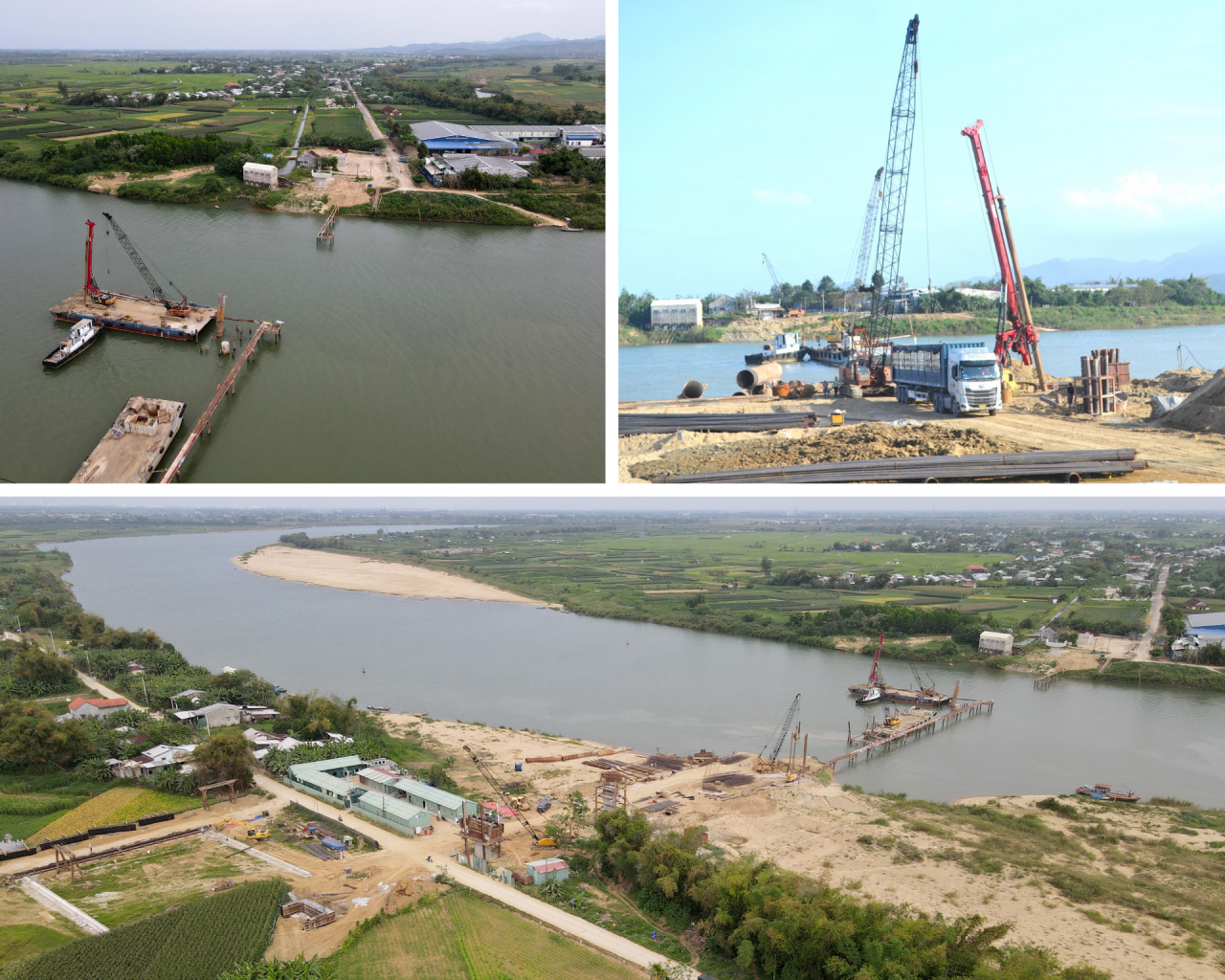
The Van Ly bridge and access road project will create a breakthrough in connecting the two districts of Dai Loc and Dien Ban. Photo: QT
Meanwhile, the main link between Dien Ban and Dai Loc has long been the DT609 road connecting Vinh Dien ward (Dien Ban) to Ai Nghia town and the western communes of Dai Loc. A new turning point for the connection between these two localities is the Van Ly bridge and access road project, which commenced in 2023. The project will contribute to completing the northern transportation infrastructure system, connecting the two banks of the Thu Bon River.
Mr. Le Do Tuan Khuong, Vice Chairman of the People's Committee of Dai Loc district, said that the Van Ly bridge and access road project, along with the connecting road from National Highway 14H to 14B, including the Song Thu bridge over the Thu Bon river and the An Binh bridge over the Vu Gia river, are under construction. The DT609B road through Giao Thuy bridge and other national and provincial roads in the region have been fully invested in, contributing to the formation of the district's infrastructure framework.
"
In our regional planning for Dai Loc district, we have integrated the transportation infrastructure framework to create a foundation for the development of local industry, services, and tourism to a new level.
Mr. Le Do Tuan Khuong - Vice Chairman of the People's Committee of Dai Loc District
[VIDEO] - Mr. Le Do Tuan Khuong - Vice Chairman of the People's Committee of Dai Loc District, assesses the role of regional linkage projects being implemented in the locality:
The synchronized infrastructure in the north is raising expectations for improving the quality of the Dien Nam - Dien Ngoc Industrial Park and other industrial clusters in Dien Ban. Simultaneously, it aims to adjust industrial clusters along National Highway 14B towards connectivity and expansion into industrial parks with synchronized infrastructure and a guaranteed environment.
[VIDEO] - The Van Ly bridge and access road project is being constructed urgently:
Focus resources on the city of Tam Ky.
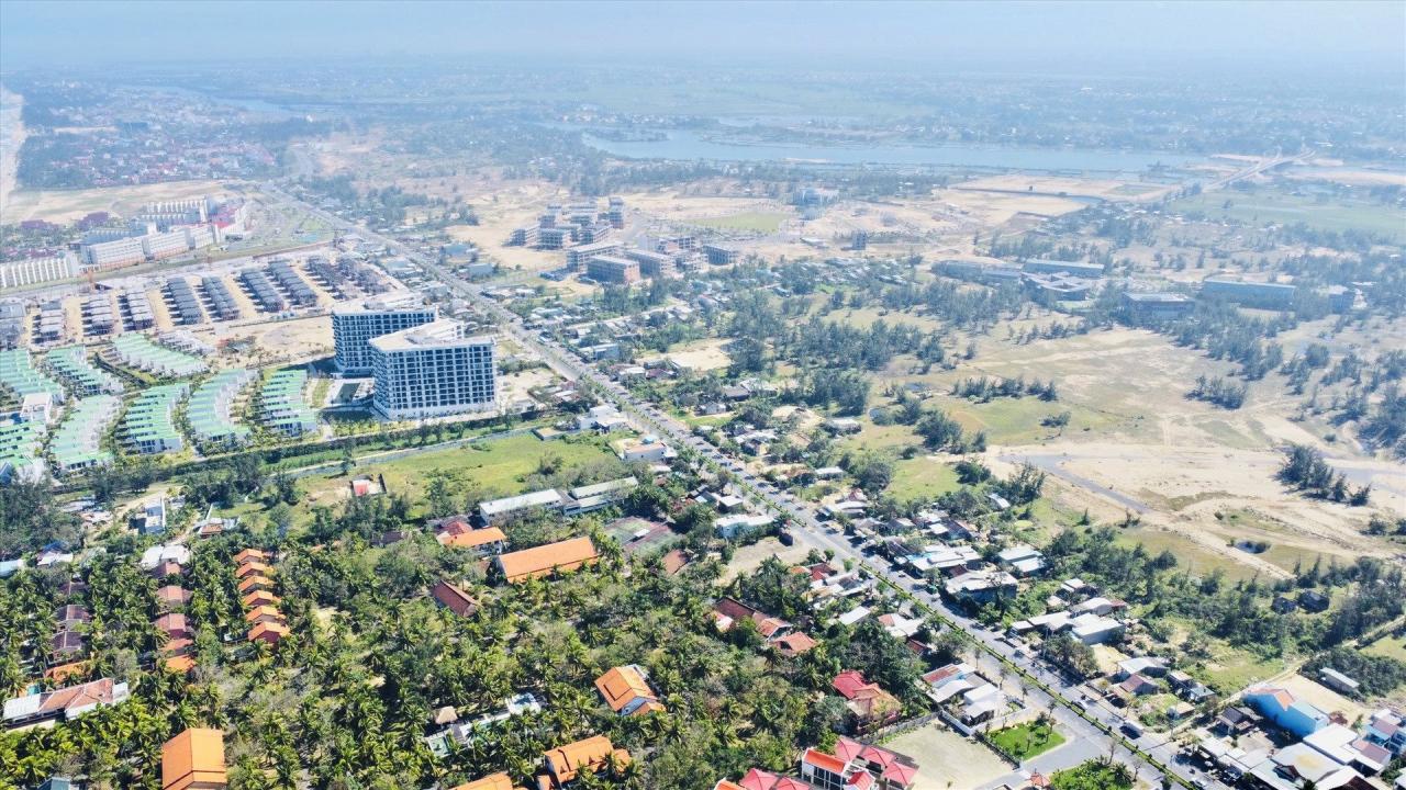
The Southern Growth Pole will encompass three localities: Tam Ky, Nui Thanh, and Phu Ninh. This area will focus on industrial development, port and aviation logistics services, trade, coastal tourism, healthcare, education and training, and smart cities. Nui Thanh district will be merged with Tam Ky city to develop it into a Class I urban area.
Strengths of the new Tam Ky - Nui Thanh urban area. Photo: QT
According to Chairman of the Provincial People's Committee Le Tri Thanh, to avoid spreading resources too thinly, three communes in the western part of Nui Thanh district will be merged into Phu Ninh district. At the same time, investment resources will be concentrated in the eastern part of the Tam Ky - Nui Thanh urban area. In the future, this will be a large-scale urban area, possessing all the strategic infrastructure elements including an airport, seaport, inland waterways, and with expressways, National Highway 1, the coastal road, and the North-South railway passing through it.
"
The Tam Ky - Nui Thanh urban area will be the new political and administrative center of the province, playing an important role in the chain of urban areas in Central Vietnam. Quang Nam will focus on allocating resources and developing investment plans towards becoming a type I urban area.
Chairman of the Provincial People's Committee Le Tri Thanh
[VIDEO] - Automotive engineering is a key industry in Chu Lai:


Comment (0)