

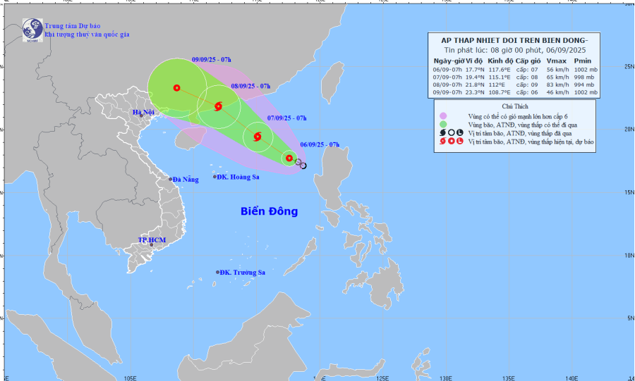
Forecast map of the trajectory and intensity of the tropical depression at 08:00 on September 6, 2025. Photo: nchmf
At 7:00 a.m. on September 7, the tropical depression moved northwest at a speed of 10–15 km/h, with the potential to strengthen into a storm. The forecast location is 19.4 degrees north latitude – 115.1 degrees east longitude, about 430 km northeast of the Paracel Islands. Strong winds of level 8, gusts of level 10. Dangerous area: latitude 16 degrees north–21.0° south; longitude 113.5–119 degrees east longitude. Disaster risk level: level 3, northeastern waters of the East Sea.
At 7:00 a.m. on September 8, the storm continued to move northwest at a speed of about 15 km/h and strengthened. Location at 21.8 degrees north latitude - 112 degrees east longitude, on the coastal area of Guangdong province (China). Strong winds level 9, gusts level 11. Dangerous area: north of latitude 18 degrees north; longitude 110.0 - 117 degrees east. Disaster risk level: level 3, northern waters of the East Sea.
Disaster risk level: level 3, eastern sea area of the northern East Sea.
At 1:00 a.m. on September 8, the tropical depression/storm continued to move northwest at a speed of about 15 km/h and strengthened. The forecast location is at about 20.9 degrees north latitude - 113.8 degrees east longitude, in the northern sea area of the North East Sea. Wind force is level 9, gusting to level 11. The dangerous area is between latitude 17-22 degrees north; longitude 112-118 degrees east. Disaster risk level: level 3, northern sea area of the North East Sea.
Storm warning for the next 48-72 hours, the storm moves west-northwest, about 15 km per hour.
The northeastern sea area of the East Sea has strong winds of level 6, later increasing to level 7-8, gusting to level 10; waves 2-4 m high, rough seas. Ships operating in the danger zone are likely to be affected by storms, whirlwinds, strong winds and big waves.
LP
Source: https://baothanhhoa.vn/ap-thap-nhiet-doi-tren-bien-dong-co-kha-nang-manh-thanh-bao-260713.htm

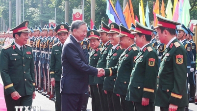
![[Photo] General Secretary To Lam attends the 80th Anniversary of the General Staff of the Vietnam People's Army](https://vphoto.vietnam.vn/thumb/1200x675/vietnam/resource/IMAGE/2025/9/6/126697ab3e904fd68a2a510323659767)

![[Photo] 80th Anniversary of the General Staff of the Vietnam People's Army](https://vphoto.vietnam.vn/thumb/1200x675/vietnam/resource/IMAGE/2025/9/6/49153e2a2ffc43b7b5b5396399b0c471)

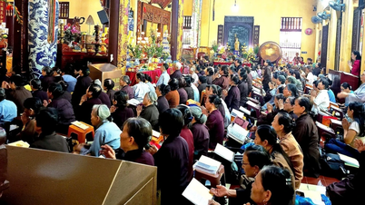
![[Photo] Many people directly experience beloved Uncle Ho and the General Secretaries](https://vphoto.vietnam.vn/thumb/1200x675/vietnam/resource/IMAGE/2025/9/6/2f4d9a1c1ef14be3933dbef3cd5403f6)


![[Photo] Hanoi students excitedly and joyfully open the new school year 2025-2026](https://vphoto.vietnam.vn/thumb/1200x675/vietnam/resource/IMAGE/2025/9/5/ecc91eddd50a467aa7670463f7b142f5)


Comment (0)