As a renowned destination with outstanding geographical, cultural, scenic, and ecotourism significance for the entire country, Mui Ca Mau National Park is also a sacred and beloved place in the hearts of every Vietnamese person, a place everyone wishes to visit at least once.
Mui Ca Mau National Park - a World Biosphere Reserve, an exciting destination in the land of the nine dragons.
The Ca Mau Cape National Park was established in 2003 when the Dat Mui Nature Reserve was transformed into a national park within Vietnam's system of special-use forests. It is the largest primary mangrove forest in the country, bordering both the East and West Seas, and therefore subject to both tidal regimes: the semi-diurnal tides of the East Sea and the diurnal tides of the West Sea. This area serves as a breeding ground for many economically valuable aquatic species and is a stopover point for many migratory waterbirds during the winter.
Mui Ca Mau National Park covers an area of approximately 41,862 hectares. Of this, about 15,262 hectares are mainland area, while the remaining 26,600 hectares are coastal areas bordering the mainland. The park is divided into four main zones: a strictly protected zone (12,203 ha), an ecological restoration zone (2,859 ha), an administrative and service zone (200 ha), and a marine conservation zone (26,600 ha).
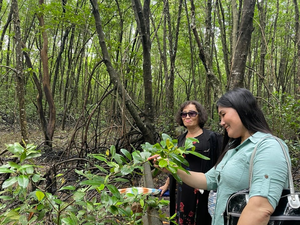
Currently, Mui Ca Mau National Park boasts a rich and diverse flora and fauna, with approximately 28 to 32 species of mangrove trees; about 26 species of mammals, 93 species of birds, 43 species of reptiles, 139 different species of fish, including 9 species of amphibians, 49 species of plankton, and many other rare species… Among them are two species listed in the World Red List: the long-tailed macaque (Macaca fascicularis) and the silver langur (Trachypithecus cristatus), and four species listed in the Vietnam Red List.
On May 26, 2009, Mui Ca Mau National Park (Ngoc Hien district) and U Minh Ha National Park (U Minh district) in Ca Mau province were added to the UNESCO list of World Biosphere Reserves. On April 13, 2013, the Secretariat of the World Ramsar Convention recognized Mui Ca Mau National Park as the world's 2,088th Ramsar site.
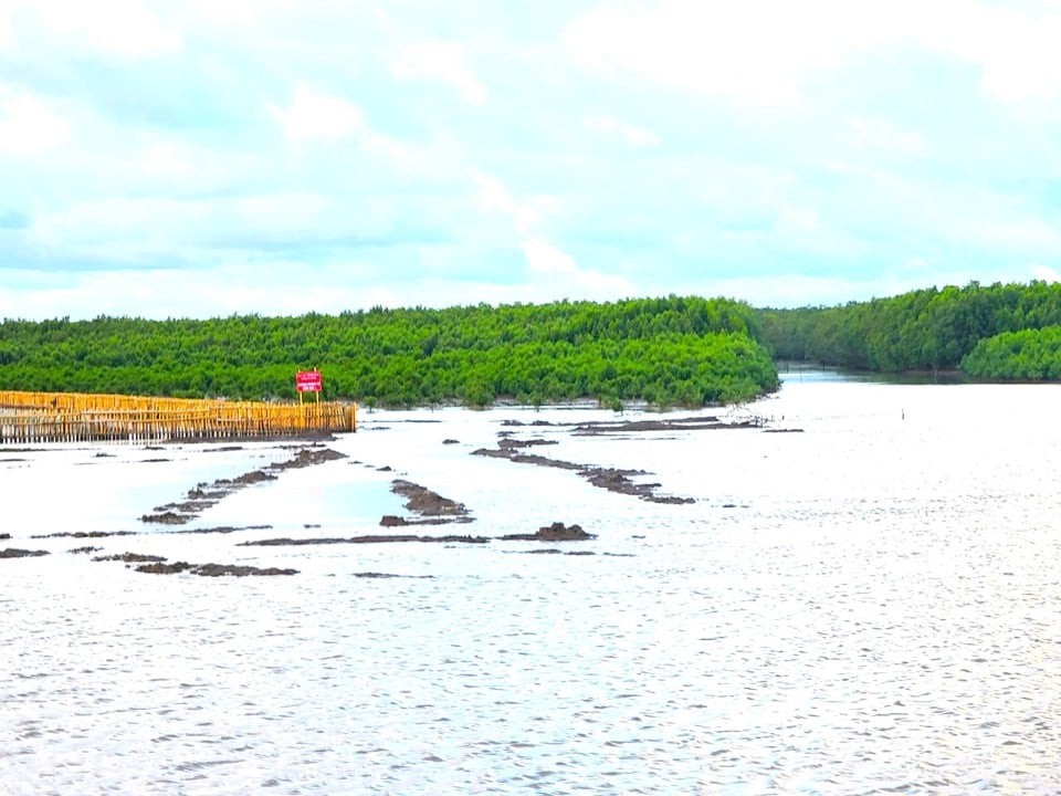
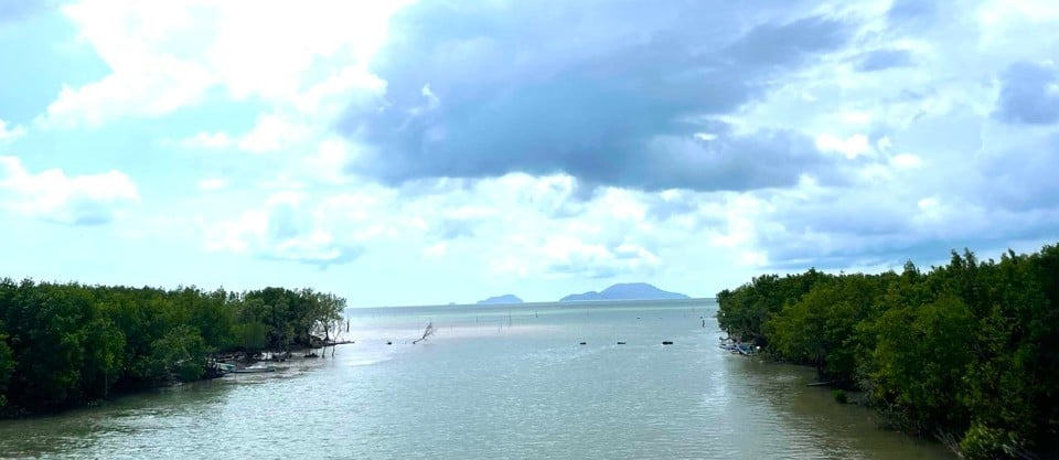
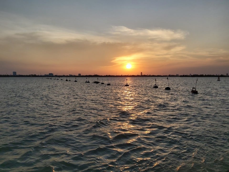
The peninsula jutting out into the sea in the shape of a boat's bow, known as Cape Cape, is a place where you can watch the sunrise over the East Sea in the morning and also see the sunset over the West Sea. The best spots to see this view are along the winding breakwater that encloses the mangrove forest and the land inside Cape Cape, or at the viewpoints on the alluvial plain (where the land is expanding).
According to local elders, Ca Mau Cape extends hundreds of meters into the sea each year without human intervention. The ecosystem here is dominated by two main types of trees: mangrove and nipa palm, which live intertwined and support each other. The nipa palm gradually creeps towards the sea, surviving by extending its roots to absorb silt for survival, but its roots also act as a "breakwater," protecting the fallen mangrove fruits that grow in the soil. The mature mangrove trees grow strong, extending long, sturdy roots to envelop the nipa palms, accumulating silt to nourish the young mangrove trees as they grow.
That symbiotic relationship has propelled Ca Mau Cape and the entire nation further out to sea for centuries, carrying with it the proud spirit of the Vietnamese people on their journey of territorial expansion, as the poet Xuan Dieu said:


“…. Our homeland is like a ship
"That's the bow of our boat, Cape Ca Mau..."
As the first rays of dawn gradually appear, illuminating the entire sky with red light, the mangrove forests here also awaken. The vast expanse of green mangroves, nipa palms, and shimmering mudflats blends with the azure blue of the sea, captivating visitors.
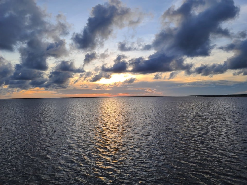
As evening falls and the sun sets, casting colorful clouds that add to the poetic and romantic atmosphere of Ca Mau Cape. This is how the majestic and peaceful image of our homeland unfolds every day at Ca Mau Cape.
The imprint of Ca Mau Cape - as the nation's territory gradually expands towards the sea.
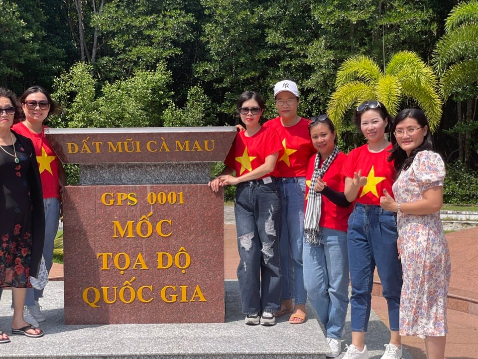
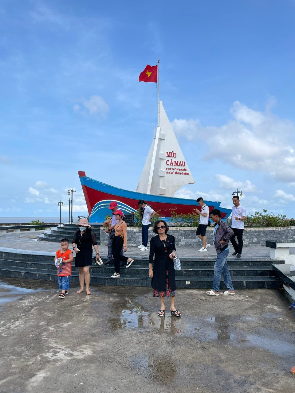
At Ca Mau Cape, tourists can visit and take souvenir photos at characteristic landmarks of the Cape such as the GPS coordinate marker 0001, the panoramic view (image of a ship), the breakwater, the symbols of the snail and mudskipper fish, the forest village bridge, the marker marking the end of the Ho Chi Minh Trail, the Lac Long Quan Temple, the statue of Mother Au Co, etc.
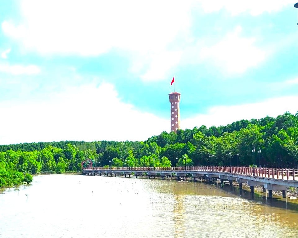
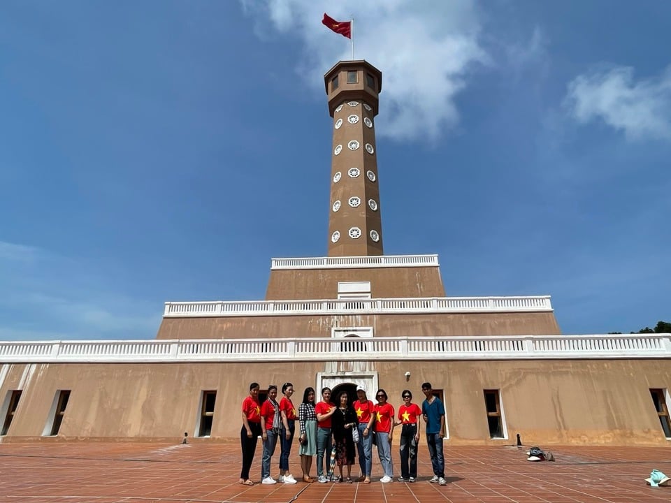
Notably, this area also features the Hanoi Flagpole at Ca Mau Cape, a gift from the Hanoi Party Committee and people to the province, inaugurated in 2019. Visitors can walk up to the upper levels of the Hanoi Flagpole to admire the panoramic view of the Ca Mau mangrove forest, the vast East Sea, and the Hon Khoai island cluster appearing in the distance. The blend of forest and sea creates a beautiful and poetic landscape rarely found elsewhere.
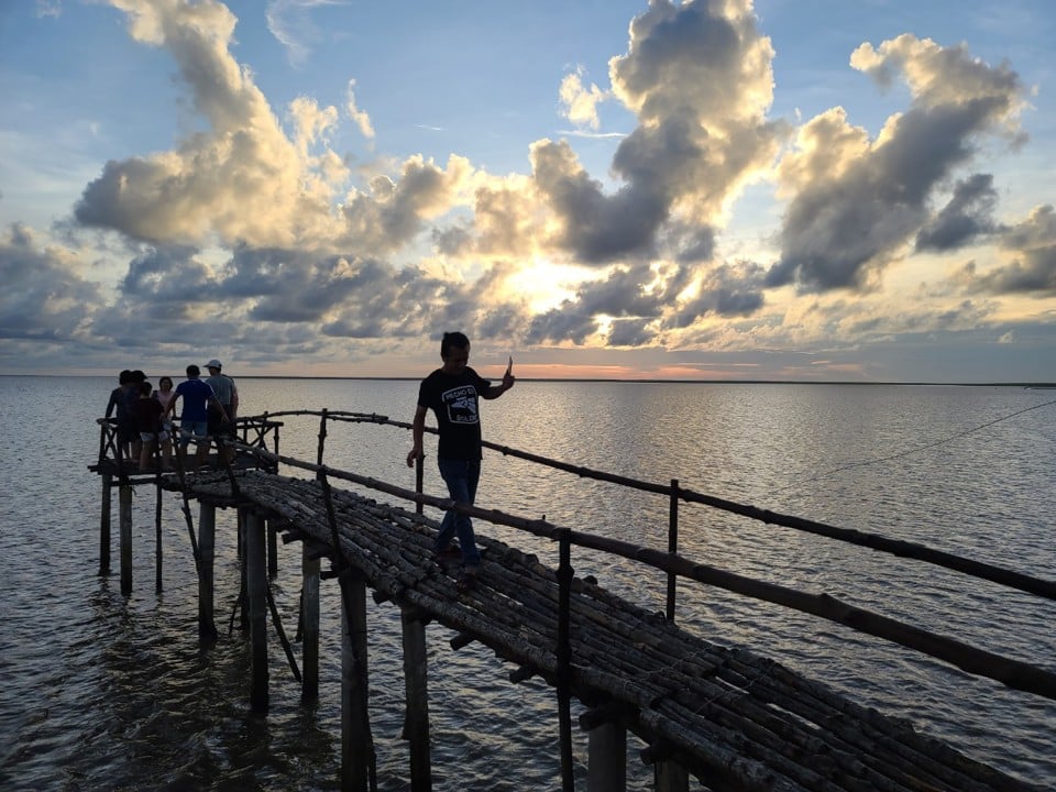
Visitors to this area can experience trekking through the forest, cruising along the Lạch Vàm canal in small boats or canoes, admiring the dense clusters of oysters covering the river surface, and learning about seafood farming. They can explore the mangrove ecosystem, learn about the creatures living beneath the canopy, and find ideal spots to observe migratory birds. They can also take in panoramic views of the alluvial plains gradually extending into the sea.
According to travel agencies, Ca Mau Cape is always a popular choice for tourists on many tours, especially domestic tourists. The reason is that many people want to visit the southernmost point of Vietnam, to witness firsthand the wonders of nature as the country's territory gradually expands towards the sea.
Ms. Vo Ly Mai Phuong, a tourist from Binh Thanh District, Ho Chi Minh City, said that visiting Ca Mau Cape not only allows you to admire the diverse and fascinating mangrove ecosystem, but also to see how vast and expansive our homeland is. “If you get to watch the sunrise and sunset in a mudflat area, you’ll see how wonderfully vast our country is. But even more amazing is that if you return the following year, that spot may have been filled in by alluvial deposits and become mainland,” Ms. Vo Ly Mai Phuong said.


"But the most convenient option is to visit multiple interconnected destinations in a single trip. After visiting Ha Tien and Phu Quoc, you can go to Rach Gia, then straight to Ca Mau Cape, return to Ca Mau City, then visit Bac Lieu City, and finally head to Soc Trang. That's why Ca Mau Cape is an indispensable stop in that chain," Ms. Phuong added.

Speaking with a reporter from the Economic and Urban Newspaper, Mr. Tran Hieu Hung, Director of the Department of Culture, Sports and Tourism of Ca Mau province, said that Ca Mau Cape National Park is an important point in the tourism chain and route in Ca Mau in particular and the whole region in general. If regional tourism linkages are well organized, Ca Mau Cape will be an indispensable link to promote regional tourism. Most recently, in just 5 days during the Lunar New Year 2024, 103,368 (307 international tourists) visited tourist areas, sites, and stayed in Ca Mau province, an increase of 17% compared to the same period. Of these, more than 50% visited Ca Mau Cape.
“To capitalize on the advantageous tourism potential of Ca Mau Cape, the province is implementing many in-depth policies and solutions. Accordingly, it is focusing on investing in upgrading and building new eco-tourism tours; promoting regional linkages in tourism exploitation and development, especially the program of cooperation and development between Ca Mau and Ho Chi Minh City and other provinces in the Mekong Delta; and creating favorable conditions for connecting travel agencies and tourism service businesses between localities,” Mr. Tran Hieu Hung emphasized.
On March 29, 2024, in Can Tho City, the Economic & Urban Newspaper, in collaboration with the Mekong Delta Tourism Association and the Department of Culture, Sports and Tourism of Can Tho City, co-organized the seminar "Building and developing unique tours, routes and tourism products in the Mekong Delta".
The workshop was attended by representatives from the Departments of Culture, Sports and Tourism of 13 provinces in the Mekong Delta, along with numerous researchers, scientists, and tourism businesses, to assess the potential, location, and advantages of tourism in the Mekong Delta provinces. From this, solutions were sought to address weaknesses and promote the effective and sustainable development of tourism in the Mekong Delta. Additionally, solutions for promoting Mekong Delta tourism to domestic and international tourists were also discussed.
Source


![[Image] National conference summarizing one year of operation of the overall organizational model of the political system, the three-tiered government model.](https://vphoto.vietnam.vn/thumb/1200x675/vietnam/resource/IMAGE/2026/07/01/1782882811691_ndo_br_1-jpg.webp)