

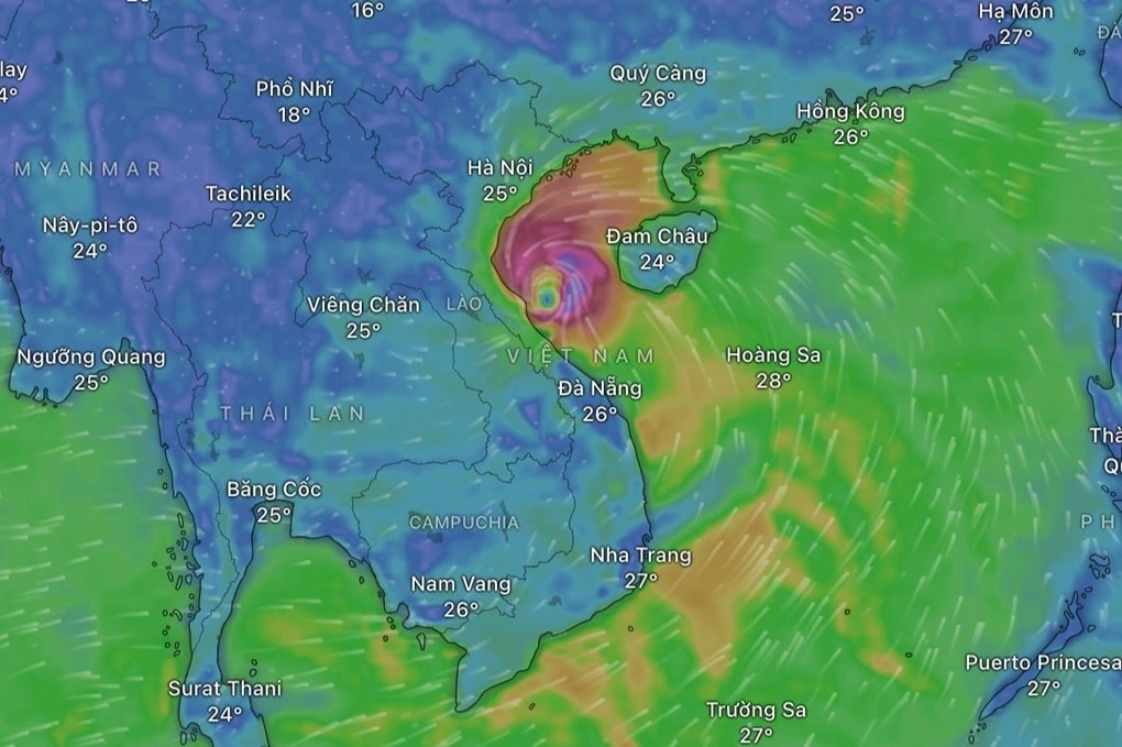
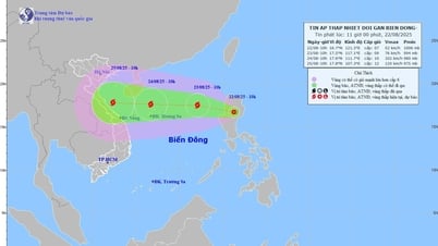
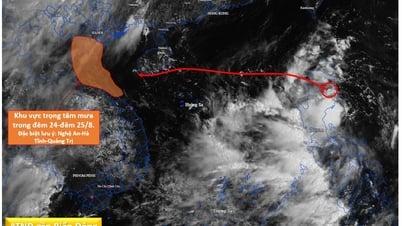
According to the National Center for Hydro-Meteorological Forecasting, this morning, August 22, the center of the tropical depression is in the eastern central coast of the Philippines.
Forecast for the day and night of August 22, the eastern sea area of the North and Central East Sea, the southern East Sea area (including the Truong Sa special zone); the sea area from Gia Lai to Ca Mau, from Ca Mau to An Giang and the Gulf of Thailand will have scattered showers and thunderstorms. During thunderstorms, there is a possibility of tornadoes, strong gusts of wind level 6-7 and waves 1.0-2.0m high.
Dr. Nguyen Ngoc Huy, an expert on climate change and natural disaster warning, said that at 3 a.m. this morning, August 22, the center of the tropical depression was in the eastern coast of the central Philippines.
On the evening of August 22, the center of the tropical depression will enter the East Sea and then strengthen into storm number 5. The storm is forecast to move west into the central region of Vietnam.
"The exact location of the storm's landing cannot be determined at this time. People in the area from Quang Ngai to Thanh Hoa should pay attention to follow the updates in the next news bulletins," said Dr. Nguyen Ngoc Huy.
This storm is also likely to create a relatively large area of rain and a very large amount of water because the sea surface is currently hot and the East wind is dominant, so a quantity of moist clouds can be pushed by the inertial pressure of the storm to the shore before the storm center hits the shore.
Tomorrow, August 23, when entering the East Sea, the storm's path will be clearer.
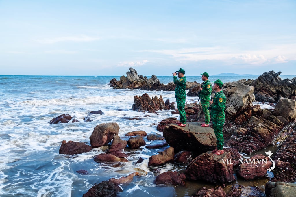
Fishermen at sea should note to move their fishing areas to the southern sea (below the 15th parallel) or should return to shore before August 24. Even if fishing in the south, they should pay attention to localized thunderstorms occurring in the south during the storm.
The storm is likely to cause heavy rain of 300-400 mm in the North Central region, the North and the midland and mountainous provinces in the North from August 25 to August 27.
Source: https://baohaiphong.vn/du-bao-ap-thap-nhiet-doi-vao-bien-dong-chieu-nay-va-manh-len-thanh-bao-so-5-518776.html
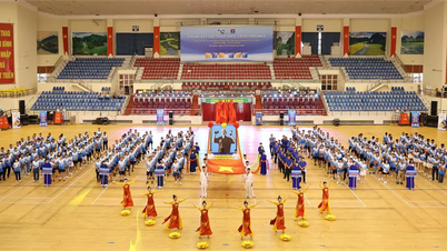
![[Photo] President Luong Cuong receives delegation of the Youth Committee of the Liberal Democratic Party of Japan](https://vphoto.vietnam.vn/thumb/1200x675/vietnam/resource/IMAGE/2025/8/22/2632d7f5cf4f4a8e90ce5f5e1989194a)
![[Photo] President Luong Cuong attends special political-artistic television show "Golden Opportunity"](https://vphoto.vietnam.vn/thumb/1200x675/vietnam/resource/IMAGE/2025/8/22/44ca13c28fa7476796f9aa3618ff74c4)

![[Photo] Prime Minister Pham Minh Chinh chairs the conference to review the 2024-2025 school year and deploy tasks for the 2025-2026 school year.](https://vphoto.vietnam.vn/thumb/1200x675/vietnam/resource/IMAGE/2025/8/22/2ca5ed79ce6a46a1ac7706a42cefafae)


Comment (0)