
The National Center for Hydro-Meteorological Forecasting has just analyzed and assessed the weather and climate of the past month and forecasted the next month (September 21 - October 20, 2024).
Accordingly, during the period from August 21 to September 20, our country experienced many severe natural disasters, causing great damage to people and property of the people and the state.
Specifically, in less than half a month, two storms have occurred consecutively. That is storm number 3 and the circulation after the storm with terrible destructive power has caused huge damage to many localities in the North. While the whole country is still working together to overcome the consequences of this storm, the people of the Central region have to brace themselves to cope with storm number 4. Fortunately, storm number 4 has a low intensity, so the damage is minimized.
According to the meteorological agency, storm No. 3 Yagi entered the East Sea on September 3 and on September 5, the storm increased to level 8 in 48 hours (from level 8 to level 16, super typhoon level).
On the night of September 6, storm No. 3 entered the eastern sea of the Northern Gulf of Tonkin, the storm intensity decreased to level 14, gusting to level 17. On the afternoon of September 7, storm No. 3 made landfall in the provinces of Quang Ninh and Hai Phong with an intensity of level 10-12, the area near the storm center level 13-14, gusting to level 16-17.
Early morning of September 8, storm No. 3 weakened into a tropical depression in the Northwest region.

Storm No. 3 Yagi made landfall, causing heavy damage to many localities in the North. Photo of the storm entering Quang Ninh: Thach Thao
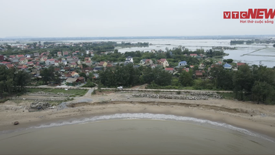
Storm No. 4 (Soulik): On the morning of September 17, a tropical depression entered the eastern sea of the North East Sea and strengthened into a storm early on the morning of September 19. The strongest wind near the storm's center was level 8, gusting to level 10, moving mainly in a westerly direction. On the afternoon of September 19, after making landfall in Quang Binh - Quang Tri, storm No. 4 weakened into a tropical depression, then continued to weaken into a low pressure area over Central Laos.
According to the National Steering Committee for Natural Disaster Prevention and Control, in the past 20 years, natural disasters have occurred irregularly, abnormally and very severely. In particular, storms and floods have occurred with great intensity and over a large area, leaving serious consequences on people's lives and production.
Also in the past month, the meteorological agency said that there were a number of thunderstorms, tornadoes, and lightning strikes nationwide, most concentrated in the Northern provinces and some places in the South.
In addition, in the North, there were 2 heat waves and widespread severe heat waves from August 27-29 and from September 4-6. Heat waves and widespread severe heat waves lasted for many days in the Central region. Across the country, many meteorological stations recorded the highest daily temperature exceeding the historical value (GTLS) of the same period.
Notably, during this period, there were many days of widespread showers and thunderstorms in the Northern region; of which there were 3 heavy rains (August 21-25, September 6-11 and September 16-19).
In the Central region, there were 2 widespread moderate and heavy rains (September 6-12 and September 17-20). Of which, the rain from September 17-20 was affected by the tropical convergence zone and the circulation of storm No. 4. The Northern and Central regions had widespread rains, especially the southern region of the Northern Delta. The North and Central Central regions had moderate and heavy rains, and some places had very heavy rains with total rainfall (TLM) commonly from 150-300mm, the Central Central region 300-400mm, and some places higher.
In the Central Highlands and the South, there were many days of scattered showers and thunderstorms, especially moderate and heavy rain from August 22-31 and September 1-10. Across the country, many meteorological stations observed daily rainfall values exceeding the average rainfall for the same period.
During the same period, TLM nationwide was generally 20-50% higher than the average of many years, especially in the Northern region, it was 100-200% higher, in some places it was 3-4 times higher than the average; in the South Central region, it was 10-30% lower than the average of the same period.
In addition, the average temperature across the country is 0.5-1 degree higher than the average, and higher in some places; especially in the North and Central Central regions, it is 1-1.5 degree higher, and higher in some places than the average for the same period.
Cold air starts working
Forecasting climate trends for the period from September 21 to October 20, 2024, the National Center for Hydro-Meteorological Forecasting said that the average temperature across the country is generally approximately the same as the average temperature for the same period, with the Central Highlands and the South generally being 0.5-1 degrees higher, and some places higher than the average.
Besides, TLM nationwide is generally at the same level as the average, especially in the Central Central region, it is 15-30% higher than the average in the same period.
During the forecast period, the meteorological agency assessed that storm/tropical low pressure activities in the East Sea and their impact on Vietnam's mainland are likely to be approximately the same as the average for the same period (average for the East Sea: 2.1 storms; average for landfall: 0.9 storms).

Cold air will start to operate from September 22-23. Illustration: Thach Thao
Also during this period, cold air begins to act and affect our country's weather.
Notably, nationwide there will be many days of rain, showers and thunderstorms, some days of moderate rain, heavy rain; in the Central region, there is a possibility of some widespread heavy rains.
The Meteorological Agency warns that dangerous weather phenomena such as storms/tropical depressions, cold air, southwest monsoon, thunderstorms, and tornadoes at sea are likely to cause strong winds and large waves that could affect activities in the East Sea. Heavy rain, strong thunderstorms accompanied by tornadoes, lightning, hail, and strong gusts of wind can greatly affect production and people's activities.
| The North welcomes the first cold air Currently (September 22), cold air has affected some places in the Northeast. During the day and tonight, cold air continues to affect other places in the Northeast, then affect some places in the Northwest and North Central regions. Northeast wind inland level 2-3, coastal areas level 4-5. From this morning, in the Gulf of Tonkin, the Northeast wind gradually increases to level 6, sometimes level 7, gusting to level 8; rough seas; waves from 2-3m high. On September 22-23, the weather in the North and Thanh Hoa will be cool, while in some mountainous areas in the North it will be cold. During this cold air mass, the lowest temperature in the North and Thanh Hoa will be from 20-23 degrees Celsius, and in some mountainous areas it will be below 19 degrees Celsius. Hanoi area: September 22-23, cool weather with lowest temperature commonly 21-23 degrees. Due to the influence of cold air, during the day and tonight, in the midlands and deltas of the North, Hoa Binh will have moderate rain, heavy rain, locally very heavy rain and thunderstorms with common rainfall of 30-50mm, locally over 100mm; from this morning to tomorrow (September 23), in the North Central region, there will be moderate rain, heavy rain, locally very heavy rain with rainfall of 40-90mm, locally over 150mm. From this evening to tomorrow night, the rain will spread to Quang Binh - Thua Thien Hue, also with rainfall from 40-90mm, some places over 150mm; Thua Thien Hue alone 30-60mm, locally over 120mm. |


Comment (0)