
With three sides bordered by the sea and over 100,000 hectares of mangrove forest, Ca Mau Cape is the center of the UNESCO-recognized Ca Mau Cape World Biosphere Reserve, which includes Ca Mau Cape National Park, U Minh Ha National Park, and the Western coastal protection forest area.
Upon reaching Vietnam's national GPS coordinate marker 0001 (kilometer 0), visitors will be immersed in a myriad of exciting experiences.
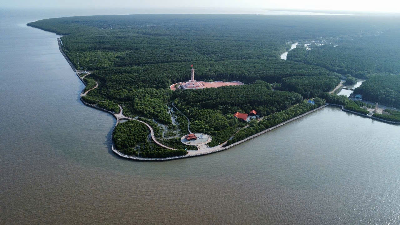 |
| Cape Ca Mau looks impressive in this panoramic aerial photograph. |
 |
| Ca Mau Cape is not just a destination, but also a journey of emotions, where you can immerse yourself in pristine nature and feel the sacredness of the southernmost point of the country. |
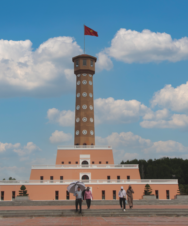 |
| The Hanoi flagpole at Ca Mau Cape, a magnificent structure over 41 meters high, is modeled after the flagpole of the capital city, symbolizing the unity of the nation and the national sovereignty of Vietnam. |
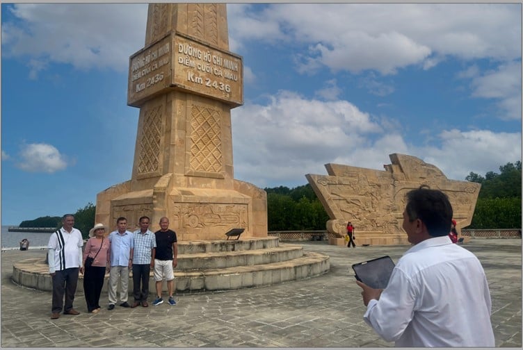 |
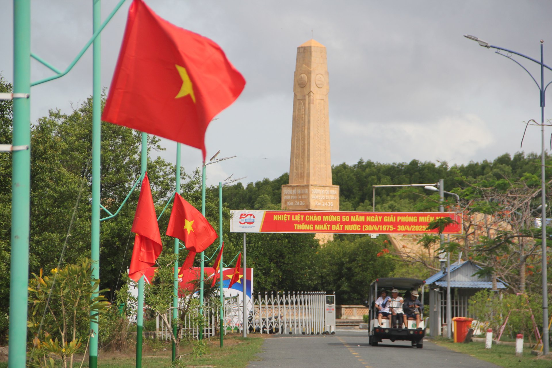
| The Ho Chi Minh Trail milestone - Ca Mau end point, Km2436. The Ho Chi Minh Trail begins in Pac Bo, Cao Bang province and ends at the southernmost point of the country at Dat Mui, Ca Mau province. |
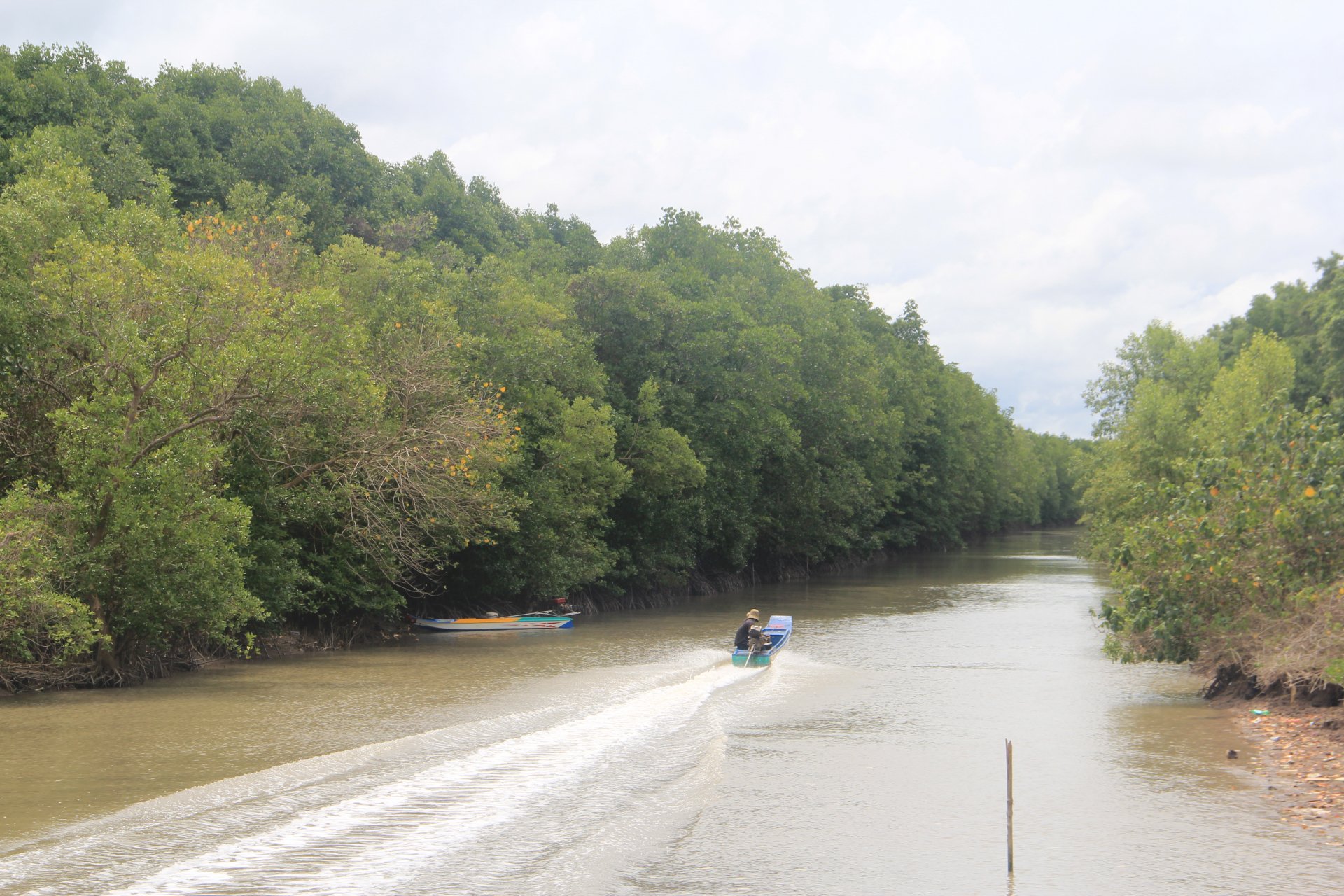 |
| Visitors can experience trekking through the forest and exploring the unique mangrove ecosystem in Mui Ca Mau National Park through attractive ecotourism tours. |
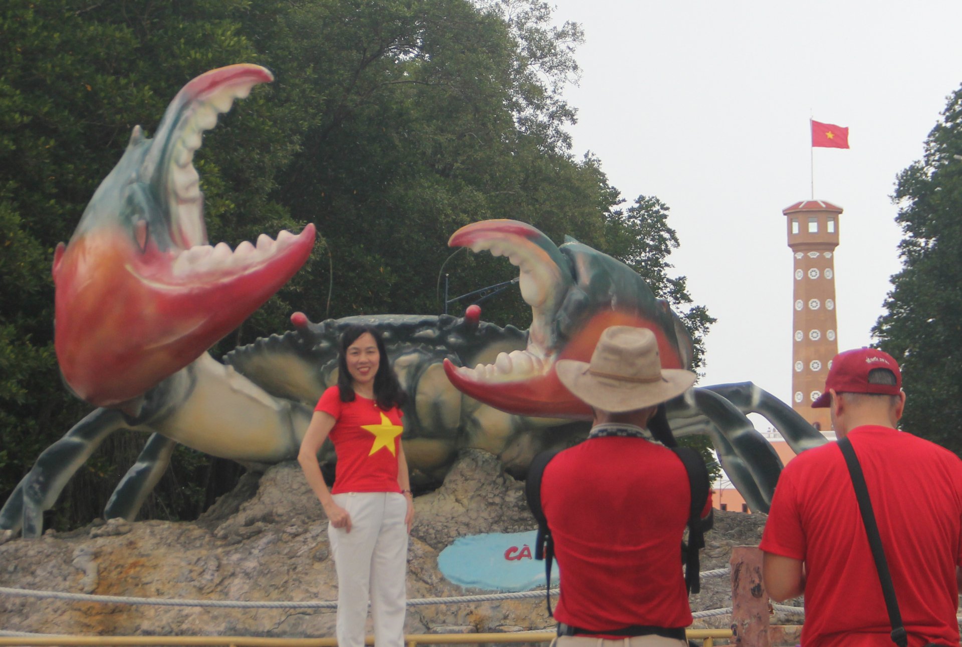 |
| The iconic Ca Mau crab, one of the four characteristic seafood species of the Ca Mau Cape region, has become a favorite destination for many tourists. |
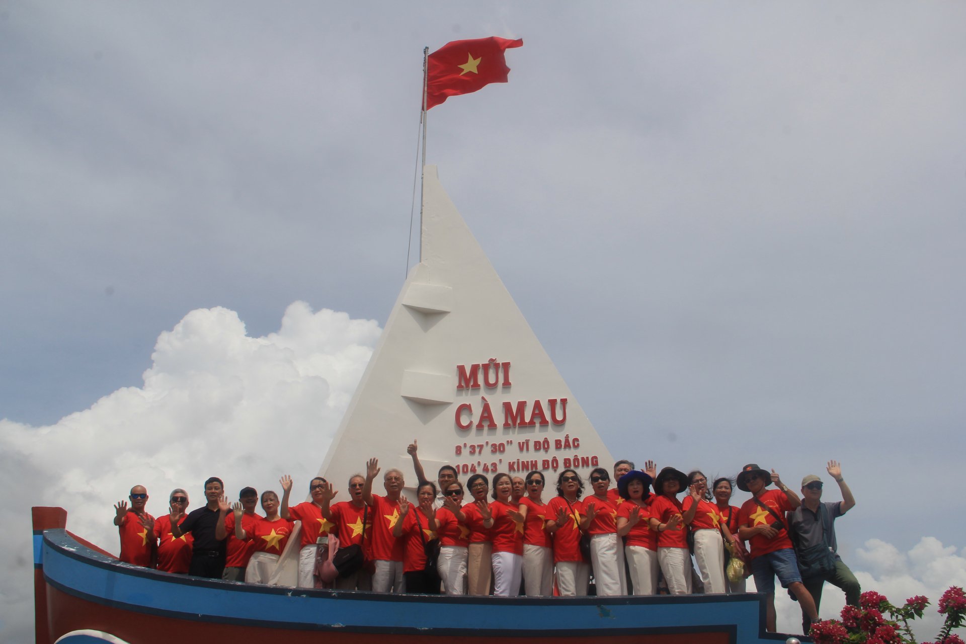 |
| Tourists enjoy visiting and taking photos at the iconic boat-shaped landmark of Ca Mau Cape, a place associated with the heartfelt verses of Xuan Dieu: "My homeland is like a ship / Our ship's bow is there - Ca Mau Cape." |
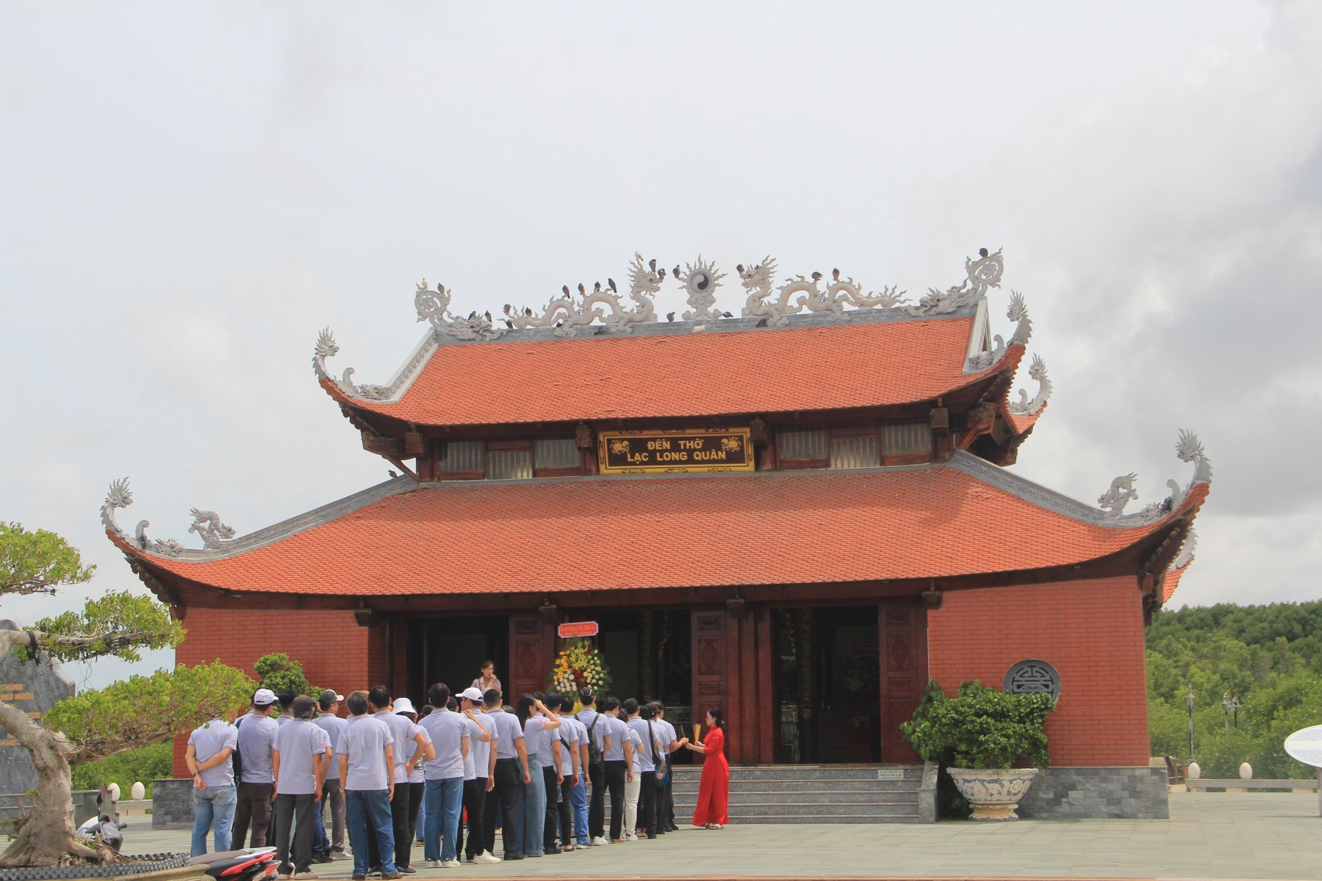 |
| Descendants of Lac Hong returned to the temple to respectfully offer incense to the National Ancestor Lac Long Quan, expressing the gratitude of today's generation to their ancestors, the forefathers who endured hardships to build and defend the nation. |
Source: https://baophuyen.vn/xa-hoi/202505/kham-pha-dat-mui-ca-mau-0ca24d7/


Comment (0)