

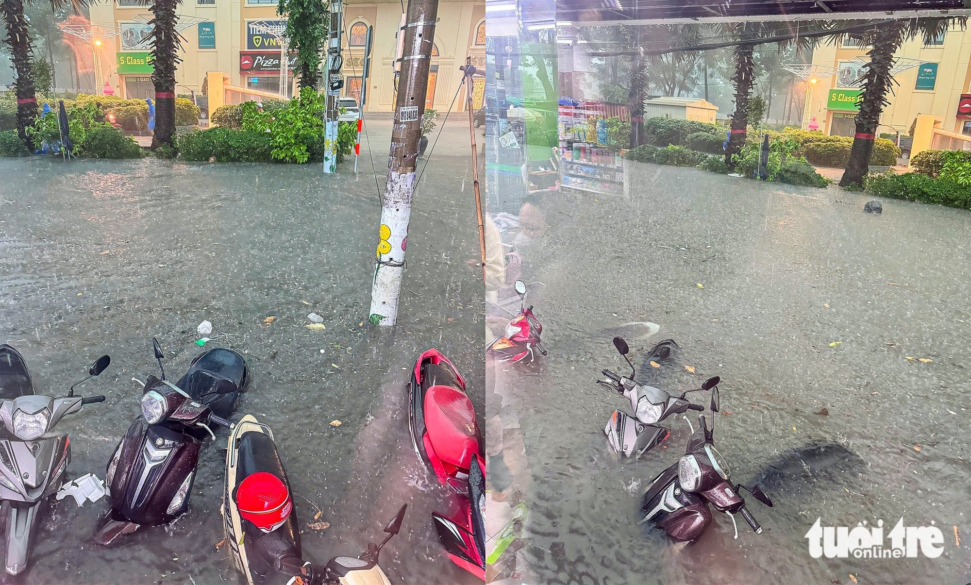
Speaking with Tuoi Tre Online , a representative of Thu Duc City People's Committee said that the city currently has 24 inherent flooding points, scattered in many wards such as Thao Dien, An Khanh, Linh Tay, Hiep Binh Phuoc , Tang Nhon Phu A, Linh Dong...
Not only that, there are 13 other locations that are being closely monitored by the city due to high risk of flooding. From the beginning of 2025 to May, out of 9 heavy rains in Thu Duc City, 3 caused flooding, the water drained in less than 30 minutes, but still caused many inconveniences for people, especially in the Thu Duc market area (rain on May 10).
24 flooded areas in Thu Duc City that people need to pay attention to:
Thao Dien Street ( Thao Dien) : from alley 97 to door number 8, flooded 10cm deep, 270m long, water drains slowly (120 minutes). Quoc Huong Street (Thao Dien): section from Tong Huu Dinh to street number 65 is slightly flooded but lasts for a long time (90 minutes).
Nguyen Van Huong Street (Thao Dien) : in front of house number 170, the water is 12cm deep, 200m long. Luong Dinh Cua Street (An Khanh): from D1 to street number 18, the water is widespread, 30-40cm deep, 640m long.
National Highway 1 - Provincial Highway 43 - Le Thi Hoa (Binh Chieu) : from Linh Xuan overpass to the intersection of Provincial Highway 43 and National Highway 1, flooded over a large area, 1,500m. Kha Van Can Street (Hiep Binh Chanh): from National Highway 13 to Pham Van Dong, flooded slightly but up to 1,100m long.
Duong Van Cam Street (Linh Tay) : from Le Van Ninh to Pham Van Dong, 250m long, drains in 30 minutes. Dang Van Bi Street (Linh Tay): from To Ngoc Van to Duong Van Cam, often flooded after heavy rain.
Le Van Viet Street (Hiep Phu - Tang Nhon Phu A) : the section from Binh Phu to La Xuan Oai is 550m long and 0.2m deep. La Xuan Oai Street (Tang Nhon Phu A): from Le Van Viet to Road 102, an area prone to flooding due to low-lying areas, 350m long.
Do Xuan Hop Street (Phuoc Binh - Phuoc Long B) : from Street 8 to Street 9, 700m long, 0.4m deep. National Highway 13 (Ward 1.3, Hiep Binh Phuoc): from National Highway 1 to National Highway 13, slightly flooded but 600m long.
Road No. 12 (An Khanh): Tran Nao section to Caric Joint Stock Company housing project, 200m long, 0.3m deep. Alley 789 (Tam Binh): the beginning of the parallel road of National Highway 1 to Thu Duc agricultural market, 140m long, 0.2m deep.
Alley 95, Vo Van Ngan Street (Linh Chieu) : from house number 95/26 to the end of the alley, 40m long, no drainage. Alley 606 National Highway 13, Ward 6 (Hiep Binh Phuoc): adjacent to Hong Long project, 100m long, no sewer system.
Road 22 (Linh Dong): from Road 22 to Linh Dong Road, 400m long, recedes slowly after rain. Road 6 (Linh Tay): from Van Canh to the end of the route, 600m long, flooded due to water accumulating from the highlands.
Cau Xay Street (Phuoc Long A) : from alley 41 to alley 15, locally flooded, often congested. Alley 384 Pham Van Dong (Hiep Binh Chanh): from Pham Van Dong to street 26, 160m long, locally flooded 30cm.
Road No. 8 (Long Binh ): from Road No. 6 to the end of the route, 200m long, no drainage. Dinh Hoi Road (Phuoc Long B): from Road No. 359 to the end of the route, 140m long, sunken, garbage blocking the drainage.
Dang Phu Street (Tang Nhon Phu A) : from Street No. 6 to the end of Hong Long Bridge, 120m long. Lien Phuong Street (Phuoc Long B - Tang Nhon Phu B): from Tang Nhon Phu Street to Alley 2, 150m long, slightly flooded.
Why is Thu Duc flooded?
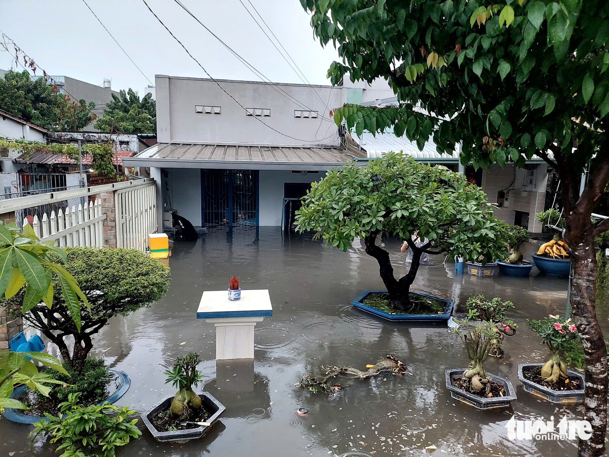
Thu Duc City has complex terrain with more than 59% of the area being low-lying, and is influenced by tides from the Saigon and Dong Nai rivers.
Most of the drainage systems are degraded, small in size (DN400 - DN800), and are a common sewer system for both rainwater and wastewater, so they are often overloaded.
Not only that, rapid urbanization, many areas without sewer systems or not connected to the common network, the situation of garbage blocking water intakes, and slow progress of renovation projects due to land acquisition problems are also the reasons why Thu Duc City still "floods when it rains" after many years.
Source: https://ttbc-hcm.gov.vn/24-diem-mua-la-ngap-o-tp-thu-duc-nguoi-dan-can-chu-y-1018710.html

![[Photo] Prime Minister Pham Minh Chinh chairs the meeting of the Government Party Committee Standing Committee](https://vphoto.vietnam.vn/thumb/1200x675/vietnam/resource/IMAGE/2025/8/23/8e94aa3d26424d1ab1528c3e4bbacc45)


![[Photo] General Secretary To Lam attends the 80th Anniversary of the Cultural Sector's Traditional Day](https://vphoto.vietnam.vn/thumb/1200x675/vietnam/resource/IMAGE/2025/8/23/7a88e6b58502490aa153adf8f0eec2b2)


Comment (0)